Roches (Roches)

- commune in Creuse, France
- Country:

- Postal Code: 23270
- Coordinates: 46° 16' 59" N, 1° 59' 59" E


- GPS tracks (wikiloc): [Link]
- Area: 25.55 sq km
- Population: 368
- Wikipedia en: wiki(en)
- Wikipedia: wiki(fr)
- Wikidata storage: Wikidata: Q1012448
- Wikipedia Commons Category: [Link]
- Freebase ID: [/m/03mfk6_]
- Freebase ID: [/m/03mfk6_]
- GeoNames ID: Alt: [2983229]
- GeoNames ID: Alt: [2983229]
- SIREN number: [212316202]
- SIREN number: [212316202]
- BnF ID: [152515496]
- BnF ID: [152515496]
- VIAF ID: Alt: [121018692]
- VIAF ID: Alt: [121018692]
- ISNI: Alt: [0000 0001 1536 8754]
- ISNI: Alt: [0000 0001 1536 8754]
- INSEE municipality code: 23162
- INSEE municipality code: 23162
Shares border with regions:


Jouillat
- commune in Creuse, France
- Country:
- Postal Code: 23220
- Coordinates: 46° 15' 26" N, 1° 56' 10" E
- GPS tracks (wikiloc): [Link]
- Area: 22.44 sq km
- Population: 422


Genouillac
- commune in Creuse, France
- Country:
- Postal Code: 23350
- Coordinates: 46° 21' 9" N, 1° 59' 32" E
- GPS tracks (wikiloc): [Link]
- Area: 35.76 sq km
- Population: 752


Bonnat
- commune in Creuse, France
- Country:
- Postal Code: 23220
- Coordinates: 46° 19' 40" N, 1° 54' 17" E
- GPS tracks (wikiloc): [Link]
- Area: 45.79 sq km
- Population: 1307

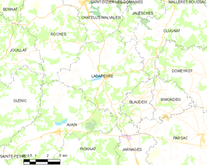
Ladapeyre
- commune in Creuse, France
- Country:
- Postal Code: 23270
- Coordinates: 46° 14' 54" N, 2° 2' 54" E
- GPS tracks (wikiloc): [Link]
- Area: 30.63 sq km
- Population: 355


Châtelus-Malvaleix
- commune in Creuse, France
- Country:
- Postal Code: 23270
- Coordinates: 46° 18' 16" N, 2° 1' 24" E
- GPS tracks (wikiloc): [Link]
- Area: 14.97 sq km
- Population: 581
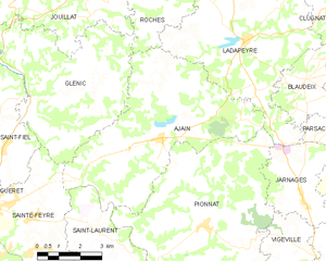
Ajain
- commune in Creuse, France
- Country:
- Postal Code: 23380
- Coordinates: 46° 12' 27" N, 1° 59' 55" E
- GPS tracks (wikiloc): [Link]
- Area: 33.14 sq km
- Population: 1130


Glénic
- commune in Creuse, France
- Country:
- Postal Code: 23380
- Coordinates: 46° 13' 24" N, 1° 55' 22" E
- GPS tracks (wikiloc): [Link]
- Area: 27.6 sq km
- Population: 657