Rocquencourt (Rocquencourt)

- commune in Oise, France
- Country:

- Postal Code: 60120
- Coordinates: 49° 38' 59" N, 2° 25' 3" E


- GPS tracks (wikiloc): [Link]
- Area: 9.81 sq km
- Population: 191
- Wikipedia en: wiki(en)
- Wikipedia: wiki(fr)
- Wikidata storage: Wikidata: Q1386987
- Wikipedia Commons Category: [Link]
- Freebase ID: [/m/03qgnt6]
- GeoNames ID: Alt: [6438926]
- SIREN number: [216005389]
- BnF ID: [15267779b]
- INSEE municipality code: 60544
Shares border with regions:


Sérévillers
- commune in Oise, France
- Country:
- Postal Code: 60120
- Coordinates: 49° 38' 20" N, 2° 25' 49" E
- GPS tracks (wikiloc): [Link]
- Area: 3.26 sq km
- Population: 132


Rouvroy-les-Merles
- commune in Oise, France
- Country:
- Postal Code: 60120
- Coordinates: 49° 38' 53" N, 2° 21' 28" E
- GPS tracks (wikiloc): [Link]
- Area: 4.06 sq km
- Population: 52
- Web site: [Link]


Coullemelle
- commune in Somme, France
- Country:
- Postal Code: 80250
- Coordinates: 49° 40' 5" N, 2° 25' 23" E
- GPS tracks (wikiloc): [Link]
- Area: 9.32 sq km
- Population: 339


Quiry-le-Sec
- commune in Somme, France
- Country:
- Postal Code: 80250
- Coordinates: 49° 40' 21" N, 2° 22' 55" E
- GPS tracks (wikiloc): [Link]
- Area: 6.88 sq km
- Population: 326
- Web site: [Link]


Tartigny
- commune in Oise, France
- Country:
- Postal Code: 60120
- Coordinates: 49° 38' 2" N, 2° 21' 38" E
- GPS tracks (wikiloc): [Link]
- Area: 6.98 sq km
- Population: 281


Villers-Tournelle
- commune in Somme, France
- Country:
- Postal Code: 80500
- Coordinates: 49° 39' 12" N, 2° 27' 49" E
- GPS tracks (wikiloc): [Link]
- Area: 5.93 sq km
- Population: 158

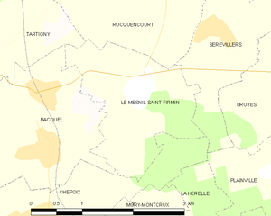
Le Mesnil-Saint-Firmin
- commune in Oise, France
- Country:
- Postal Code: 60120
- Coordinates: 49° 37' 42" N, 2° 24' 38" E
- GPS tracks (wikiloc): [Link]
- Area: 4.14 sq km
- Population: 193
- Web site: [Link]