Sérévillers (Sérévillers)

- commune in Oise, France
- Country:

- Postal Code: 60120
- Coordinates: 49° 38' 20" N, 2° 25' 49" E


- GPS tracks (wikiloc): [Link]
- Area: 3.26 sq km
- Population: 132
- Wikipedia en: wiki(en)
- Wikipedia: wiki(fr)
- Wikidata storage: Wikidata: Q1333821
- Wikipedia Commons Category: [Link]
- Freebase ID: [/m/03qg7vb]
- GeoNames ID: Alt: [6438976]
- SIREN number: [216006064]
- INSEE municipality code: 60615
Shares border with regions:


Chepoix
- commune in Oise, France
- Country:
- Postal Code: 60120
- Coordinates: 49° 36' 19" N, 2° 22' 53" E
- GPS tracks (wikiloc): [Link]
- Area: 8.86 sq km
- Population: 400


Broyes
- commune in Oise, France
- Country:
- Postal Code: 60120
- Coordinates: 49° 37' 42" N, 2° 27' 25" E
- GPS tracks (wikiloc): [Link]
- Area: 4.8 sq km
- Population: 181

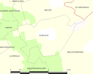
Plainville
- commune in Oise, France
- Country:
- Postal Code: 60120
- Coordinates: 49° 36' 49" N, 2° 27' 10" E
- GPS tracks (wikiloc): [Link]
- Area: 4.25 sq km
- Population: 160
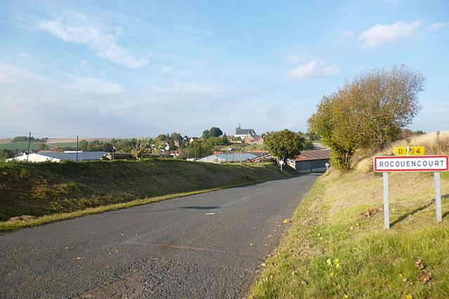

Rocquencourt
- commune in Oise, France
- Country:
- Postal Code: 60120
- Coordinates: 49° 38' 59" N, 2° 25' 3" E
- GPS tracks (wikiloc): [Link]
- Area: 9.81 sq km
- Population: 191


Villers-Tournelle
- commune in Somme, France
- Country:
- Postal Code: 80500
- Coordinates: 49° 39' 12" N, 2° 27' 49" E
- GPS tracks (wikiloc): [Link]
- Area: 5.93 sq km
- Population: 158

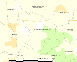
Le Mesnil-Saint-Firmin
- commune in Oise, France
- Country:
- Postal Code: 60120
- Coordinates: 49° 37' 42" N, 2° 24' 38" E
- GPS tracks (wikiloc): [Link]
- Area: 4.14 sq km
- Population: 193
- Web site: [Link]