Romegoux (Romegoux)

- commune in Charente-Maritime, France
- Country:

- Postal Code: 17250
- Coordinates: 45° 52' 18" N, 0° 48' 23" E


- GPS tracks (wikiloc): [Link]
- Area: 13.25 sq km
- Population: 624
- Web site: http://romegoux.chez-alice.fr
- Wikipedia en: wiki(en)
- Wikipedia: wiki(fr)
- Wikidata storage: Wikidata: Q1144388
- Wikipedia Commons Category: [Link]
- Freebase ID: [/m/03mcjq4]
- GeoNames ID: Alt: [6428046]
- SIREN number: [211703020]
- BnF ID: [15249163c]
- WOEID: [619858]
- INSEE municipality code: 17302
Shares border with regions:


La Vallée
- commune in Charente-Maritime, France
- Country:
- Postal Code: 17250
- Coordinates: 45° 53' 30" N, 0° 50' 30" E
- GPS tracks (wikiloc): [Link]
- Area: 16.37 sq km
- Population: 684
- Web site: [Link]


Bords
- commune in Charente-Maritime, France
- Country:
- Postal Code: 17430
- Coordinates: 45° 53' 49" N, 0° 47' 40" E
- GPS tracks (wikiloc): [Link]
- Area: 15.47 sq km
- Population: 1347


Beurlay
- commune in Charente-Maritime, France
- Country:
- Postal Code: 17250
- Coordinates: 45° 51' 37" N, 0° 50' 13" E
- GPS tracks (wikiloc): [Link]
- AboveSeaLevel: 23 м m
- Area: 9.71 sq km
- Population: 1030
- Web site: [Link]


Geay
- commune in Charente-Maritime, France
- Country:
- Postal Code: 17250
- Coordinates: 45° 52' 18" N, 0° 45' 56" E
- GPS tracks (wikiloc): [Link]
- Area: 15.9 sq km
- Population: 734

Saint-Sulpice-d'Arnoult
- commune in Charente-Maritime, France
- Country:
- Postal Code: 17250
- Coordinates: 45° 48' 17" N, 0° 50' 55" E
- GPS tracks (wikiloc): [Link]
- Area: 16.12 sq km
- Population: 816

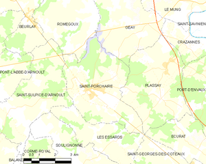
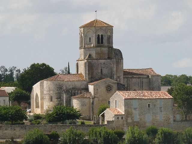
Saint-Porchaire
- commune in Charente-Maritime, France
- Country:
- Postal Code: 17250
- Coordinates: 45° 49' 18" N, 0° 47' 7" E
- GPS tracks (wikiloc): [Link]
- Area: 17.4 sq km
- Population: 1849
- Web site: [Link]