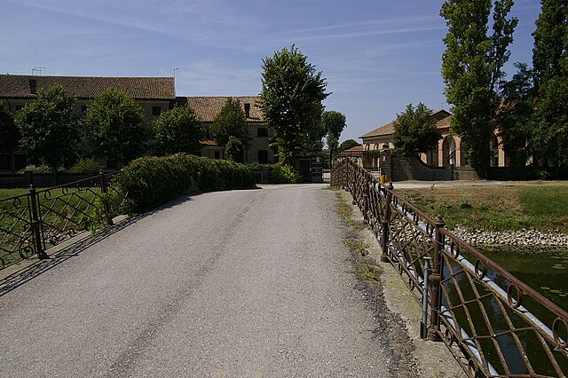
Rosolina (Rosolina)
.svg)
- Italian comune
 Hiking in Rosolina
Rosolina, located in the Veneto region of Italy, is not a typical hiking destination like mountainous areas, but it offers unique opportunities for outdoor activities, especially for those who enjoy nature and coastal landscapes. Here are some key points about hiking in and around Rosolina:
Natural Parks
-
Po Delta Regional Park: This is one of the most significant areas near Rosolina for hiking and exploring. The park encompasses wetlands, forests, and coastal areas, providing a rich biodiversity. You can explore various trails that offer views of the local flora and fauna, as well as birdwatching opportunities.
-
Regional Park of the Delta del Po: You may find paths that meander through marshes and river deltas, ideal for a peaceful hike while enjoying the serenity of nature.
Trails
-
There are several marked trails within the Po Delta Regional Park that can range from easy to moderate in difficulty. These paths often lead you through picturesque landscapes, dense vegetation, and alongside waterways.
-
Some walks may also include cultural points of interest, such as historical buildings, old fishing villages, and lookout points.
Wildlife
- Hiking in Rosolina provides a chance to see various bird species, especially migratory birds. Bring binoculars if you're interested in birdwatching along the trails.
Coastal Area
- The nearby coastline along the Adriatic Sea offers opportunities for scenic walks along the beach. These trails are generally flat and can be enjoyable for casual strolls or longer hikes.
Preparation
- Make sure to wear proper hiking shoes, bring plenty of water, and check the weather conditions before you head out. Since the area can be marshy, waterproof footwear could be beneficial.
Local Advice
- Connecting with local hiking groups or guides can enhance your experience, as they can offer insights into the best routes and hidden gems in the area.
Conclusion
While Rosolina may not offer high-altitude hikes or challenging mountainous terrain, it provides a different yet equally rewarding experience in nature, particularly for those who appreciate wetlands, coastal views, and diverse ecosystems. Happy hiking!
- Country:

- Postal Code: 45010
- Local Dialing Code: 0426
- Licence Plate Code: RO
- Coordinates: 45° 4' 0" N, 12° 14' 0" E


- GPS tracks (wikiloc): [Link]
- AboveSeaLevel: 1 м m
- Area: 74.69 sq km
- Population: 6456
- Web site: http://www.comune.rosolina.ro.it/
- Wikipedia en: wiki(en)
- Wikipedia: wiki(it)
- Wikidata storage: Wikidata: Q34378
- Wikipedia Commons Category: [Link]
- Freebase ID: [/m/0gk76k]
- GeoNames ID: Alt: [6538356]
- OSM relation ID: [44127]
- ISTAT ID: 029040
- Italian cadastre code: H573
Shares border with regions:

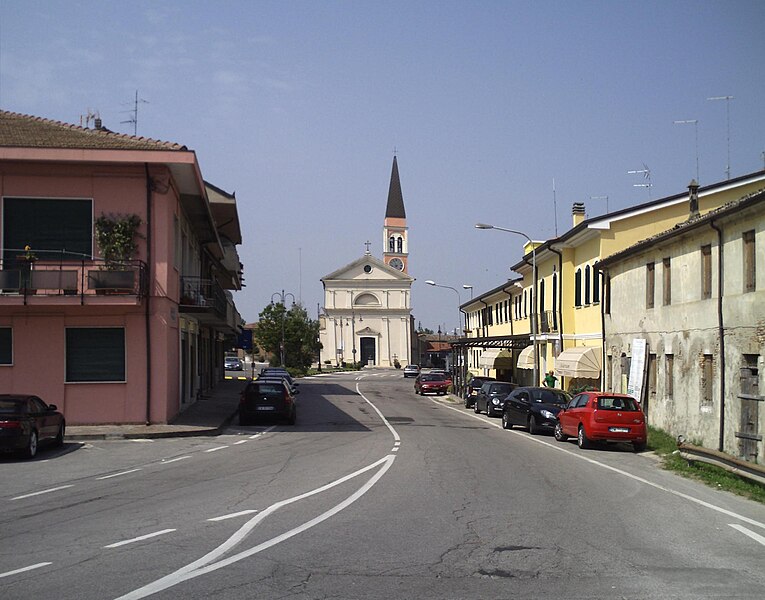
Loreo
- Italian comune
Hiking in Loreo
Loreo, located in the region of Veneto, Italy, is not as widely known for hiking as some other areas in the Veneto region, but it does offer some charming landscapes and trails for those looking to explore the area. The region is characterized by its flat lands and rivers, predominantly made up of agricultural fields, historical sites, and natural reserves....
- Country:
- Postal Code: 45017
- Local Dialing Code: 0426
- Licence Plate Code: RO
- Coordinates: 45° 4' 0" N, 12° 12' 0" E
- GPS tracks (wikiloc): [Link]
- AboveSeaLevel: 1 м m
- Area: 39.84 sq km
- Population: 3459
- Web site: [Link]

Porto Viro
- Italian comune
Hiking in Porto Viro
Porto Viro, located in the Veneto region of Italy, is a charming area that offers a unique blend of natural beauty and cultural experiences. While it may not be as famous as some other hiking destinations, it has several routes and trails that can satisfy outdoor enthusiasts looking for exploration within its picturesque landscapes....
- Country:
- Postal Code: 45014
- Local Dialing Code: 0426
- Licence Plate Code: RO
- Coordinates: 45° 1' 0" N, 12° 13' 0" E
- GPS tracks (wikiloc): [Link]
- AboveSeaLevel: 2 м m
- Area: 133.77 sq km
- Population: 14298
- Web site: [Link]

Chioggia
- Italian comune
Hiking in Chioggia
Chioggia, located on the Venetian Lagoon in Italy, is primarily known for its charming canals, colorful buildings, and rich fishing heritage rather than hiking trails. However, if you're looking to combine some outdoor exploration with the scenic beauty of the area, there are a few options nearby....
- Country:
- Postal Code: 30015
- Local Dialing Code: 041
- Licence Plate Code: VE
- Coordinates: 45° 13' 8" N, 12° 16' 43" E
- GPS tracks (wikiloc): [Link]
- AboveSeaLevel: 2 м m
- Area: 187.91 sq km
- Population: 49430
- Web site: [Link]