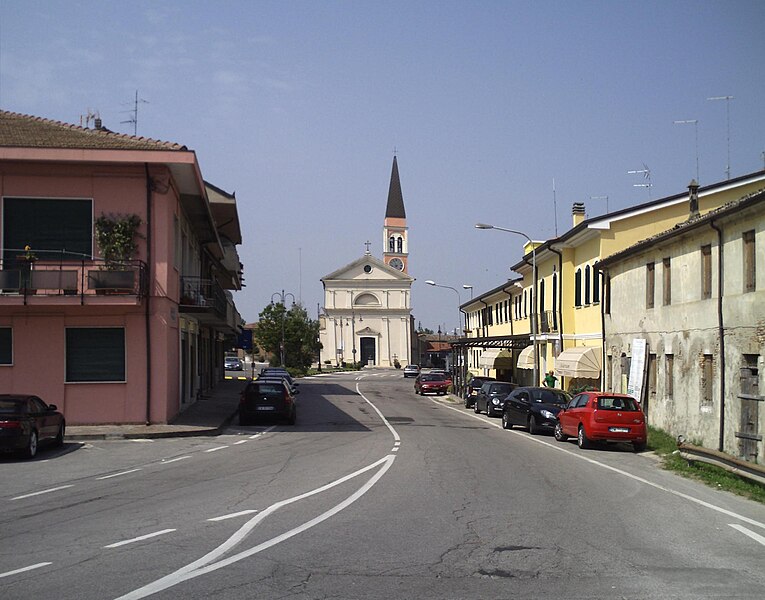
Loreo (Loreo)
.svg)
- Italian comune
 Hiking in Loreo
Loreo, located in the region of Veneto, Italy, is not as widely known for hiking as some other areas in the Veneto region, but it does offer some charming landscapes and trails for those looking to explore the area. The region is characterized by its flat lands and rivers, predominantly made up of agricultural fields, historical sites, and natural reserves.
Hiking Opportunities
-
Natural Reserves: The nearby Po Delta Regional Park is a notable area for nature lovers and offers a variety of trails with opportunities to observe local wildlife, especially birds. This area is a UNESCO World Heritage site and provides a unique ecosystem perfect for hiking.
-
Flat Trails: The terrain around Loreo is mostly flat, making it suitable for easy hikes. You can enjoy leisurely walks through scenic countryside, passing by vineyards, orchards, and farmland.
-
Cultural Hikes: You can also consider hikes that incorporate visits to historical sites in and around Loreo. This can include exploring old churches and the architecture in nearby towns.
Tips for Hiking in Loreo
-
Best Time to Hike: Spring (April to June) and fall (September to October) are ideal for hiking in the Veneto region, offering mild weather and beautiful scenery.
-
Preparation: Be sure to wear comfortable shoes suitable for flat terrain and carry enough water, especially during warmer months.
-
Navigation: While the paths are mostly straightforward, bringing a map or using a GPS device can be helpful to find the best trails and avoid getting lost.
-
Local Expertise: If you're looking for guided hikes or additional information, try to connect with local hiking clubs or tourist information centers. They can provide valuable insights into the area and suggest the best routes.
Enjoy your hiking adventure in Loreo and the surrounding Veneto region!
- Country:

- Postal Code: 45017
- Local Dialing Code: 0426
- Licence Plate Code: RO
- Coordinates: 45° 4' 0" N, 12° 12' 0" E


- GPS tracks (wikiloc): [Link]
- AboveSeaLevel: 1 м m
- Area: 39.84 sq km
- Population: 3459
- Web site: http://www.comune.loreo.ro.it
- Wikipedia en: wiki(en)
- Wikipedia: wiki(it)
- Wikidata storage: Wikidata: Q34377
- Wikipedia Commons Category: [Link]
- Freebase ID: [/m/0gk6zc]
- GeoNames ID: Alt: [6538354]
- OSM relation ID: [44032]
- UN/LOCODE: [ITLRE]
- ISTAT ID: 029030
- Italian cadastre code: E689
Shares border with regions:

Taglio di Po
- Italian comune
Hiking in Taglio di Po
Taglio di Po is a small town located in the Veneto region of Italy. While it may not be a widely recognized hiking destination, there are various outdoor activities and scenic landscapes nearby that can offer enjoyable hiking experiences....
- Country:
- Postal Code: 45019
- Local Dialing Code: 0426
- Licence Plate Code: RO
- Coordinates: 45° 0' 0" N, 12° 13' 0" E
- GPS tracks (wikiloc): [Link]
- AboveSeaLevel: 0 м m
- Area: 78.68 sq km
- Population: 8271
- Web site: [Link]


Rosolina
- Italian comune
Hiking in Rosolina
Rosolina, located in the Veneto region of Italy, is not a typical hiking destination like mountainous areas, but it offers unique opportunities for outdoor activities, especially for those who enjoy nature and coastal landscapes. Here are some key points about hiking in and around Rosolina:...
- Country:
- Postal Code: 45010
- Local Dialing Code: 0426
- Licence Plate Code: RO
- Coordinates: 45° 4' 0" N, 12° 14' 0" E
- GPS tracks (wikiloc): [Link]
- AboveSeaLevel: 1 м m
- Area: 74.69 sq km
- Population: 6456
- Web site: [Link]

Porto Viro
- Italian comune
Hiking in Porto Viro
Porto Viro, located in the Veneto region of Italy, is a charming area that offers a unique blend of natural beauty and cultural experiences. While it may not be as famous as some other hiking destinations, it has several routes and trails that can satisfy outdoor enthusiasts looking for exploration within its picturesque landscapes....
- Country:
- Postal Code: 45014
- Local Dialing Code: 0426
- Licence Plate Code: RO
- Coordinates: 45° 1' 0" N, 12° 13' 0" E
- GPS tracks (wikiloc): [Link]
- AboveSeaLevel: 2 м m
- Area: 133.77 sq km
- Population: 14298
- Web site: [Link]


Adria
- Italian comune
Hiking in Adria
Adria, often referred to as the "Adriatic Coast," encompasses parts of several countries including Italy, Slovenia, and Croatia. This region is renowned for its picturesque landscapes, charming coastal towns, and diverse hiking opportunities. Here’s an overview of hiking in the area:...
- Country:
- Postal Code: 45011
- Local Dialing Code: 0426
- Licence Plate Code: RO
- Coordinates: 45° 3' 0" N, 12° 3' 0" E
- GPS tracks (wikiloc): [Link]
- AboveSeaLevel: 4 м m
- Area: 113.39 sq km
- Population: 19436
- Web site: [Link]

Cavarzere
- Italian comune
Hiking in Cavarzere
Cavarzere is a town located in the Veneto region of Italy, near the Po Delta and not far from the Adriatic Sea. While it is not a widely known hiking destination compared to other regions in Italy, it does offer some opportunities for those looking to explore the area on foot. Here are some aspects to consider if you're planning a hike in and around Cavarzere:...
- Country:
- Postal Code: 30014
- Local Dialing Code: 0426
- Licence Plate Code: VE
- Coordinates: 45° 8' 13" N, 12° 4' 54" E
- GPS tracks (wikiloc): [Link]
- AboveSeaLevel: 4 м m
- Area: 140.44 sq km
- Population: 13791
- Web site: [Link]
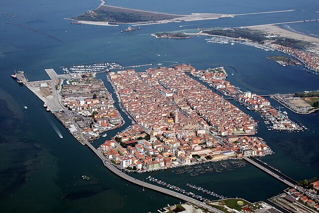

Chioggia
- Italian comune
Hiking in Chioggia
Chioggia, located on the Venetian Lagoon in Italy, is primarily known for its charming canals, colorful buildings, and rich fishing heritage rather than hiking trails. However, if you're looking to combine some outdoor exploration with the scenic beauty of the area, there are a few options nearby....
- Country:
- Postal Code: 30015
- Local Dialing Code: 041
- Licence Plate Code: VE
- Coordinates: 45° 13' 8" N, 12° 16' 43" E
- GPS tracks (wikiloc): [Link]
- AboveSeaLevel: 2 м m
- Area: 187.91 sq km
- Population: 49430
- Web site: [Link]