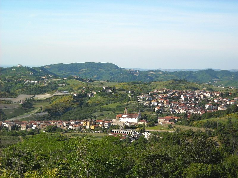
Rossiglione (Rossiglione)
.svg)
- Italian comune
 Hiking in Rossiglione
Rossiglione is a charming village located in the Liguria region of Italy, nestled among the lush hills and landscapes of the Apennines. It's an excellent spot for hiking, offering a variety of trails that cater to different skill levels and interests. Here are some highlights about hiking in Rossiglione:
1.
- The area surrounding Rossiglione features numerous trails that provide breathtaking views of the surrounding valleys, forests, and distant mountains. You can enjoy both serene natural beauty and the rich biodiversity of the region.
2.
- Some trails in Rossiglione follow ancient paths that connect villages and historical sites. Hiking these trails not only allows you to appreciate nature but also gives you insight into the local culture and history.
3.
- The region is home to a variety of wildlife, including deer, foxes, and numerous bird species. The flora is equally diverse, with beautiful wildflowers and dense forests creating a vibrant environment for hikers.
4.
- There are trails suitable for all levels—whether you're a beginner or an experienced hiker. Make sure to check trail maps and guides for specific difficulty levels.
- Some popular trails lead to notable landmarks, such as the nearby Mount Beigua, which is part of a UNESCO Global Geopark.
5.
- As with any hiking adventure, it's crucial to prepare adequately. Carry sufficient water, snacks, appropriate footwear, and a detailed map or a GPS device. It's also wise to check the weather conditions before heading out.
6.
- Consider visiting local tourist information centers in Rossiglione for trail maps and recommendations. You may also find guided hikes, which can enhance your experience.
7.
- In addition to hiking, the area offers opportunities for biking and exploring local cuisine in the quaint restaurants and cafes.
Whether you are looking for a leisurely stroll or an adventurous hike, Rossiglione provides a perfect backdrop to immerse yourself in the beauty of the Italian countryside. Enjoy your hiking experience!
- Country:

- Postal Code: 16010
- Local Dialing Code: 010
- Licence Plate Code: GE
- Coordinates: 44° 34' 0" N, 8° 40' 0" E


- GPS tracks (wikiloc): [Link]
- AboveSeaLevel: 300 м m
- Area: 47.59 sq km
- Population: 2693
- Web site: http://www.comune.rossiglione.ge.it/
- Wikipedia en: wiki(en)
- Wikipedia: wiki(it)
- Wikidata storage: Wikidata: Q265325
- Wikipedia Commons Gallery: [Link]
- Wikipedia Commons Category: [Link]
- Freebase ID: [/m/0ghwqp]
- GeoNames ID: Alt: [6537064]
- VIAF ID: Alt: [145310426]
- OSM relation ID: [43277]
- MusicBrainz area ID: [35e27d11-e59a-4e5b-a5b1-ec8e916cf333]
- ISTAT ID: 010051
- Italian cadastre code: H581
Shares border with regions:


Belforte Monferrato
- municipality in Italy
Hiking in Belforte Monferrato
Belforte Monferrato is a charming village located in the Piedmont region of Italy, surrounded by beautiful landscapes perfect for hiking. Here are some important aspects to consider when hiking in and around Belforte Monferrato:...
- Country:
- Postal Code: 15070
- Local Dialing Code: 0143
- Licence Plate Code: AL
- Coordinates: 44° 37' 34" N, 8° 39' 44" E
- GPS tracks (wikiloc): [Link]
- AboveSeaLevel: 233 м m
- Area: 8.33 sq km
- Population: 506
- Web site: [Link]

Bosio
- municipality in Italy
Hiking in Bosio
Bosio, a charming town located in the province of Genoa in the Liguria region of Italy, offers a variety of hiking opportunities that showcase the beautiful natural landscapes of the Apennine Mountains. Here are some key points to consider when hiking in Bosio:...
- Country:
- Postal Code: 15060
- Local Dialing Code: 0143
- Licence Plate Code: AL
- Coordinates: 44° 39' 3" N, 8° 47' 38" E
- GPS tracks (wikiloc): [Link]
- AboveSeaLevel: 358 м m
- Area: 67.61 sq km
- Population: 1195
- Web site: [Link]

Molare
- municipality in Italy
Hiking in Molare
Molare is a picturesque area located in the Piedmont region of Italy, known for its scenic landscapes, rolling hills, vineyards, and lush countryside. While Molare itself is a small town, it serves as a gateway to various hiking trails that explore the surrounding natural beauty....
- Country:
- Postal Code: 15074
- Local Dialing Code: 0143
- Licence Plate Code: AL
- Coordinates: 44° 37' 5" N, 8° 35' 59" E
- GPS tracks (wikiloc): [Link]
- AboveSeaLevel: 226 м m
- Area: 32.5 sq km
- Population: 2117
- Web site: [Link]
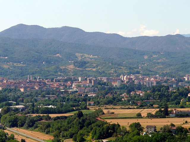

Ovada
- municipality in Italy
Hiking in Ovada
Ovada is a charming town located in the Piedmont region of northwest Italy, surrounded by beautiful landscapes that offer excellent hiking opportunities. The area is characterized by rolling hills, vineyards, and lush greenery, making it an ideal destination for both novice and experienced hikers. Here are some key points to consider when hiking in and around Ovada:...
- Country:
- Postal Code: 15076
- Local Dialing Code: 0143
- Licence Plate Code: AL
- Coordinates: 44° 38' 21" N, 8° 38' 47" E
- GPS tracks (wikiloc): [Link]
- AboveSeaLevel: 186 м m
- Area: 35.37 sq km
- Population: 11365
- Web site: [Link]
Tagliolo Monferrato
- municipality in Italy
Hiking in Tagliolo Monferrato
Tagliolo Monferrato is a charming village located in the Monferrato region of northern Italy, known for its stunning landscapes, vineyards, and rich cultural heritage. Hiking in this area offers a fantastic opportunity to explore the picturesque countryside, rolling hills, and ancient villages....
- Country:
- Postal Code: 15070
- Local Dialing Code: 0143
- Licence Plate Code: AL
- Coordinates: 44° 38' 21" N, 8° 40' 1" E
- GPS tracks (wikiloc): [Link]
- AboveSeaLevel: 315 м m
- Area: 26.21 sq km
- Population: 1567
- Web site: [Link]


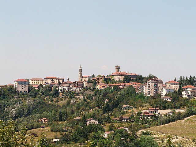
Campo Ligure
- Italian comune
Hiking in Campo Ligure
Campo Ligure is a picturesque town located in the Liguria region of Italy, quite known for its beautiful hiking trails and stunning natural landscapes. Here are some highlights you might find interesting about hiking in the area:...
- Country:
- Postal Code: 16013
- Local Dialing Code: 010
- Licence Plate Code: GE
- Coordinates: 44° 32' 17" N, 8° 41' 52" E
- GPS tracks (wikiloc): [Link]
- AboveSeaLevel: 342 м m
- Area: 23.74 sq km
- Population: 2885
- Web site: [Link]


Tiglieto
- Italian comune
Hiking in Tiglieto
Tiglieto, located in the Ligurian Alps of Italy, is a fantastic destination for hiking enthusiasts. It offers a mix of stunning landscapes, rich biodiversity, and historical sites. Here are some highlights and tips for hiking in the Tiglieto area:...
- Country:
- Postal Code: 16010
- Local Dialing Code: 010
- Licence Plate Code: GE
- Coordinates: 44° 31' 30" N, 8° 37' 11" E
- GPS tracks (wikiloc): [Link]
- AboveSeaLevel: 500 м m
- Area: 24.54 sq km
- Population: 538
- Web site: [Link]