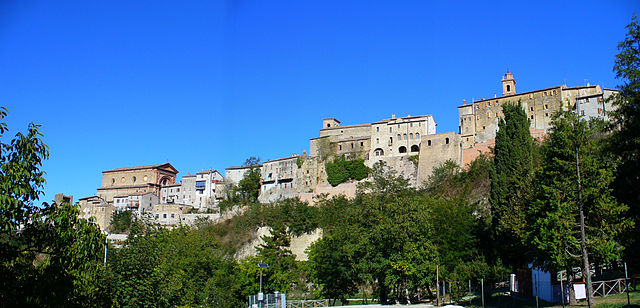
Rotella (Rotella)
.svg)
- Italian comune
 Hiking in Rotella
Rotella is a picturesque village located in the province of Fermo, in the Marche region of Italy. Nestled in the rolling hills of the Apennine Mountains, it offers a tranquil environment for hiking enthusiasts. The region is characterized by its beautiful landscapes, rich history, and diverse flora and fauna.
Hiking Opportunities in Rotella:
-
Trails and Routes:
- The area around Rotella features a network of marked hiking trails that lead through forests, fields, and along rivers. Some trails offer stunning views of the surrounding mountains and valleys.
- Popular routes include paths that connect to nearby historical sites or rural areas, allowing hikers to explore both nature and culture.
-
Natural Features:
- The terrain includes a mix of gentle hills and more challenging inclines, making it suitable for hikers of different skill levels.
- Nature enthusiasts can enjoy the region's biodiversity, with opportunities for bird watching and spotting local wildlife.
-
Cultural Aspects:
- Hikers can discover ancient ruins, charming villages, and traditional farms throughout the trails. The cultural heritage of the Marche region adds an enriching dimension to the hiking experience.
-
Best Seasons to Hike:
- Spring and autumn are ideal for hiking in Rotella due to mild temperatures and beautiful scenery, with spring flowers or autumn foliage enhancing the landscape.
- Summer can be warmer, but early morning or late afternoon hikes can be pleasant.
-
Safety and Preparation:
- As with any hiking trip, it's essential to wear appropriate footwear and carry enough water and snacks.
- Familiarize yourself with the trails and local regulations, as some paths may require permits or have specific seasonal access.
-
Local Amenities:
- After a day of hiking, you can explore local cuisine in Rotella, enjoying traditional dishes made from fresh, local ingredients.
-
Guided Tours:
- If you’re new to the area or prefer a structured experience, consider joining a guided hiking tour. Local guides can provide valuable insights into the landscape, history, and ecology of the region.
Always check current conditions and trail maps before heading out, as weather and trail maintenance can affect accessibility. Enjoy your hiking adventures in Rotella!
- Country:

- Postal Code: 63071
- Local Dialing Code: 0736
- Licence Plate Code: AP
- Coordinates: 42° 57' 16" N, 13° 33' 39" E


- GPS tracks (wikiloc): [Link]
- AboveSeaLevel: 395 м m
- Area: 27.44 sq km
- Population: 870
- Web site: http://www.comunerotella.net
- Wikipedia en: wiki(en)
- Wikipedia: wiki(it)
- Wikidata storage: Wikidata: Q56089
- Wikipedia Commons Gallery: [Link]
- Wikipedia Commons Category: [Link]
- Freebase ID: [/m/0gl8v8]
- GeoNames ID: Alt: [6536804]
- OSM relation ID: [42242]
- WOEID: [722069]
- UN/LOCODE: [ITIIP]
- Google Maps Customer ID: [4799412383850172134]
- ISTAT ID: 044065
- Italian cadastre code: H588
Shares border with regions:


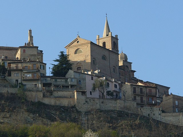
Castignano
- Italian comune
Hiking in Castignano
Castignano is a picturesque village located in the Marche region of Italy, known for its scenic landscapes, rich history, and charming architecture. Hiking in and around Castignano offers beautiful views of the rolling hills, vineyards, and olive groves characteristic of the region....
- Country:
- Postal Code: 63072
- Local Dialing Code: 0736
- Licence Plate Code: AP
- Coordinates: 42° 56' 17" N, 13° 37' 19" E
- GPS tracks (wikiloc): [Link]
- AboveSeaLevel: 473 м m
- Area: 38.8 sq km
- Population: 2737
- Web site: [Link]

Force, Marche
- Italian comune
Hiking in Force, Marche
Force, located in the Marche region of Italy, is a charming hilltop village surrounded by beautiful landscapes that are perfect for hiking enthusiasts. The area is characterized by its rolling hills, forests, and stunning views of the surrounding countryside, making it an excellent destination for outdoor activities....
- Country:
- Postal Code: 63086
- Local Dialing Code: 0736
- Licence Plate Code: AP
- Coordinates: 42° 57' 48" N, 13° 29' 28" E
- GPS tracks (wikiloc): [Link]
- AboveSeaLevel: 689 м m
- Area: 34.31 sq km
- Population: 1278
- Web site: [Link]

Montedinove
- Italian comune
Hiking in Montedinove
Montedinove is a picturesque village located in the Marche region of Italy, known for its stunning landscapes and beautiful hiking trails. Nestled in the hills, it provides a great opportunity to explore the natural beauty of the area, including rolling hills, lush forests, and panoramic views of the surrounding countryside....
- Country:
- Postal Code: 63069
- Local Dialing Code: 0736
- Licence Plate Code: AP
- Coordinates: 42° 58' 14" N, 13° 35' 13" E
- GPS tracks (wikiloc): [Link]
- AboveSeaLevel: 561 м m
- Area: 11.93 sq km
- Population: 498
- Web site: [Link]

Venarotta
- Italian comune
Hiking in Venarotta
Venarotta is a picturesque village located in the province of Ascoli Piceno in the Marche region of Italy. The surrounding area offers wonderful opportunities for hiking, thanks to its stunning landscapes, rolling hills, and proximity to the Sibillini Mountains....
- Country:
- Postal Code: 63091
- Local Dialing Code: 0736
- Licence Plate Code: AP
- Coordinates: 42° 52' 55" N, 13° 29' 40" E
- GPS tracks (wikiloc): [Link]
- AboveSeaLevel: 421 м m
- Area: 30.21 sq km
- Population: 2030
- Web site: [Link]


Montelparo
- Italian comune
Hiking in Montelparo
Montelparo is a charming hilltop village located in the Marche region of Italy, surrounded by beautiful landscapes, rolling hills, and rich natural beauty. Hiking in and around Montelparo offers a variety of trails suitable for different experience levels, providing stunning views of the surrounding countryside, vineyards, and distant mountains....
- Country:
- Postal Code: 63853
- Local Dialing Code: 0734
- Licence Plate Code: FM
- Coordinates: 43° 1' 5" N, 13° 32' 7" E
- GPS tracks (wikiloc): [Link]
- AboveSeaLevel: 588 м m
- Area: 21.63 sq km
- Population: 758
- Web site: [Link]
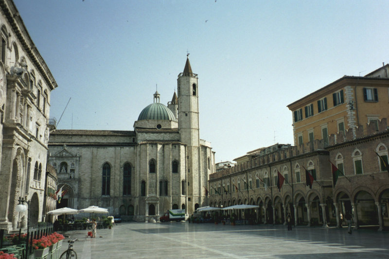

Ascoli Piceno
- Italian comune
Hiking in Ascoli Piceno
Ascoli Piceno, a charming town in the Marche region of Italy, offers a variety of hiking opportunities that allow you to explore its stunning landscapes, rich history, and charming villages. Here are some details about hiking in and around Ascoli Piceno:...
- Country:
- Postal Code: 63100
- Local Dialing Code: 0736
- Licence Plate Code: AP
- Coordinates: 42° 51' 17" N, 13° 34' 31" E
- GPS tracks (wikiloc): [Link]
- AboveSeaLevel: 154 м m
- Area: 158.02 sq km
- Population: 48773
- Web site: [Link]