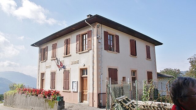
Rotherens (Rotherens)

- commune in Savoie, France
 Hiking in Rotherens
It looks like there might be a small error in the name "Rotherens." If you're referring to hiking in a specific area, it might be Rotherham in England, Rothenburg in Germany, or perhaps a different location entirely. Each of these places offers a variety of hiking options.
If you meant Rotherham, England: Rotherham is surrounded by beautiful countryside and offers access to the South Yorkshire region, which includes the Peak District National Park. You can find trails suitable for all skill levels. Some notable hikes include:
- Dalton Historic Walk: A scenic trail that combines nature with local history.
- Clifton Park: A lovely place for short, family-friendly walks with landscaped gardens and a serene atmosphere.
- Wickersley Woods: Offers wooded trails that range from easy to moderate difficulties.
If you meant Rothenburg ob der Tauber, Germany: This picturesque medieval town is surrounded by scenic routes, suitable for hiking enthusiasts wanting to explore the Franconian countryside. Highlights include:
- The Romantic Road: A section of this famous tourist route has hiking trails that connect charming towns and beautiful landscapes.
- Tauber Valley Trails: Explore the beautiful valley with trails along the Tauber River, perfect for nature lovers.
General Hiking Tips:
- Always wear appropriate footwear and gear.
- Carry plenty of water, snacks, and a map or GPS device.
- Be mindful of the weather and check forecasts before heading out.
If you have a specific location or more details in mind, please let me know, and I can provide more detailed information!
- Country:

- Postal Code: 73110
- Coordinates: 45° 28' 22" N, 6° 8' 10" E


- GPS tracks (wikiloc): [Link]
- Area: 1.74 sq km
- Population: 367
- Wikipedia en: wiki(en)
- Wikipedia: wiki(fr)
- Wikidata storage: Wikidata: Q671767
- Wikipedia Commons Category: [Link]
- Freebase ID: [/m/03qlm_h]
- GeoNames ID: Alt: [6454653]
- SIREN number: [217302173]
- BnF ID: [15274148w]
- INSEE municipality code: 73217
Shares border with regions:


La Croix-de-la-Rochette
- commune in Savoie, France
Hiking in La Croix-de-la-Rochette
La Croix-de-la-Rochette is a charming area located in the French Alps, known for its stunning landscapes and outdoor recreational opportunities. Hiking in this region offers a variety of trails suited to different skill levels, ranging from easy walks to more challenging hikes. Here are some highlights of hiking in La Croix-de-la-Rochette:...
- Country:
- Postal Code: 73110
- Coordinates: 45° 28' 1" N, 6° 7' 8" E
- GPS tracks (wikiloc): [Link]
- Area: 3.04 sq km
- Population: 340

Étable
- commune in Savoie, France
Hiking in Étable
Étable is a charming area often associated with beautiful landscapes, scenic trails, and diverse ecosystems that make it an attractive destination for hiking enthusiasts. However, since "Étable" refers to various locations in French-speaking regions, I'll provide a general overview of what to expect when hiking in regions that may have this name, such as Étable-sur-Montmel, located in France....
- Country:
- Postal Code: 73110
- Coordinates: 45° 27' 47" N, 6° 8' 29" E
- GPS tracks (wikiloc): [Link]
- Area: 2.7 sq km
- Population: 388


La Rochette
- commune in Savoie, France
Hiking in La Rochette
La Rochette, located in the Savoie region of the French Alps, offers a range of hiking opportunities for both beginners and experienced hikers. The area is known for its stunning alpine scenery, with impressive mountain views, lush forests, and scenic valleys....
- Country:
- Postal Code: 73110
- Coordinates: 45° 27' 31" N, 6° 7' 13" E
- GPS tracks (wikiloc): [Link]
- Area: 4.66 sq km
- Population: 3694
- Web site: [Link]


Villard-Sallet
- commune in Savoie, France
Hiking in Villard-Sallet
Villard-Sallet is a picturesque destination located in the French Alps, known for its stunning landscapes and outdoor activities, particularly hiking. Nestled at the heart of nature, it's a great spot for both novice and experienced hikers. Here are some key highlights and tips for hiking in Villard-Sallet:...
- Country:
- Postal Code: 73110
- Coordinates: 45° 29' 7" N, 6° 8' 18" E
- GPS tracks (wikiloc): [Link]
- Area: 3.14 sq km
- Population: 289


La Table
- commune in Savoie, France
Hiking in La Table
La Table, located on the island of La Réunion in the Indian Ocean, is a prominent hiking destination known for its stunning landscapes, unique geological features, and rich biodiversity. Here’s what you need to know about hiking in La Table:...
- Country:
- Postal Code: 73110
- Coordinates: 45° 28' 48" N, 6° 10' 18" E
- GPS tracks (wikiloc): [Link]
- Area: 14.85 sq km
- Population: 475