Rouet (Rouet)

- commune in Hérault, France
- Country:

- Postal Code: 34380
- Coordinates: 43° 48' 43" N, 3° 48' 47" E


- GPS tracks (wikiloc): [Link]
- AboveSeaLevel: 261 м m
- Area: 24.77 sq km
- Population: 59
- Wikipedia en: wiki(en)
- Wikipedia: wiki(fr)
- Wikidata storage: Wikidata: Q196419
- Wikipedia Commons Category: [Link]
- Freebase ID: [/m/03nv8w7]
- Freebase ID: [/m/03nv8w7]
- Freebase ID: [/m/03nv8w7]
- GeoNames ID: Alt: [6616592]
- GeoNames ID: Alt: [6616592]
- GeoNames ID: Alt: [6616592]
- SIREN number: [213402365]
- SIREN number: [213402365]
- SIREN number: [213402365]
- BnF ID: [152568377]
- BnF ID: [152568377]
- BnF ID: [152568377]
- INSEE municipality code: 34236
- INSEE municipality code: 34236
- INSEE municipality code: 34236
Shares border with regions:


Claret
- commune in Hérault, France
- Country:
- Postal Code: 34270
- Coordinates: 43° 51' 43" N, 3° 54' 17" E
- GPS tracks (wikiloc): [Link]
- Area: 28.27 sq km
- Population: 1477
- Web site: [Link]


Valflaunès
- commune in Hérault, France
- Country:
- Postal Code: 34270
- Coordinates: 43° 48' 2" N, 3° 52' 19" E
- GPS tracks (wikiloc): [Link]
- Area: 21.04 sq km
- Population: 745
- Web site: [Link]


Notre-Dame-de-Londres
- commune in Hérault, France
- Country:
- Postal Code: 34380
- Coordinates: 43° 49' 36" N, 3° 46' 37" E
- GPS tracks (wikiloc): [Link]
- Area: 28.15 sq km
- Population: 479
Ferrières-les-Verreries
- commune in Hérault, France
- Country:
- Postal Code: 34190
- Coordinates: 43° 52' 41" N, 3° 47' 50" E
- GPS tracks (wikiloc): [Link]
- Area: 17.42 sq km
- Population: 55

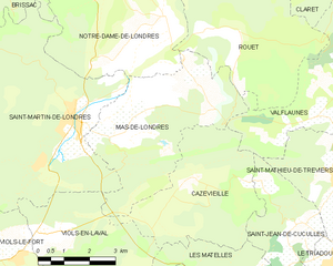
Mas-de-Londres
- commune in Hérault, France
- Country:
- Postal Code: 34380
- Coordinates: 43° 46' 53" N, 3° 45' 9" E
- GPS tracks (wikiloc): [Link]
- Area: 19.06 sq km
- Population: 634