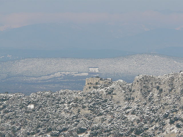
Claret (Claret)

- commune in Hérault, France
- Country:

- Postal Code: 34270
- Coordinates: 43° 51' 43" N, 3° 54' 17" E


- GPS tracks (wikiloc): [Link]
- Area: 28.27 sq km
- Population: 1477
- Web site: http://www.claret.fr
- Wikipedia en: wiki(en)
- Wikipedia: wiki(fr)
- Wikidata storage: Wikidata: Q1011393
- Wikipedia Commons Category: [Link]
- Freebase ID: [/m/03mgpxr]
- Freebase ID: [/m/03mgpxr]
- GeoNames ID: Alt: [6613009]
- GeoNames ID: Alt: [6613009]
- SIREN number: [213400781]
- SIREN number: [213400781]
- BnF ID: [15256679m]
- BnF ID: [15256679m]
- PACTOLS thesaurus ID: [pcrtSeY33Vnn3D]
- PACTOLS thesaurus ID: [pcrtSeY33Vnn3D]
- INSEE municipality code: 34078
- INSEE municipality code: 34078
Shares border with regions:


Lauret
- commune in Hérault, France
- Country:
- Postal Code: 34270
- Coordinates: 43° 50' 8" N, 3° 53' 11" E
- GPS tracks (wikiloc): [Link]
- Area: 6.67 sq km
- Population: 591


Valflaunès
- commune in Hérault, France
- Country:
- Postal Code: 34270
- Coordinates: 43° 48' 2" N, 3° 52' 19" E
- GPS tracks (wikiloc): [Link]
- Area: 21.04 sq km
- Population: 745
- Web site: [Link]
Ferrières-les-Verreries
- commune in Hérault, France
- Country:
- Postal Code: 34190
- Coordinates: 43° 52' 41" N, 3° 47' 50" E
- GPS tracks (wikiloc): [Link]
- Area: 17.42 sq km
- Population: 55

Rouet
- commune in Hérault, France
- Country:
- Postal Code: 34380
- Coordinates: 43° 48' 43" N, 3° 48' 47" E
- GPS tracks (wikiloc): [Link]
- AboveSeaLevel: 261 м m
- Area: 24.77 sq km
- Population: 59


Sauteyrargues
- commune in Hérault, France
- Country:
- Postal Code: 34270
- Coordinates: 43° 50' 20" N, 3° 55' 9" E
- GPS tracks (wikiloc): [Link]
- Area: 12.76 sq km
- Population: 400


Corconne
- commune in Gard, France
- Country:
- Postal Code: 30260
- Coordinates: 43° 52' 19" N, 3° 56' 22" E
- GPS tracks (wikiloc): [Link]
- Area: 12.98 sq km
- Population: 540
- Web site: [Link]

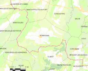
Pompignan
- commune in Gard, France
- Country:
- Postal Code: 30170
- Coordinates: 43° 53' 38" N, 3° 51' 22" E
- GPS tracks (wikiloc): [Link]
- Area: 41.31 sq km
- Population: 922