Rudiano (Rudiano)
.svg)
- Italian comune
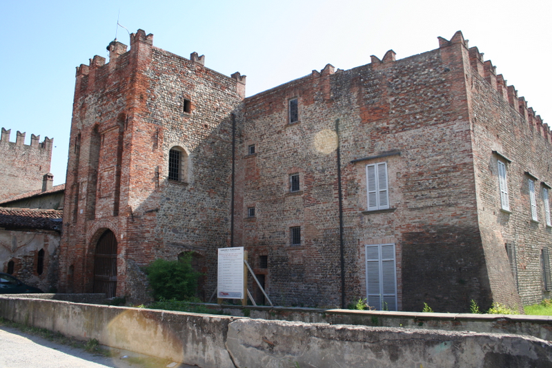
 Hiking in Rudiano
Rudiano is a small town in the Lombardy region of Italy, known for its picturesque landscapes and tranquil environment. While it may not be a widely recognized hiking destination, the surrounding area offers opportunities for outdoor activities, especially for those who enjoy exploring less crowded trails.
Hiking Opportunities Near Rudiano:
-
Local Trails:
- The countryside surrounding Rudiano features various paths and small trails that are suitable for casual hiking. These trails often pass through fields, vineyards, and woodlands, providing a serene atmosphere for nature lovers.
- Look for local signs or maps that may indicate popular walking routes.
-
Oglio River Park:
- Located not far from Rudiano, Oglio River Park offers scenic trails along the river. The park is known for its rich biodiversity and beautiful landscapes. Hiking here allows you to enjoy the natural beauty of the region, with opportunities for birdwatching and photography.
-
Nearby Hills and Mountains:
- To the north and east of Rudiano, the landscape transitions to hills, which may offer access to more challenging hiking trails. The Valle Sabbia region is an excellent option for hiking enthusiasts, featuring trails that vary in difficulty and provide stunning views of the surrounding landscapes.
-
Cultural Hikes:
- Consider incorporating cultural elements into your hikes by visiting nearby towns such as Palazzolo sull'Oglio or Chiari. These towns have historical sites and local charm that can enhance your hiking experience.
Tips for Hiking in Rudiano:
- Check Local Conditions: Before heading out, check the weather conditions and the status of the trails, as some paths may be affected by seasonal changes.
- Gear Appropriately: Wear suitable hiking shoes and bring water and snacks for your hike, especially if you're planning a longer trek.
- Respect Nature: Follow the Leave No Trace principles, ensuring that you preserve the natural beauty of the area for future hikers.
- Safety First: Always let someone know your plans and expected return time, especially if you plan to hike in more remote areas.
While Rudiano may not be a traditional hiking hotspot, its surrounding areas offer peaceful outdoor experiences that could be perfect for both beginner and seasoned hikers looking for a quiet escape.
- Country:

- Postal Code: 25030
- Local Dialing Code: 030
- Licence Plate Code: BS
- Coordinates: 45° 29' 0" N, 9° 53' 0" E


- GPS tracks (wikiloc): [Link]
- AboveSeaLevel: 117 м m
- Area: 9.85 sq km
- Population: 5783
- Web site: http://www.comune.rudiano.bs.it/
- Wikipedia en: wiki(en)
- Wikipedia: wiki(it)
- Wikidata storage: Wikidata: Q111650
- Wikipedia Commons Category: [Link]
- Freebase ID: [/m/047p02]
- GeoNames ID: Alt: [6541673]
- VIAF ID: Alt: [307294260]
- OSM relation ID: [45139]
- TGN ID: [7042338]
- UN/LOCODE: [ITRUD]
- ISTAT ID: 017167
- Italian cadastre code: H630
Shares border with regions:


Calcio, Lombardy
- Italian comune
Hiking in Calcio, Lombardy
Calcio, a small town in Lombardy near the Adda River, may not be as widely recognized as a hiking destination compared to other areas in Italy, but it offers charming landscapes and opportunities for outdoor activities. While the town itself is not a major hiking hub, it’s surrounded by beautiful natural areas that can be explored on foot....
- Country:
- Postal Code: 24054
- Local Dialing Code: 0363
- Licence Plate Code: BG
- Coordinates: 45° 30' 30" N, 9° 51' 3" E
- GPS tracks (wikiloc): [Link]
- AboveSeaLevel: 123 м m
- Area: 15.67 sq km
- Population: 5326
- Web site: [Link]

Pumenengo
- Italian comune
Hiking in Pumenengo
It seems there might be some confusion, as there isn't a well-known hiking destination specifically named "Pumenengo." It's possible you meant a different location, or it could be a lesser-known area....
- Country:
- Postal Code: 24050
- Local Dialing Code: 0363
- Licence Plate Code: BG
- Coordinates: 45° 28' 0" N, 9° 52' 0" E
- GPS tracks (wikiloc): [Link]
- AboveSeaLevel: 106 м m
- Area: 10.12 sq km
- Population: 1715
- Web site: [Link]

Chiari
- Italian comune
Hiking in Chiari
Chiari, located in the province of Brescia in Lombardy, Italy, is not only known for its charming historic center but also for its access to beautiful natural landscapes that are ideal for hiking enthusiasts. The surrounding area offers various trails and paths that cater to different skill levels, making it a great destination for both beginners and experienced hikers....
- Country:
- Postal Code: 25032
- Local Dialing Code: 030
- Licence Plate Code: BS
- Coordinates: 45° 31' 11" N, 9° 53' 0" E
- GPS tracks (wikiloc): [Link]
- AboveSeaLevel: 145 м m
- Area: 38.02 sq km
- Population: 18944
- Web site: [Link]
Roccafranca
- Italian comune
Hiking in Roccafranca
Roccafranca, located in the Lombardy region of Italy, is not typically known as a major hiking destination, but it has its charm and opportunities for outdoor activities. The surrounding areas offer scenic landscapes that can be explored through various trails....
- Country:
- Postal Code: 25030
- Local Dialing Code: 030
- Licence Plate Code: BS
- Coordinates: 45° 28' 0" N, 9° 55' 0" E
- GPS tracks (wikiloc): [Link]
- AboveSeaLevel: 117 м m
- Area: 19 sq km
- Population: 4777
- Web site: [Link]
Urago d'Oglio
- Italian comune
Hiking in Urago d'Oglio
Urago d'Oglio is a charming municipality in Italy, nestled in the Lombardy region, and offers a variety of scenic hiking opportunities for outdoor enthusiasts. Although it's a small area, there are several aspects to consider when hiking there:...
- Country:
- Postal Code: 25030
- Local Dialing Code: 030
- Licence Plate Code: BS
- Coordinates: 45° 31' 0" N, 9° 52' 0" E
- GPS tracks (wikiloc): [Link]
- AboveSeaLevel: 131 м m
- Area: 10 sq km
- Population: 3814
- Web site: [Link]