Rumo (Rumo)
- Italian comune
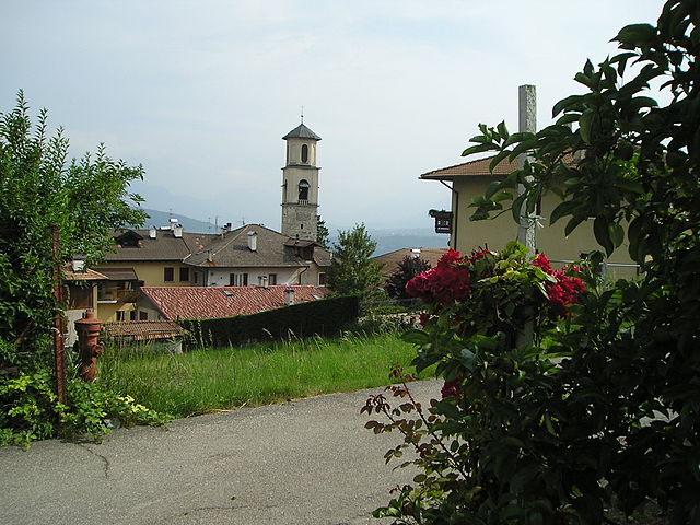
Rumo is a small municipality located in the Trentino-Alto Adige/Südtirol region of northern Italy. It's known for its stunning natural landscapes, including the Dolomites, which are recognized as a UNESCO World Heritage Site. Here are some features and tips for hiking in and around Rumo:
Hiking Trails
-
Dolomites Trails: The region offers a variety of trails with varying difficulties. Popular hikes include routes that lead to scenic viewpoints, alpine lakes, and historically significant areas.
-
Mendel Pass: This area provides a network of trails with beautiful views of the surrounding mountains. The Mendel Pass is accessible and serves as a great starting point for various hikes.
-
Val di Non: Explore the picturesque valley with apple orchards and breathtaking landscapes. There are several trails perfect for day hikes.
-
Forest Trails: The areas surrounding Rumo have well-marked forest paths. These trails are typically easier and are great for families or those looking for a leisurely hike.
Recommendations
-
Start Early: To make the most of your hiking experience and to avoid crowds, start your hikes early in the day.
-
Check Weather Conditions: Mountain weather can change quickly, so it’s wise to check the forecast before heading out and be prepared for sudden changes.
-
Equip Properly: Wear sturdy hiking shoes, and bring layers of clothing, as temperatures can fluctuate. Always carry water and some snacks.
-
Local Maps and Guides: Consider picking up a local hiking map or hiring a guide for the best experience and to navigate the trails safely.
-
Respect Nature: Follow the principles of Leave No Trace, stay on marked paths, and respect wildlife and plants.
Seasonal Considerations
-
Summer: This is the peak hiking season. Trails may be busier, but the weather is usually favorable for hiking.
-
Autumn: Early autumn can be stunning with fall foliage. Some trails might become less accessible later in the season due to snow.
-
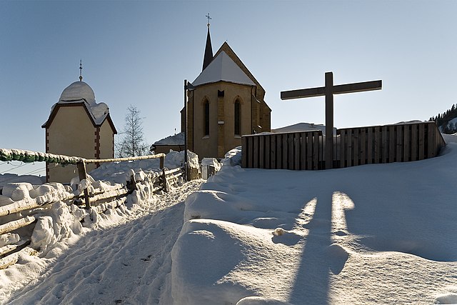
Winter: While some trails become winter hiking paths, you may need snowshoes or crampons, and extreme caution should be exercised.
-
Spring: Spring can also be a beautiful time with blooming wildflowers and flowing streams, but be mindful of wet and muddy trails.
Hiking in Rumo offers an excellent way to experience the beauty of the Italian Alps. Always prioritize safety and enjoyment as you explore this stunning region!
- Country:

- Postal Code: 38020
- Local Dialing Code: 0463
- Licence Plate Code: TN
- Coordinates: 46° 27' 0" N, 11° 1' 0" E


- GPS tracks (wikiloc): [Link]
- AboveSeaLevel: 944 м m
- Area: 30.85 sq km
- Population: 811
- Web site: http://www.comune.rumo.tn.it/
- Wikipedia en: wiki(en)
- Wikipedia: wiki(it)
- Wikidata storage: Wikidata: Q301492
- Wikipedia Commons Category: [Link]
- Freebase ID: [/m/0gb0cg]
- GeoNames ID: Alt: [6542635]
- VIAF ID: Alt: [245435449]
- OSM relation ID: [47201]
- ISTAT ID: 022163
- Italian cadastre code: H639
Shares border with regions:
Bresimo
- Italian comune
Bresimo, located in the Province of Trento in Northern Italy, is a hidden gem for hiking enthusiasts. Nestled in the Val di Non region, it offers stunning landscapes, diverse trails, and a deep connection with nature....
- Country:

- Postal Code: 38020
- Local Dialing Code: 0463
- Licence Plate Code: TN
- Coordinates: 46° 25' 0" N, 10° 58' 0" E


- GPS tracks (wikiloc): [Link]
- AboveSeaLevel: 900 м m
- Area: 41.01 sq km
- Population: 249
- Web site: [Link]


Cagnò
- Italian comune
Cagnò is a small town located in the Trentino-Alto Adige region of northern Italy, known for its beautiful landscapes and proximity to the stunning Dolomites. Hiking in and around Cagnò offers a variety of trails that showcase the natural beauty of the area, including forests, mountains, and views of vineyards and orchards typical of this region....
- Country:

- Postal Code: 38028
- Local Dialing Code: 0463
- Licence Plate Code: TN
- Coordinates: 46° 24' 0" N, 11° 3' 0" E


- GPS tracks (wikiloc): [Link]
- AboveSeaLevel: 670 м m
- Area: 3.41 sq km
- Population: 330
- Web site: [Link]
Livo
- human settlement in Italy
Livo is a charming village located in the Trentino region of northern Italy, offering beautiful scenery and various hiking opportunities for outdoor enthusiasts. The area is known for its stunning landscapes, characterized by rolling hills, lush forests, and breathtaking views of the surrounding mountains, including the Adamello and Brenta ranges....
- Country:

- Postal Code: 38020
- Local Dialing Code: 0463
- Licence Plate Code: TN
- Coordinates: 46° 24' 0" N, 11° 1' 0" E


- GPS tracks (wikiloc): [Link]
- AboveSeaLevel: 741 м m
- Area: 15.22 sq km
- Population: 826
- Web site: [Link]


Revò
- comune of Italy
Revò is a charming village located in the Trentino region of northern Italy, nestled in the heart of the Val di Non. The area is known for its stunning natural beauty, characterized by rolling hills, apple orchards, and the majestic backdrop of the Dolomites. Hiking in Revò offers a variety of trails that cater to different skill levels and preferences....
- Country:

- Postal Code: 38028
- Local Dialing Code: 0463
- Licence Plate Code: TN
- Coordinates: 46° 23' 0" N, 11° 4' 0" E


- GPS tracks (wikiloc): [Link]
- AboveSeaLevel: 729 м m
- Area: 13.36 sq km
- Population: 1278
- Web site: [Link]


Proveis
- Italian comune
Proveis, a small village in the Trentino region of Italy, offers some stunning hiking opportunities surrounded by the natural beauty of the Dolomites. Here are some highlights to consider if you're planning to hike in this area:...
- Country:

- Postal Code: 39040
- Local Dialing Code: 0463
- Licence Plate Code: BZ
- Coordinates: 46° 28' 36" N, 11° 1' 21" E


- GPS tracks (wikiloc): [Link]
- AboveSeaLevel: 1420 м m
- Area: 18.37 sq km
- Population: 267
- Web site: [Link]


Ulten
- Italian comune
Hiking in Ulten, which is located in South Tyrol (Südtirol), northern Italy, offers a fantastic experience for outdoor enthusiasts. The region is characterized by its stunning alpine scenery, lush valleys, and a rich diversity of flora and fauna. Here’s what you need to know about hiking in Ulten:...
- Country:

- Postal Code: 39016
- Local Dialing Code: 0473
- Licence Plate Code: BZ
- Coordinates: 46° 32' 54" N, 11° 0' 15" E


- GPS tracks (wikiloc): [Link]
- AboveSeaLevel: 1190 м m
- Area: 208.12 sq km
- Population: 2871
- Web site: [Link]

