Hof (Landkreis Hof)
- district in Bavaria, Germany
Hof is a district located in Bavaria, Germany, known for its scenic landscapes, charming towns, and outdoor recreational opportunities. The region offers various hiking trails that cater to different skill levels, making it a great destination for both beginners and experienced hikers.
Hiking Highlights in Hof District:
-
Natural Parks and Reserves:
- The nearby Frankenwald Nature Park is a great starting point for hiking enthusiasts. It features dense forests, rolling hills, and diverse wildlife, providing numerous trails that can be explored.
- The park is characterized by its lush nature, making it perfect for hiking in various seasons, with colorful foliage in the fall and vibrant greenery in spring.
-
Trail Variety:
- Trails range from short, gentle walks to more challenging hikes. Popular trails include those around the towns of Hof, Naila, and Marktredwitz.
- You can also find longer routes that connect with surrounding regions, allowing for multi-day hikes if you prefer a more immersive experience.
-
Historical Sites:
- Many trails lead you through areas rich with history, including castles, ruins, and ancient monuments. The combination of natural beauty and cultural heritage adds depth to the hiking experience.
-
Lake and River Trails:
- The district features several lakes and rivers, such as the Saale River, which offer scenic walking paths along their banks. These areas are often quieter and perfect for a peaceful hike.
-
Facilities:
- Many trailheads are equipped with facilities like parking, restrooms, and information boards. Some trails also feature guesthouses or inns where hikers can rest and enjoy local cuisine.
-
Guided Hikes:
- If you're unfamiliar with the area or want to learn more about the local flora and fauna, consider joining a guided hike. Local hiking clubs or tour operators may offer organized excursions.
Recommendations:
- Planning: Always check the weather and trail conditions before heading out. It’s advisable to bring a map or use a hiking app for navigation.
- Equipment: Wear sturdy hiking boots, and don’t forget water, snacks, a first-aid kit, and appropriate clothing based on the weather conditions.
- Safety: Inform someone about your hiking plans and anticipated return time, especially when hiking in more remote areas.
Hiking in the Hof district can be a rewarding experience for its blend of natural beauty and cultural significance, providing an excellent way to explore Bavaria's diverse landscapes.
- Country:

- Capital: Hof
- Licence Plate Code: SAN; REH; NAI; MÜB; HO
- Coordinates: 50° 15' 0" N, 11° 49' 48" E


- GPS tracks (wikiloc): [Link]
- AboveSeaLevel: 581 м m
- Area: 893.00 sq km
- Population: 105628
- Web site: http://www.landkreis-hof.de
- Wikipedia en: wiki(en)
- Wikipedia: wiki(de)
- Wikidata storage: Wikidata: Q10431
- Wikipedia Commons Category: [Link]
- Freebase ID: [/m/01w53q]
- GeoNames ID: Alt: [3220850]
- VIAF ID: Alt: [242070634]
- OSM relation ID: [2145179]
- GND ID: Alt: [4025456-2]
- archINFORM location ID: [5659]
- TGN ID: [7077102]
- Historical Gazetteer (GOV) ID: [adm_139475]
- Bavarikon ID: [ODB_A00002060]
- NUTS code: [DE249]
- BabelNet ID: [02616428n]
- German district key: 09475
Includes regions:


Geroldsgrüner Forst
- unincorporated area in Germany
Geroldsgrüner Forst, located in Bavaria, Germany, offers a variety of hiking opportunities amidst beautiful natural scenery. This forested area is part of the larger Franconian Forest and features well-maintained trails, diverse flora and fauna, and scenic views that attract both novice and experienced hikers....
- Country:

- Coordinates: 50° 20' 0" N, 11° 34' 0" E


- GPS tracks (wikiloc): [Link]


Martinlamitzer Forst-Nord
- unincorporated area in Germany
 Hiking in Martinlamitzer Forst-Nord
Martinlamitzer Forst-Nord is a beautiful area that offers a range of hiking opportunities, characterized by its lush forests, diverse flora and fauna, and scenic landscapes. Situated in Germany, it is part of a larger forested region often appreciated for outdoor activities....
- Country:

- Coordinates: 50° 18' 0" N, 12° 0' 0" E


- GPS tracks (wikiloc): [Link]

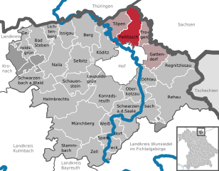
Feilitzsch
- municipality of Germany
Feilitzsch is a small town in Germany, located in the state of Bavaria. While it may not be as widely known as other hiking destinations, it offers opportunities for outdoor enthusiasts to explore scenic landscapes and enjoy nature....
- Country:

- Postal Code: 95183
- Local Dialing Code: 09281
- Licence Plate Code: HO
- Coordinates: 50° 22' 0" N, 11° 55' 0" E


- GPS tracks (wikiloc): [Link]
- AboveSeaLevel: 550 м m
- Area: 30.2 sq km
- Population: 2862
- Web site: [Link]


Münchberg
- municipality of Germany
Münchberg, located in Bavaria, Germany, offers beautiful hiking opportunities, particularly for those who enjoy scenic landscapes, forests, and the charm of the Franconian region....
- Country:

- Postal Code: 95213
- Local Dialing Code: 09251
- Coordinates: 50° 12' 0" N, 11° 46' 0" E


- GPS tracks (wikiloc): [Link]
- AboveSeaLevel: 546 м m
- Area: 68.8 sq km
- Population: 11668
- Web site: [Link]
Forst Schwarzenbach am Wald
- unincorporated area in Germany
 Hiking in Forst Schwarzenbach am Wald
Forst Schwarzenbach am Wald is a beautiful area located in Germany, perfect for hiking enthusiasts. Nestled in the scenic Bavarian region of Franconia, it offers a variety of trails that cater to different skill levels, from leisurely walks to more challenging hikes....
- Country:

- Coordinates: 50° 18' 0" N, 11° 35' 0" E


- GPS tracks (wikiloc): [Link]


Zell im Fichtelgebirge
- town in Bavaria, Germany
 Hiking in Zell im Fichtelgebirge
Zell im Fichtelgebirge is a charming village located in the Fichtelgebirge mountain range in Bavaria, Germany. This area is known for its beautiful landscapes, diverse hiking trails, and rich natural environment, making it an excellent destination for hikers of all skill levels....
- Country:

- Postal Code: 95239
- Local Dialing Code: 09257
- Licence Plate Code: HO
- Coordinates: 50° 8' 7" N, 11° 49' 22" E


- GPS tracks (wikiloc): [Link]
- AboveSeaLevel: 615 м m
- Area: 31.2 sq km
- Population: 2005
- Web site: [Link]
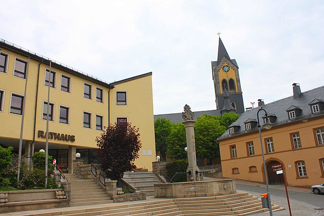

Helmbrechts
- municipality of Germany
Helmbrechts is a small town located in the Franconian region of Bavaria, Germany, surrounded by beautiful landscapes that are ideal for hiking enthusiasts. The area features a mix of wooded trails, open fields, and scenic views, making it a great destination for both beginners and experienced hikers....
- Country:

- Postal Code: 95233
- Local Dialing Code: 09252
- Licence Plate Code: HO
- Coordinates: 50° 14' 8" N, 11° 42' 57" E


- GPS tracks (wikiloc): [Link]
- AboveSeaLevel: 621 м m
- Area: 58.66 sq km
- Population: 10126
- Web site: [Link]


Rehau
- town in Bavaria, Germany
Rehau, located in Bavaria, Germany, is surrounded by beautiful landscapes that offer a variety of hiking opportunities. The region features rolling hills, dense forests, and scenic rivers, making it an attractive destination for outdoor enthusiasts....
- Country:

- Postal Code: 95111
- Local Dialing Code: 09283
- Coordinates: 50° 15' 0" N, 12° 1' 0" E


- GPS tracks (wikiloc): [Link]
- AboveSeaLevel: 528 м m
- Area: 80.34 sq km
- Population: 9335
- Web site: [Link]


Schwarzenbach am Wald
- municipality of Germany
 Hiking in Schwarzenbach am Wald
Schwarzenbach am Wald is a charming town located in Bavaria, Germany, known for its beautiful landscapes and outdoor activities, including hiking. Here are some key points about hiking in and around Schwarzenbach am Wald:...
- Country:

- Postal Code: 95131
- Local Dialing Code: 09289
- Licence Plate Code: HO
- Coordinates: 50° 17' 0" N, 11° 37' 15" E


- GPS tracks (wikiloc): [Link]
- AboveSeaLevel: 686 м m
- Area: 36.5 sq km
- Population: 4599
- Web site: [Link]


Schauenstein
- municipality of Germany
Schauenstein is a charming destination in the Fränkische Schweiz region of Germany, offering beautiful landscapes and a variety of hiking opportunities. It's known for its rolling hills, lush forests, and picturesque villages, making it a great place for both casual and more experienced hikers....
- Country:

- Postal Code: 95197
- Local Dialing Code: 09252
- Licence Plate Code: HO
- Coordinates: 50° 16' 0" N, 11° 46' 0" E


- GPS tracks (wikiloc): [Link]
- AboveSeaLevel: 606 м m
- Area: 26.7 sq km
- Population: 1977
- Web site: [Link]


Döhlau
- municipality of Germany
Döhlau is a small locality in Bavaria, Germany, known for its quaint landscapes and scenic beauty. While it may not be a major hiking destination like larger national parks, it offers several opportunities for outdoor enthusiasts to explore the surrounding nature....
- Country:

- Postal Code: 95182
- Local Dialing Code: 09286; 09283; 09281
- Licence Plate Code: HO
- Coordinates: 50° 16' 0" N, 11° 56' 0" E


- GPS tracks (wikiloc): [Link]
- AboveSeaLevel: 500 м m
- Area: 15.25 sq km
- Population: 3390
- Web site: [Link]


Berg
- municipality of Germany
Berg, a small municipality in Upper Franconia, Bavaria, offers a variety of hiking opportunities that cater to different skill levels and preferences. The region is known for its beautiful landscapes, including rolling hills, dense forests, and scenic views, making it an appealing destination for outdoor enthusiasts. Here are some highlights and tips for hiking in and around Berg:...
- Country:

- Postal Code: 95180
- Local Dialing Code: 09293
- Licence Plate Code: HO
- Coordinates: 50° 22' 0" N, 11° 46' 0" E


- GPS tracks (wikiloc): [Link]
- AboveSeaLevel: 536 м m
- Area: 38.93 sq km
- Population: 2138
- Web site: [Link]
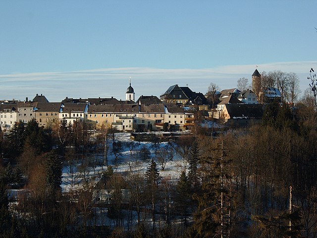

Lichtenberg
- human settlement in Germany
Lichtenberg, located in Bavaria, Germany, is a picturesque region that offers a variety of hiking opportunities. The area is characterized by its scenic landscapes, including rolling hills, lush forests, and quaint villages. Here’s a brief overview of what you can expect when hiking in Lichtenberg:...
- Country:

- Postal Code: 95192
- Local Dialing Code: 09288
- Licence Plate Code: HO
- Coordinates: 50° 22' 0" N, 11° 40' 0" E


- GPS tracks (wikiloc): [Link]
- AboveSeaLevel: 564 м m
- Area: 9.47 sq km
- Population: 1040
- Web site: [Link]


Issigau
- municipality of Germany
Issigau is a picturesque area located in Germany, ideal for hiking enthusiasts. It offers a variety of trails that cater to different skill levels, from leisurely walks to challenging hikes. The region is known for its stunning natural beauty, including dense forests, rolling hills, and serene rivers, making it an excellent destination for outdoor activities....
- Country:

- Postal Code: 95188
- Local Dialing Code: 09293
- Coordinates: 50° 22' 0" N, 11° 43' 0" E


- GPS tracks (wikiloc): [Link]
- AboveSeaLevel: 524 м m
- Area: 18.7 sq km
- Population: 1233
- Web site: [Link]


Gattendorf
- municipality of Germany
Gattendorf is a small village located in Austria, in the state of Burgenland. While it may not be widely known for extensive hiking trails compared to larger national parks or mountain ranges, it offers access to scenic walking paths and nearby routes that can make for lovely hikes....
- Country:

- Postal Code: 95185
- Local Dialing Code: 09281
- Licence Plate Code: HO
- Coordinates: 50° 19' 0" N, 12° 1' 0" E


- GPS tracks (wikiloc): [Link]
- AboveSeaLevel: 563 м m
- Area: 22.2 sq km
- Population: 1021
- Web site: [Link]


Geroldsgrün
- municipality of Germany
Geroldsgrün is a picturesque village located in Bavaria, Germany, surrounded by beautiful landscapes that are perfect for hiking. The area offers a variety of trails that cater to different skill levels, making it an excellent destination for both novice and experienced hikers....
- Country:

- Postal Code: 95179
- Local Dialing Code: 09288; 09267
- Licence Plate Code: HO
- Coordinates: 50° 19' 0" N, 11° 35' 0" E


- GPS tracks (wikiloc): [Link]
- AboveSeaLevel: 606 м m
- Area: 15.6 sq km
- Population: 2916
- Web site: [Link]


Oberkotzau
- municipality of Germany
Oberkotzau, located in Bavaria, Germany, is a charming locale that offers a range of hiking opportunities for enthusiasts of all levels. The region is known for its picturesque landscapes, including rolling hills, forests, and fields, making it an excellent destination for nature lovers and outdoor adventurers....
- Country:

- Postal Code: 95145
- Local Dialing Code: 09286
- Licence Plate Code: HO
- Coordinates: 50° 15' 45" N, 11° 56' 0" E


- GPS tracks (wikiloc): [Link]
- AboveSeaLevel: 484 м m
- Area: 21.5 sq km
- Population: 5338
- Web site: [Link]
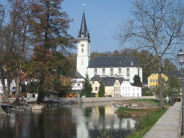

Schwarzenbach an der Saale
- municipality of Germany
 Hiking in Schwarzenbach an der Saale
Hiking in Schwarzenbach an der Saale offers an opportunity to explore beautiful landscapes and enjoy nature in the picturesque region of Bavaria, Germany. Nestled along the banks of the Saale River, this small town is surrounded by rolling hills, forests, and scenic routes. Here are a few highlights to consider for hiking in the area:...
- Country:

- Postal Code: 95126
- Local Dialing Code: 09284
- Licence Plate Code: HO
- Coordinates: 50° 13' 22" N, 11° 56' 6" E


- GPS tracks (wikiloc): [Link]
- AboveSeaLevel: 500 м m
- Area: 59.1 sq km
- Population: 7069
- Web site: [Link]

Trogen
- municipality of Germany
Trogen is actually located in Switzerland, not Bavaria, Germany. It is a picturesque village situated on the Appenzell plateau, known for its beautiful landscapes, rolling hills, and stunning views of the Swiss Alps. If you're also interested in hiking opportunities in Bavaria, I can provide that information as well....
- Country:

- Postal Code: 95183
- Local Dialing Code: 09281
- Licence Plate Code: HO
- Coordinates: 50° 22' 0" N, 11° 56' 0" E


- GPS tracks (wikiloc): [Link]
- AboveSeaLevel: 508 м m
- Area: 12.3 sq km
- Population: 1428
- Web site: [Link]


Naila
- town in Upper Franconia, Bavaria, Germany
Naila is a picturesque town in Bavaria, Germany, surrounded by beautiful landscapes, making it a great destination for hiking enthusiasts. Here are some highlights about hiking in and around Naila:...
- Country:

- Postal Code: 95119
- Local Dialing Code: 09282
- Coordinates: 50° 19' 0" N, 11° 41' 0" E


- GPS tracks (wikiloc): [Link]
- AboveSeaLevel: 512 м m
- Area: 37.1 sq km
- Population: 8636
- Web site: [Link]


Weißdorf
- municipality of Germany
Weißdorf is a charming village located in Bavaria, Germany, surrounded by beautiful landscapes and natural scenery, making it a great spot for hiking enthusiasts. The region features rolling hills, wooded areas, and quaint fields, ideal for various hiking trails catering to different skill levels....
- Country:

- Postal Code: 95237
- Local Dialing Code: 09251
- Licence Plate Code: HO
- Coordinates: 50° 10' 0" N, 11° 50' 0" E


- GPS tracks (wikiloc): [Link]
- AboveSeaLevel: 532 м m
- Area: 21.9 sq km
- Population: 1256
- Web site: [Link]


Töpen
- municipality of Germany
Töpen is a small municipality located in Bavaria, Germany, and while it may not be universally recognized as a hiking hotspot, there are opportunities for outdoor enthusiasts to enjoy nature in the surrounding areas. The scenic landscapes typical of Bavaria, including rolling hills, forests, and picturesque countryside, provide a great backdrop for hiking....
- Country:

- Postal Code: 95183
- Local Dialing Code: 09295
- Licence Plate Code: HO
- Coordinates: 50° 23' 25" N, 11° 52' 19" E


- GPS tracks (wikiloc): [Link]
- AboveSeaLevel: 516 м m
- Area: 20.8 sq km
- Population: 1049
- Web site: [Link]

Konradsreuth
- municipality of Germany
Konradsreuth is a charming municipality located in Bavaria, Germany, nestled within a beautiful landscape that's perfect for hiking enthusiasts. The area is characterized by its rolling hills, lush forests, and scenic views, making it a delightful destination for outdoor activities....
- Country:

- Postal Code: 95176
- Local Dialing Code: 09292
- Licence Plate Code: HO
- Coordinates: 50° 16' 0" N, 11° 50' 0" E


- GPS tracks (wikiloc): [Link]
- AboveSeaLevel: 552 м m
- Area: 43.3 sq km
- Population: 3230
- Web site: [Link]


Regnitzlosau
- municipality of Germany
Regnitzlosau is a charming municipality located in the Free State of Bavaria, Germany, surrounded by beautiful landscapes that offer a variety of hiking opportunities. The region is characterized by its rolling hills, forests, and fields, providing an excellent backdrop for outdoor activities....
- Country:

- Postal Code: 95194
- Local Dialing Code: 09294
- Licence Plate Code: HO
- Coordinates: 50° 17' 0" N, 12° 3' 0" E


- GPS tracks (wikiloc): [Link]
- AboveSeaLevel: 518 м m
- Area: 39.9 sq km
- Population: 2562
- Web site: [Link]


Köditz
- municipality of Germany
Köditz, a small town located in Bavaria, Germany, is an excellent spot for various outdoor activities, including hiking. The region surrounding Köditz offers beautiful landscapes characterized by rolling hills, forests, and charming views, making it suitable for both novice and experienced hikers. Here are some key points about hiking in Köditz and the surrounding area:...
- Country:

- Postal Code: 95189
- Local Dialing Code: 09281
- Licence Plate Code: HO
- Coordinates: 50° 19' 0" N, 11° 50' 0" E


- GPS tracks (wikiloc): [Link]
- AboveSeaLevel: 510 м m
- Area: 31.5 sq km
- Population: 2505
- Web site: [Link]


Leupoldsgrün
- municipality of Germany
Leupoldsgrün is a picturesque village located in Bavaria, Germany, surrounded by beautiful landscapes that are ideal for hiking enthusiasts. The region boasts a variety of trails, ranging from easy walks to more challenging hikes, providing options for all skill levels....
- Country:

- Postal Code: 95191
- Local Dialing Code: 09292
- Licence Plate Code: HO
- Coordinates: 50° 17' 0" N, 11° 48' 0" E


- GPS tracks (wikiloc): [Link]
- AboveSeaLevel: 631 м m
- Area: 10.26 sq km
- Population: 1387
- Web site: [Link]


Bad Steben
- municipality of Germany
Bad Steben, located in the Bavarian region of Germany, is a charming spa town that offers a variety of hiking opportunities amidst beautiful landscapes. The area is characterized by its lush forests, rolling hills, and scenic views of the surrounding countryside, making it an excellent destination for both casual walkers and avid hikers....
- Country:

- Postal Code: 95138
- Local Dialing Code: 09288
- Coordinates: 50° 22' 0" N, 11° 39' 0" E


- GPS tracks (wikiloc): [Link]
- AboveSeaLevel: 578 м m
- Area: 25.84 sq km
- Population: 3435
- Web site: [Link]


Selbitz
- municipality of Germany
Selbitz is a charming town located in the Bavaria region of Germany, nestled in the scenic landscapes of the Fichtelgebirge mountains. Hiking in and around Selbitz offers an enjoyable experience for outdoor enthusiasts, featuring a mix of well-marked trails, lush forests, and beautiful views of the surrounding countryside....
- Country:

- Postal Code: 95152
- Local Dialing Code: 09280
- Licence Plate Code: SAN; REH; NAI; MÜB; HO
- Coordinates: 50° 19' 0" N, 11° 45' 0" E


- GPS tracks (wikiloc): [Link]
- AboveSeaLevel: 520 м m
- Area: 27.7 sq km
- Population: 4304
- Web site: [Link]


Sparneck
- municipality of Germany
Sparneck is a charming village located in the upper Franconia region of Bavaria, Germany. It is surrounded by lush forests, rolling hills, and scenic landscapes, making it a great spot for hiking enthusiasts. Here are some key points about hiking in Sparneck:...
- Country:

- Postal Code: 95234
- Local Dialing Code: 09251
- Licence Plate Code: HO
- Coordinates: 50° 10' 0" N, 11° 49' 0" E


- GPS tracks (wikiloc): [Link]
- AboveSeaLevel: 563 м m
- Area: 16.4 sq km
- Population: 1639
- Web site: [Link]


Stammbach
- gemeente in Duitsland
Stammbach, located in the Bavarian region of Germany, is a charming area that offers various hiking opportunities amidst picturesque landscapes. The region is characterized by lush forests, rolling hills, and serene meadows, making it a great destination for both novice and experienced hikers....
- Country:

- Postal Code: 95236
- Local Dialing Code: 09256
- Licence Plate Code: HO
- Coordinates: 50° 9' 0" N, 11° 42' 0" E


- GPS tracks (wikiloc): [Link]
- AboveSeaLevel: 550 м m
- Area: 34.7 sq km
- Population: 2368
- Web site: [Link]
Gerlaser Forst
- unincorporated area in Germany
Gerlaser Forst is a beautiful forested area located in Germany, known for its scenic hiking trails and serene natural environment. When planning a hiking trip in Gerlaser Forst, here are some key points to keep in mind:...
- Country:

- Coordinates: 50° 19' 0" N, 11° 37' 0" E


- GPS tracks (wikiloc): [Link]
Shares border with regions:


Wunsiedel
- district of Bavaria, Germany
Wunsiedel is a picturesque district located in the Upper Franconia region of Bavaria, Germany. It's renowned for its beautiful landscapes, rich history, and a variety of hiking trails suitable for different skill levels. Here are some highlights of hiking in Wunsiedel:...
- Country:

- Licence Plate Code: SEL; REH; MAK; WUN
- Coordinates: 50° 5' 24" N, 12° 2' 24" E


- GPS tracks (wikiloc): [Link]
- AboveSeaLevel: 558 м m
- Area: 606.40 sq km
- Population: 87941
- Web site: [Link]

Kronach
- district in Bavaria, Germany
Kronach, located in Bavaria, Germany, is an excellent destination for hiking enthusiasts. The district is characterized by its beautiful landscapes, rich history, and diverse trails suitable for all levels of hikers. Here are some highlights regarding hiking in Kronach:...
- Country:

- Capital: Kronach
- Licence Plate Code: SAN; KC
- Coordinates: 50° 19' 48" N, 11° 22' 12" E


- GPS tracks (wikiloc): [Link]
- AboveSeaLevel: 412 м m
- Area: 651.00 sq km
- Population: 75353
- Web site: [Link]


Kulmbach
- district in Bavaria, Germany
Kulmbach district, located in Bavaria, Germany, offers a variety of hiking opportunities that showcase the region’s scenic beauty, rich history, and diverse landscapes. Here are some highlights and tips for hiking in Kulmbach:...
- Country:

- Capital: Kulmbach
- Licence Plate Code: SAN; KU; EBS
- Coordinates: 50° 5' 12" N, 11° 23' 50" E


- GPS tracks (wikiloc): [Link]
- AboveSeaLevel: 391 м m
- Area: 656.00 sq km
- Population: 73055
- Web site: [Link]


Bayreuth
- district in Bavaria, Germany
Bayreuth, located in the northern part of Bavaria, Germany, offers a diverse range of hiking opportunities set against a backdrop of beautiful landscapes, forests, and cultural sites. The region is known for its rich history, stunning scenery, and well-marked trails suitable for hikers of all levels....
- Country:

- Capital: Bayreuth
- Licence Plate Code: PEG; MÜB; KEM; ESB; EBS; BT
- Coordinates: 49° 55' 12" N, 11° 30' 0" E


- GPS tracks (wikiloc): [Link]
- AboveSeaLevel: 507 м m
- Area: 1273.00 sq km
- Population: 96772
- Web site: [Link]
Vogtlandkreis
- German district of Saxony
Vogtlandkreis is a scenic region in Saxony, Germany, known for its beautiful landscapes and diverse hiking opportunities. Nestled in the foothills of the Ore Mountains, the area offers a mix of lush forests, rolling hills, and picturesque valleys, making it a great destination for hikers of all levels....
- Country:

- Licence Plate Code: V
- Coordinates: 50° 26' 0" N, 12° 16' 0" E


- GPS tracks (wikiloc): [Link]
- AboveSeaLevel: 468 м m
- Area: 1309.9 sq km
- Web site: [Link]


Hof
- town in Bavaria, Germany
Hof, located in the Bavaria region of Germany, offers a variety of hiking opportunities that showcase its stunning landscapes, rich culture, and natural beauty. Here are some key points to consider when planning a hiking trip in and around Hof:...
- Country:

- Postal Code: 95032; 95030; 95028
- Local Dialing Code: 09281
- Licence Plate Code: HO
- Coordinates: 50° 19' 0" N, 11° 55' 0" E


- GPS tracks (wikiloc): [Link]
- AboveSeaLevel: 500 м m
- Area: 58.03 sq km
- Population: 44522
- Web site: [Link]


Saale-Orla-Kreis
- district in Thuringia, Germany
Hiking in Saale-Orla-Kreis, located in the Free State of Thuringia, Germany, offers a wonderful experience for outdoor enthusiasts. The region is characterized by its diverse landscapes, which include rolling hills, dense forests, vibrant meadows, and charming villages. Here’s a brief overview of what hikers can expect in this area:...
- Country:

- Capital: Schleiz
- Licence Plate Code: SOK
- Coordinates: 50° 34' 48" N, 11° 45' 0" E


- GPS tracks (wikiloc): [Link]
- AboveSeaLevel: 472 м m
- Area: 1151.3 sq km
- Population: 82951
- Web site: [Link]
