Saalekreis (Saalekreis)

- German district in Saxony-Anhalt
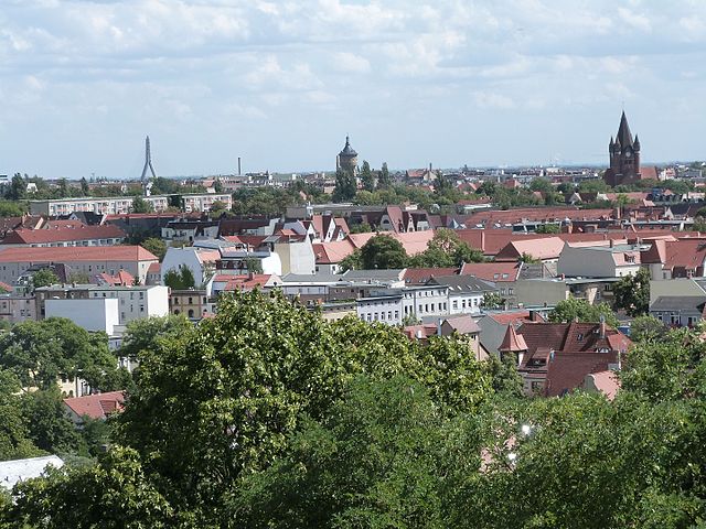
 Hiking in Saalekreis
Saalekreis, located in Saxony-Anhalt, Germany, offers a variety of hiking opportunities thanks to its beautiful landscapes, forests, and historical sites. Here are some highlights for anyone looking to hike in this region:
Natural Landscapes
- Rivers and Lakes: The Saalekreis area is characterized by its proximity to the Saale River and several public lakes, providing beautiful scenery and spots for relaxation during hikes.
- Forests: The region is home to rich wooded areas, including parts of the Ore Mountains. These forests provide shade and a diverse ecosystem for wildlife spotting.
Hiking Trails
- Saale-Unstrut Cycle Path: Although primarily a cycling route, this path offers plenty of opportunities for walking alongside the river, providing scenic views and access to small villages.
- Geological hiking trails: Saalekreis has trails that showcase the geological diversity of the region, including rock formations and mineral springs.
- Local Nature Parks: The nearby nature parks, such as the "Dübener Heide," offer well-marked trails ranging from easy walks to more challenging hikes.
Historical Sites
- Castles and Ruins: While hiking, you can encounter historical castles such as the Castle of Giebichenstein or the ruins of old fortifications, which add a cultural touch to your outdoor experience.
- Saalfeld Fairy Grottoes: While slightly outside of Saalekreis, this natural wonder can be included in a hiking itinerary for those interested in unique geological formations.
Tips for Hiking in Saalekreis
- Trail Maps: Always carry a map or have a navigation app handy, as some trails may not be well-marked.
- Seasonal Considerations: Be aware of the seasons; the trails can be affected by weather conditions, especially in winter.
- Local Wildlife: Respect the local environment and wildlife by sticking to marked trails and leaving no trace.
Accessibility
Saalekreis is relatively well connected by public transportation, making it easier to access various trailheads. It's a good idea to check local transit schedules for buses or trains that can take you near your desired hiking locations.
Whether you are an experienced hiker or a beginner looking for a scenic walk, Saalekreis has something to offer everyone. Happy hiking!
- Country:

- Licence Plate Code: QFT; MQ; MER; SK
- Coordinates: 51° 24' 0" N, 11° 50' 0" E


- GPS tracks (wikiloc): [Link]
- AboveSeaLevel: 76 м m
- Area: 1433.67 sq km
- Population: 186431
- Web site: http://www.saalekreis.de/
- Wikipedia en: wiki(en)
- Wikipedia: wiki(de)
- Wikidata storage: Wikidata: Q6098
- Wikipedia Commons Category: [Link]
- Wikipedia Commons Maps Category: [Link]
- Freebase ID: [/m/02vmpt0]
- GeoNames ID: Alt: [2842671]
- VIAF ID: Alt: [134109856]
- OSM relation ID: [62473]
- GND ID: Alt: [7607033-5]
- archINFORM location ID: [3822]
- Library of Congress authority ID: Alt: [no2010100201]
- NUTS code: [DEE0B]
- German district key: 15088
Includes regions:


Bad Dürrenberg
- municipality of Germany
Hiking in Bad Dürrenberg
Bad Dürrenberg is a charming town in Saxony-Anhalt, Germany, known for its natural beauty and historical significance. While it might not be as famous as some other hiking destinations, it offers several opportunities for outdoor activities and exploration. Here are some details about hiking in and around Bad Dürrenberg:...
- Country:
- Postal Code: 06231
- Local Dialing Code: 03462
- Coordinates: 51° 17' 44" N, 12° 3' 57" E
- GPS tracks (wikiloc): [Link]
- AboveSeaLevel: 104 м m
- Area: 36.13 sq km
- Population: 11745
- Web site: [Link]


Braunsbedra
- municipality of Germany
Hiking in Braunsbedra
Braunsbedra is a quaint town located in Saxony-Anhalt, Germany, surrounded by beautiful nature, making it an excellent destination for hiking enthusiasts. Here are some key features and tips for hiking in and around Braunsbedra:...
- Country:
- Postal Code: 06242
- Local Dialing Code: 034633
- Coordinates: 51° 17' 0" N, 11° 54' 0" E
- GPS tracks (wikiloc): [Link]
- AboveSeaLevel: 104 м m
- Area: 74.34 sq km
- Population: 10841
- Web site: [Link]


Bad Lauchstädt
- municipality of Germany
Hiking in Bad Lauchstädt
Bad Lauchstädt, located in the Saxony-Anhalt region of Germany, is known for its scenic beauty and historical significance. The area offers several opportunities for hiking enthusiasts, combining natural landscapes with cultural exploration....
- Country:
- Postal Code: 06246
- Local Dialing Code: 0345; 034636; 034635
- Coordinates: 51° 23' 11" N, 11° 52' 10" E
- GPS tracks (wikiloc): [Link]
- AboveSeaLevel: 114 м m
- Area: 85.36 sq km
- Population: 8867
- Web site: [Link]


Schkopau
- municipality of Germany
Hiking in Schkopau
Schkopau is a small town in Saxony-Anhalt, Germany, known for its scenic landscapes and proximity to various outdoor activities. While it may not be a widely recognized hiking destination, there are opportunities for hiking and exploring nature in the surrounding areas. Here's what you should know about hiking in and around Schkopau:...
- Country:
- Postal Code: 06258
- Local Dialing Code: 03461
- Coordinates: 51° 23' 0" N, 11° 58' 0" E
- GPS tracks (wikiloc): [Link]
- AboveSeaLevel: 98 м m
- Area: 90.66 sq km
- Population: 10840
- Web site: [Link]


Kabelsketal
- municipality of Germany
Hiking in Kabelsketal
Kabelsketal is a picturesque valley located in Germany, near the town of Kabelsketal in the state of Sachsen-Anhalt. It offers a variety of hiking opportunities for outdoor enthusiasts. The region is characterized by lush forests, scenic landscapes, and quaint villages that make it a great destination for hikers of all levels....
- Country:
- Postal Code: 06184
- Local Dialing Code: 034605
- Licence Plate Code: SK
- Coordinates: 51° 26' 49" N, 12° 6' 9" E
- GPS tracks (wikiloc): [Link]
- AboveSeaLevel: 113 м m
- Area: 50.96 sq km
- Population: 8833
- Web site: [Link]
Shares border with regions:

Halle (Saale)
- city in the German state of Saxony-Anhalt
Hiking in Halle (Saale)
Hiking in Halle (Saale), a city in the state of Saxony-Anhalt, Germany, offers a blend of urban experiences and access to beautiful natural landscapes. The surrounding region features diverse hiking trails, picturesque parks, and historic sites....
- Country:
- Postal Code: 06108–06132
- Local Dialing Code: 0345
- Licence Plate Code: HAL
- Coordinates: 51° 28' 59" N, 11° 58' 19" E
- GPS tracks (wikiloc): [Link]
- AboveSeaLevel: 87 м m
- Area: 135.03 sq km
- Population: 239173
- Web site: [Link]
Anhalt-Bitterfeld
- German district in Saxony-Anhalt
Hiking in Anhalt-Bitterfeld
Anhalt-Bitterfeld is a district in the state of Saxony-Anhalt in Germany, which offers a variety of hiking opportunities amidst a blend of natural landscapes and historical sites. Here are some highlights for hiking in the region:...
- Country:
- Licence Plate Code: ZE; KÖT; BTF; AZE; ABI
- Coordinates: 51° 43' 0" N, 12° 4' 0" E
- GPS tracks (wikiloc): [Link]
- AboveSeaLevel: 87 м m
- Area: 1452.80 sq km
- Population: 168475
- Web site: [Link]
Salzlandkreis
- German district of Saxony-Anhalt
Hiking in Salzlandkreis
Salzlandkreis, located in the state of Saxony-Anhalt in Germany, offers a variety of hiking opportunities for outdoor enthusiasts. The area is characterized by its diverse landscapes, including forests, hills, and rivers, making it a great destination for hiking. Here are some highlights and recommendations for hiking in Salzlandkreis:...
- Country:
- Licence Plate Code: SLK
- Coordinates: 51° 50' 0" N, 11° 35' 0" E
- GPS tracks (wikiloc): [Link]
- AboveSeaLevel: 67 м m
- Area: 1425.9 sq km
- Web site: [Link]
Mansfeld-Südharz
- German district in Saxony-Anhalt
Hiking in Mansfeld-Südharz
Mansfeld-Südharz is a picturesque region in Germany, located in the state of Saxony-Anhalt. It offers a rich blend of natural beauty, historical sites, and diverse hiking opportunities that cater to different skill levels. Here are some highlights for hiking in this area:...
- Country:
- Licence Plate Code: MSH
- Coordinates: 51° 32' 0" N, 11° 22' 0" E
- GPS tracks (wikiloc): [Link]
- AboveSeaLevel: 169 м m
- Area: 1448.82 sq km
- Population: 144735
- Web site: [Link]


Burgenlandkreis
- rural district of Saxony-Anhalt, Germany
Hiking in Burgenlandkreis
Burgenlandkreis, located in Saxony-Anhalt, Germany, is a great destination for hikers due to its diverse landscapes and rich cultural heritage. The region features a mix of rolling hills, vineyards, river valleys, and historical sites, making it an attractive area for outdoor enthusiasts....
- Country:
- Licence Plate Code: BLK
- Coordinates: 51° 9' 0" N, 11° 52' 0" E
- GPS tracks (wikiloc): [Link]
- AboveSeaLevel: 124 м m
- Area: 1413.47 sq km
Landkreis Leipzig
- district in the federal state of Saxony, Germany
Hiking in Landkreis Leipzig
Hiking in the Leipzig district offers a unique blend of natural beauty, historical sites, and urban landscapes. While Leipzig itself is a city, there are several nearby areas that provide excellent hiking opportunities, especially in the surrounding Saxony region....
- Country:
- Licence Plate Code: WUR; MTL; L; GRM; GHA; BNA
- Coordinates: 51° 7' 0" N, 12° 30' 0" E
- GPS tracks (wikiloc): [Link]
- AboveSeaLevel: 116 м m
- Area: 1.65 sq km
- Population: 259207
- Web site: [Link]