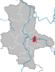
Anhalt-Bitterfeld (Landkreis Anhalt-Bitterfeld)

- German district in Saxony-Anhalt
 Hiking in Anhalt-Bitterfeld
Anhalt-Bitterfeld is a district in the state of Saxony-Anhalt in Germany, which offers a variety of hiking opportunities amidst a blend of natural landscapes and historical sites. Here are some highlights for hiking in the region:
Natural Attractions
-
Protected Areas: The area boasts several nature reserves and parks to explore. The landscape features meadows, forests, and rivers that provide scenic backgrounds for hikes.
-
Lakes and Rivers: The Bitterfeld-Wolfen area is home to many lakes, which are remnants of former lignite mining. The Bitterfelder See and surrounding lakes offer great spots for relaxed hiking, as well as opportunities for birdwatching and photography.
-
Forests: The region has extensive forested areas, such as the Waldgebiet near Bitterfeld, which provide trails for various skill levels. Forest hikes can be refreshing, with opportunities for wildlife spotting.
Hiking Trails
-
Regional Trails: There are marked hiking trails that allow you to explore the diverse landscapes of Anhalt-Bitterfeld. These include shorter loops for casual walkers and longer trails for more experienced hikers.
-
The Elbe River Trail: Although it mainly runs along the rivers of Saxony-Anhalt, parts of this long-distance trail run close to the Anhalt-Bitterfeld region, offering beautiful views of the Elbe River.
-
Circular Trails: Many areas offer circular routes that can be completed in a half-day, allowing hikers to enjoy both the natural scenery and the quaint villages.
Cultural and Historical Sites
-
Castles and Ruins: Along the hiking routes, you might discover castles or ruins that reflect the historical architecture of the region, providing a cultural backdrop to your hike.
-
Local Villages: The district is dotted with small towns and villages, where you can take a break for refreshments and experience local hospitality and cuisine.
Preparation Tips
- Weather: Always check the weather before heading out, as conditions can change rapidly.
- Footwear: Wear comfortable hiking boots with good tread, especially if you plan on hiking in forested or uneven areas.
- Supplies: Bring along sufficient water, snacks, and a map or GPS device, especially if you venture on less-marked trails.
Conclusion
Hiking in Anhalt-Bitterfeld offers a mix of trail experiences in a region that combines nature with history. Whether you're a casual walker or a seasoned hiker, there's something for everyone in this German district. Make sure to respect nature and local guidelines while exploring!
- Country:

- Licence Plate Code: ZE; KÖT; BTF; AZE; ABI
- Coordinates: 51° 43' 0" N, 12° 4' 0" E


- GPS tracks (wikiloc): [Link]
- AboveSeaLevel: 87 м m
- Area: 1452.80 sq km
- Population: 168475
- Web site: http://www.anhalt-bitterfeld.de/
- Wikipedia en: wiki(en)
- Wikipedia: wiki(de)
- Wikidata storage: Wikidata: Q6071
- Wikipedia Commons Category: [Link]
- Wikipedia Commons Maps Category: [Link]
- Freebase ID: [/m/02vmpr9]
- GeoNames ID: Alt: [2948163]
- VIAF ID: Alt: [242778962]
- OSM relation ID: [62747]
- GND ID: Alt: [7640684-2]
- archINFORM location ID: [4018]
- NUTS code: [DEE05]
- German district key: 15082
Shares border with regions:

Dessau-Roßlau
- city in Saxony-Anhalt, Germany
Hiking in Dessau-Roßlau
Dessau-Roßlau, located in Saxony-Anhalt, Germany, is known for its rich cultural heritage and beautiful natural landscapes, making it an enjoyable destination for hiking enthusiasts. Here are some highlights for hiking in the region:...
- Country:
- Postal Code: 06842–06862
- Local Dialing Code: 034901; 0340
- Licence Plate Code: RSL; DE
- Coordinates: 51° 50' 0" N, 12° 14' 0" E
- GPS tracks (wikiloc): [Link]
- AboveSeaLevel: 59 м m
- Area: 244.74 sq km
- Population: 83616
- Web site: [Link]
Jerichower Land
- German district of Saxony-Anhalt
Hiking in Jerichower Land
Jerichower Land is a picturesque area in the eastern part of Germany, situated in the state of Saxony-Anhalt. It’s known for its varied landscapes, historical sites, and a network of hiking trails that offer opportunities for both casual walkers and more seasoned hikers....
- Country:
- Licence Plate Code: JL; GNT; BRG
- Coordinates: 52° 20' 0" N, 12° 4' 0" E
- GPS tracks (wikiloc): [Link]
- AboveSeaLevel: 57 м m
- Web site: [Link]
Wittenberg
- German district in Saxony-Anhalt
Hiking in Wittenberg
Wittenberg, located in the state of Saxony-Anhalt, Germany, is not just known for its historical significance but also for its beautiful landscapes and opportunities for hiking. The region is rich in natural beauty, with a mix of woodlands, rivers, and rolling hills, making it an excellent destination for outdoor enthusiasts....
- Country:
- Licence Plate Code: WB; JE; GHC
- Coordinates: 51° 48' 0" N, 12° 41' 0" E
- GPS tracks (wikiloc): [Link]
- AboveSeaLevel: 66 м m
- Area: 1929.96 sq km
- Population: 130699
- Web site: [Link]
Salzlandkreis
- German district of Saxony-Anhalt
Hiking in Salzlandkreis
Salzlandkreis, located in the state of Saxony-Anhalt in Germany, offers a variety of hiking opportunities for outdoor enthusiasts. The area is characterized by its diverse landscapes, including forests, hills, and rivers, making it a great destination for hiking. Here are some highlights and recommendations for hiking in Salzlandkreis:...
- Country:
- Licence Plate Code: SLK
- Coordinates: 51° 50' 0" N, 11° 35' 0" E
- GPS tracks (wikiloc): [Link]
- AboveSeaLevel: 67 м m
- Area: 1425.9 sq km
- Web site: [Link]


Saalekreis
- German district in Saxony-Anhalt
Hiking in Saalekreis
Saalekreis, located in Saxony-Anhalt, Germany, offers a variety of hiking opportunities thanks to its beautiful landscapes, forests, and historical sites. Here are some highlights for anyone looking to hike in this region:...
- Country:
- Licence Plate Code: QFT; MQ; MER; SK
- Coordinates: 51° 24' 0" N, 11° 50' 0" E
- GPS tracks (wikiloc): [Link]
- AboveSeaLevel: 76 м m
- Area: 1433.67 sq km
- Population: 186431
- Web site: [Link]


Potsdam-Mittelmark District
- district in Brandenburg state, Germany
Hiking in Potsdam-Mittelmark District
Potsdam-Mittelmark, located in the state of Brandenburg, Germany, offers a rich variety of hiking opportunities amidst picturesque landscapes and historical sites. Here are some key points to consider when hiking in this beautiful region:...
- Country:
- Capital: Bad Belzig
- Postal Code: 14806
- Licence Plate Code: PM
- Coordinates: 52° 13' 10" N, 12° 40' 30" E
- GPS tracks (wikiloc): [Link]
- AboveSeaLevel: 40 м m
- Population: 204388
- Web site: [Link]