Saint-Étienne-d'Albagnan (Saint-Étienne-d'Albagnan)

- commune in Hérault, France
- Country:

- Postal Code: 34390
- Coordinates: 43° 31' 54" N, 2° 51' 23" E


- GPS tracks (wikiloc): [Link]
- Area: 22.7 sq km
- Population: 319
- Wikipedia en: wiki(en)
- Wikipedia: wiki(fr)
- Wikidata storage: Wikidata: Q1409814
- Wikipedia Commons Gallery: [Link]
- Wikipedia Commons Category: [Link]
- Freebase ID: [/m/03nv8hk]
- Freebase ID: [/m/03nv8hk]
- GeoNames ID: Alt: [6432622]
- GeoNames ID: Alt: [6432622]
- SIREN number: [213402506]
- SIREN number: [213402506]
- BnF ID: [15256851s]
- BnF ID: [15256851s]
- INSEE municipality code: 34250
- INSEE municipality code: 34250
Shares border with regions:


Berlou
- commune in Hérault, France
- Country:
- Postal Code: 34360
- Coordinates: 43° 29' 25" N, 2° 57' 22" E
- GPS tracks (wikiloc): [Link]
- Area: 11.34 sq km
- Population: 200

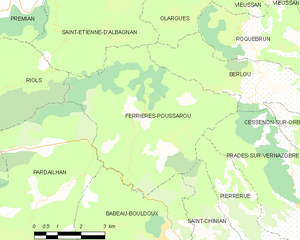
Ferrières-Poussarou
- commune in Hérault, France
- Country:
- Postal Code: 34360
- Coordinates: 43° 29' 6" N, 2° 53' 55" E
- GPS tracks (wikiloc): [Link]
- Area: 26.01 sq km
- Population: 75


Riols
- commune in Hérault, France
- Country:
- Postal Code: 34220
- Coordinates: 43° 30' 18" N, 2° 47' 31" E
- GPS tracks (wikiloc): [Link]
- Area: 56.02 sq km
- Population: 756


Fraisse-sur-Agout
- commune in Hérault, France
- Country:
- Postal Code: 34330
- Coordinates: 43° 36' 22" N, 2° 47' 53" E
- GPS tracks (wikiloc): [Link]
- Area: 58.46 sq km
- Population: 339

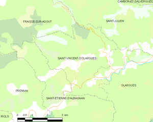
Saint-Vincent-d'Olargues
- commune in Hérault, France
- Country:
- Postal Code: 34390
- Coordinates: 43° 33' 38" N, 2° 52' 45" E
- GPS tracks (wikiloc): [Link]
- AboveSeaLevel: 280 м m
- Area: 15.84 sq km
- Population: 341


Olargues
- commune in Hérault, France
- Country:
- Postal Code: 34390
- Coordinates: 43° 33' 23" N, 2° 54' 53" E
- GPS tracks (wikiloc): [Link]
- Area: 18.6 sq km
- Population: 674


Prémian
- commune in Hérault, France
- Country:
- Postal Code: 34390
- Coordinates: 43° 31' 27" N, 2° 49' 50" E
- GPS tracks (wikiloc): [Link]
- Area: 16.69 sq km
- Population: 518