Saint-André-Capcèze (Saint-André-Capcèze)

- commune in Lozère, France
- Country:

- Postal Code: 48800
- Coordinates: 44° 25' 1" N, 3° 56' 55" E


- GPS tracks (wikiloc): [Link]
- Area: 9.85 sq km
- Population: 176
- Wikipedia en: wiki(en)
- Wikipedia: wiki(fr)
- Wikidata storage: Wikidata: Q379522
- Wikipedia Commons Category: [Link]
- Freebase ID: [/m/02z0sz1]
- Freebase ID: [/m/02z0sz1]
- GeoNames ID: Alt: [6612574]
- GeoNames ID: Alt: [6612574]
- SIREN number: [214801359]
- SIREN number: [214801359]
- BnF ID: [152615409]
- BnF ID: [152615409]
- INSEE municipality code: 48135
- INSEE municipality code: 48135
Shares border with regions:


Pied-de-Borne
- commune in Lozère, France
- Country:
- Postal Code: 48800
- Coordinates: 44° 28' 32" N, 3° 59' 5" E
- GPS tracks (wikiloc): [Link]
- AboveSeaLevel: 450 м m
- Area: 27.89 sq km
- Population: 201


Ponteils-et-Brésis
- commune in Gard, France
- Country:
- Postal Code: 30450
- Coordinates: 44° 24' 8" N, 3° 58' 36" E
- GPS tracks (wikiloc): [Link]
- Area: 27.8 sq km
- Population: 353

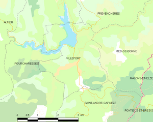
Villefort
- commune in Lozère, France
- Country:
- Postal Code: 48800
- Coordinates: 44° 26' 22" N, 3° 55' 55" E
- GPS tracks (wikiloc): [Link]
- Area: 7.35 sq km
- Population: 568
- Web site: [Link]


Pourcharesses
- commune in Lozère, France
- Country:
- Postal Code: 48800
- Coordinates: 44° 26' 19" N, 3° 55' 58" E
- GPS tracks (wikiloc): [Link]
- AboveSeaLevel: 600 м m
- Area: 31.79 sq km
- Population: 116