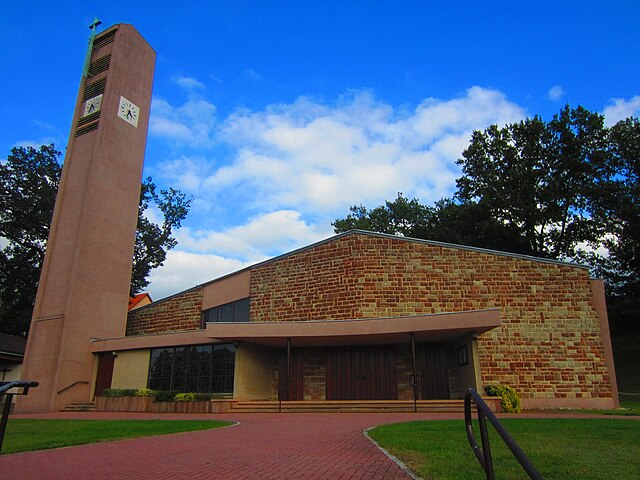
Saint-Avold (Saint-Avold)
- commune in Moselle, France
- Country:

- Postal Code: 57500
- Coordinates: 49° 6' 15" N, 6° 42' 29" E


- GPS tracks (wikiloc): [Link]
- Area: 35.48 sq km
- Population: 15748
- Web site: http://www.mairie-saint-avold.fr
- Wikipedia en: wiki(en)
- Wikipedia: wiki(fr)
- Wikidata storage: Wikidata: Q22485
- Wikipedia Commons Category: [Link]
- Freebase ID: [/m/07zxvk]
- Freebase ID: [/m/07zxvk]
- Freebase ID: [/m/07zxvk]
- GeoNames ID: Alt: [2981492]
- GeoNames ID: Alt: [2981492]
- GeoNames ID: Alt: [2981492]
- SIREN number: [215706060]
- SIREN number: [215706060]
- SIREN number: [215706060]
- BnF ID: [152661098]
- BnF ID: [152661098]
- BnF ID: [152661098]
- VIAF ID: Alt: [136104063]
- VIAF ID: Alt: [136104063]
- VIAF ID: Alt: [136104063]
- GND ID: Alt: [4214037-7]
- GND ID: Alt: [4214037-7]
- GND ID: Alt: [4214037-7]
- Library of Congress authority ID: Alt: [n85081639]
- Library of Congress authority ID: Alt: [n85081639]
- Library of Congress authority ID: Alt: [n85081639]
- PACTOLS thesaurus ID: [pcrtOSosuiiQi6]
- PACTOLS thesaurus ID: [pcrtOSosuiiQi6]
- PACTOLS thesaurus ID: [pcrtOSosuiiQi6]
- MusicBrainz area ID: [a7ee9be6-9dce-4a9b-b6e1-4ebda66e6fec]
- MusicBrainz area ID: [a7ee9be6-9dce-4a9b-b6e1-4ebda66e6fec]
- MusicBrainz area ID: [a7ee9be6-9dce-4a9b-b6e1-4ebda66e6fec]
- Quora topic ID: [Saint-Avold]
- Quora topic ID: [Saint-Avold]
- Quora topic ID: [Saint-Avold]
- Gran Enciclopèdia Catalana ID: [0057830]
- Gran Enciclopèdia Catalana ID: [0057830]
- Gran Enciclopèdia Catalana ID: [0057830]
- INSEE municipality code: 57606
- INSEE municipality code: 57606
- INSEE municipality code: 57606
Shares border with regions:


Boucheporn
- commune in Moselle, France
- Country:

- Postal Code: 57220
- Coordinates: 49° 8' 27" N, 6° 36' 32" E


- GPS tracks (wikiloc): [Link]
- Area: 6.65 sq km
- Population: 580


Laudrefang
- commune in Moselle, France
- Country:

- Postal Code: 57385
- Coordinates: 49° 4' 59" N, 6° 38' 25" E


- GPS tracks (wikiloc): [Link]
- Area: 4.7 sq km
- Population: 336


Folschviller
- commune in Moselle, France
- Country:

- Postal Code: 57730
- Coordinates: 49° 4' 10" N, 6° 41' 6" E


- GPS tracks (wikiloc): [Link]
- Area: 9.46 sq km
- Population: 4089


Longeville-lès-Saint-Avold
- commune in Moselle, France
- Country:

- Postal Code: 57740
- Coordinates: 49° 6' 58" N, 6° 38' 21" E


- GPS tracks (wikiloc): [Link]
- Area: 24.54 sq km
- Population: 3727
- Web site: [Link]


Valmont
- commune in Moselle, France
- Country:

- Postal Code: 57730
- Coordinates: 49° 5' 6" N, 6° 41' 57" E


- GPS tracks (wikiloc): [Link]
- Area: 9.24 sq km
- Population: 3203


Porcelette
- commune in Moselle, France
- Country:

- Postal Code: 57890
- Coordinates: 49° 9' 23" N, 6° 39' 20" E


- GPS tracks (wikiloc): [Link]
- Area: 13.44 sq km
- Population: 2495
- Web site: [Link]


Macheren
- commune in Moselle, France
- Country:

- Postal Code: 57730
- Coordinates: 49° 5' 59" N, 6° 44' 34" E


- GPS tracks (wikiloc): [Link]
- Area: 16.95 sq km
- Population: 2815


Freyming-Merlebach
- commune in Moselle, France
- Country:

- Postal Code: 57800
- Coordinates: 49° 8' 50" N, 6° 49' 9" E


- GPS tracks (wikiloc): [Link]
- AboveSeaLevel: 222 м m
- Area: 9.06 sq km
- Population: 13059
- Web site: [Link]


Diesen
- commune in Moselle, France
- Country:

- Postal Code: 57890
- Coordinates: 49° 10' 40" N, 6° 40' 41" E


- GPS tracks (wikiloc): [Link]
- Area: 5.47 sq km
- Population: 1071


Hombourg-Haut
- commune in Moselle, France
- Country:

- Postal Code: 57470
- Coordinates: 49° 7' 33" N, 6° 46' 41" E


- GPS tracks (wikiloc): [Link]
- Area: 12.25 sq km
- Population: 6756


Carling
- commune in Moselle, France
- Country:

- Postal Code: 57490
- Coordinates: 49° 9' 59" N, 6° 42' 57" E


- GPS tracks (wikiloc): [Link]
- Area: 2.67 sq km
- Population: 3433
- Web site: [Link]


L'Hôpital, Moselle
- commune in Moselle, France
- Country:

- Postal Code: 57490
- Coordinates: 49° 9' 29" N, 6° 43' 56" E


- GPS tracks (wikiloc): [Link]
- Area: 3.99 sq km
- Population: 5406
- Web site: [Link]
