Saint-Bressou (Saint-Bressou)

- commune in Lot, France
- Country:

- Postal Code: 46120
- Coordinates: 44° 42' 17" N, 1° 58' 19" E


- GPS tracks (wikiloc): [Link]
- Area: 10.03 sq km
- Population: 118
- Wikipedia en: wiki(en)
- Wikipedia: wiki(fr)
- Wikidata storage: Wikidata: Q580147
- Wikipedia Commons Category: [Link]
- Freebase ID: [/m/03nwkg8]
- GeoNames ID: Alt: [6434878]
- SIREN number: [214602492]
- BnF ID: [15260990q]
- VIAF ID: Alt: [245747784]
- INSEE municipality code: 46249
Shares border with regions:

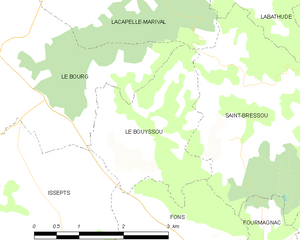
Le Bouyssou
- commune in Lot, France
- Country:
- Postal Code: 46120
- Coordinates: 44° 41' 32" N, 1° 56' 34" E
- GPS tracks (wikiloc): [Link]
- Area: 5.62 sq km
- Population: 143


Fourmagnac
- commune in Lot, France
- Country:
- Postal Code: 46100
- Coordinates: 44° 39' 48" N, 1° 58' 46" E
- GPS tracks (wikiloc): [Link]
- AboveSeaLevel: 218 м m
- Area: 3.78 sq km
- Population: 153

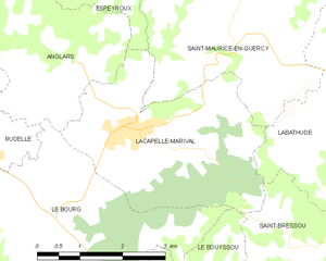
Lacapelle-Marival
- commune in Lot, France
- Country:
- Postal Code: 46120
- Coordinates: 44° 43' 44" N, 1° 55' 33" E
- GPS tracks (wikiloc): [Link]
- Area: 11.61 sq km
- Population: 1287
Sainte-Colombe
- commune in Lot, France
- Country:
- Postal Code: 46120
- Coordinates: 44° 43' 24" N, 2° 0' 9" E
- GPS tracks (wikiloc): [Link]
- Area: 11.35 sq km
- Population: 202


Fons
- commune in Lot, France
- Country:
- Postal Code: 46100
- Coordinates: 44° 39' 51" N, 1° 57' 5" E
- GPS tracks (wikiloc): [Link]
- AboveSeaLevel: 260 м m
- Area: 14.95 sq km
- Population: 402
Labathude
- commune in Lot, France
- Country:
- Postal Code: 46120
- Coordinates: 44° 44' 18" N, 1° 59' 35" E
- GPS tracks (wikiloc): [Link]
- Area: 10.05 sq km
- Population: 212


Cardaillac
- commune in Lot, France
- Country:
- Postal Code: 46100
- Coordinates: 44° 40' 48" N, 1° 59' 49" E
- GPS tracks (wikiloc): [Link]
- Area: 18.1 sq km
- Population: 602
- Web site: [Link]