Lacapelle-Marival (Lacapelle-Marival)

- commune in Lot, France
- Country:

- Postal Code: 46120
- Coordinates: 44° 43' 44" N, 1° 55' 33" E


- GPS tracks (wikiloc): [Link]
- Area: 11.61 sq km
- Population: 1287
- Wikipedia en: wiki(en)
- Wikipedia: wiki(fr)
- Wikidata storage: Wikidata: Q1332222
- Wikipedia Commons Category: [Link]
- Freebase ID: [/m/03mgnjr]
- GeoNames ID: Alt: [3010605]
- SIREN number: [214601437]
- BnF ID: [15260884h]
- VIAF ID: Alt: [299925775]
- MusicBrainz area ID: [59682393-f414-4582-95fd-9fd7d2de9c21]
- WOEID: [600678]
- INSEE municipality code: 46143
Shares border with regions:

Le Bourg
- commune in Lot, France
- Country:
- Postal Code: 46120
- Coordinates: 44° 42' 34" N, 1° 54' 12" E
- GPS tracks (wikiloc): [Link]
- Area: 13.15 sq km
- Population: 320

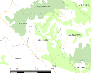
Le Bouyssou
- commune in Lot, France
- Country:
- Postal Code: 46120
- Coordinates: 44° 41' 32" N, 1° 56' 34" E
- GPS tracks (wikiloc): [Link]
- Area: 5.62 sq km
- Population: 143


Espeyroux
- commune in Lot, France
- Country:
- Postal Code: 46120
- Coordinates: 44° 45' 45" N, 1° 55' 22" E
- GPS tracks (wikiloc): [Link]
- Area: 7.64 sq km
- Population: 97


Anglars
- commune in Lot, France
- Country:
- Postal Code: 46120
- Coordinates: 44° 44' 23" N, 1° 54' 20" E
- GPS tracks (wikiloc): [Link]
- Area: 9.99 sq km
- Population: 211
Saint-Maurice-en-Quercy
- commune in Lot, France
- Country:
- Postal Code: 46120
- Coordinates: 44° 44' 36" N, 1° 56' 51" E
- GPS tracks (wikiloc): [Link]
- Area: 13 sq km
- Population: 225
Labathude
- commune in Lot, France
- Country:
- Postal Code: 46120
- Coordinates: 44° 44' 18" N, 1° 59' 35" E
- GPS tracks (wikiloc): [Link]
- Area: 10.05 sq km
- Population: 212
Saint-Bressou
- commune in Lot, France
- Country:
- Postal Code: 46120
- Coordinates: 44° 42' 17" N, 1° 58' 19" E
- GPS tracks (wikiloc): [Link]
- Area: 10.03 sq km
- Population: 118