Saint-Chély-d'Apcher (Saint-Chély-d'Apcher)

- commune in Lozère, France
- Country:

- Postal Code: 48200
- Coordinates: 44° 48' 11" N, 3° 16' 33" E


- GPS tracks (wikiloc): [Link]
- Area: 28.26 sq km
- Population: 4156
- Web site: http://www.stchelydapcher.fr
- Wikipedia en: wiki(en)
- Wikipedia: wiki(fr)
- Wikidata storage: Wikidata: Q720522
- Wikipedia Commons Category: [Link]
- Freebase ID: [/m/0drv36]
- Freebase ID: [/m/0drv36]
- GeoNames ID: Alt: [2981193]
- GeoNames ID: Alt: [2981193]
- SIREN number: [214801409]
- SIREN number: [214801409]
- BnF ID: [152615451]
- BnF ID: [152615451]
- VIAF ID: Alt: [140508159]
- VIAF ID: Alt: [140508159]
- Library of Congress authority ID: Alt: [n83023568]
- Library of Congress authority ID: Alt: [n83023568]
- SUDOC authorities ID: [026591901]
- SUDOC authorities ID: [026591901]
- INSEE municipality code: 48140
- INSEE municipality code: 48140
Shares border with regions:


Les Monts-Verts
- commune in Lozère, France
- Country:
- Postal Code: 48200
- Coordinates: 44° 51' 28" N, 3° 12' 19" E
- GPS tracks (wikiloc): [Link]
- AboveSeaLevel: 1100 м m
- Area: 29.13 sq km
- Population: 344


Saint-Pierre-le-Vieux
- commune in Lozère, France
- Country:
- Postal Code: 48200
- Coordinates: 44° 50' 50" N, 3° 18' 31" E
- GPS tracks (wikiloc): [Link]
- AboveSeaLevel: 950 м m
- Area: 15.55 sq km
- Population: 312

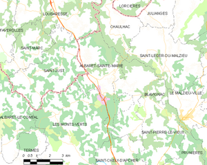
Albaret-Sainte-Marie
- commune in Lozère, France
- Country:
- Postal Code: 48200
- Coordinates: 44° 52' 55" N, 3° 14' 50" E
- GPS tracks (wikiloc): [Link]
- AboveSeaLevel: 970 м m
- Area: 15.98 sq km
- Population: 568
Les Bessons
- commune in Lozère, France
- Country:
- Postal Code: 48200
- Coordinates: 44° 46' 21" N, 3° 15' 12" E
- GPS tracks (wikiloc): [Link]
- Area: 23.49 sq km
- Population: 445


Blavignac
- commune in Lozère, France
- Country:
- Postal Code: 48200
- Coordinates: 44° 53' 8" N, 3° 17' 12" E
- GPS tracks (wikiloc): [Link]
- Area: 13.83 sq km
- Population: 288


Prunières
- commune in Lozère, France
- Country:
- Postal Code: 48200
- Coordinates: 44° 49' 35" N, 3° 20' 32" E
- GPS tracks (wikiloc): [Link]
- Area: 13.09 sq km
- Population: 261

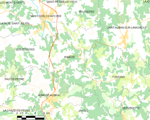
Rimeize
- commune in Lozère, France
- Country:
- Postal Code: 48200
- Coordinates: 44° 45' 54" N, 3° 19' 26" E
- GPS tracks (wikiloc): [Link]
- Area: 32.3 sq km
- Population: 577
La Fage-Saint-Julien
- commune in Lozère, France
- Country:
- Postal Code: 48200
- Coordinates: 44° 48' 11" N, 3° 11' 28" E
- GPS tracks (wikiloc): [Link]
- Area: 18.06 sq km
- Population: 293