Saint-Pierre-le-Vieux (Saint-Pierre-le-Vieux)

- commune in Lozère, France
- Country:

- Postal Code: 48200
- Coordinates: 44° 50' 50" N, 3° 18' 31" E


- GPS tracks (wikiloc): [Link]
- AboveSeaLevel: 950 м m
- Area: 15.55 sq km
- Population: 312
- Wikipedia en: wiki(en)
- Wikipedia: wiki(fr)
- Wikidata storage: Wikidata: Q520586
- Wikipedia Commons Category: [Link]
- Freebase ID: [/m/02z0wvj]
- Freebase ID: [/m/02z0wvj]
- GeoNames ID: Alt: [6435175]
- GeoNames ID: Alt: [6435175]
- SIREN number: [214801771]
- SIREN number: [214801771]
- BnF ID: [15261580j]
- BnF ID: [15261580j]
- INSEE municipality code: 48177
- INSEE municipality code: 48177
Shares border with regions:

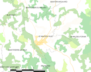
Le Malzieu-Ville
- commune in Lozère, France
- Country:
- Postal Code: 48140
- Coordinates: 44° 51' 22" N, 3° 19' 51" E
- GPS tracks (wikiloc): [Link]
- Area: 7.8 sq km
- Population: 740
- Web site: [Link]

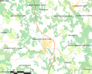
Saint-Chély-d'Apcher
- commune in Lozère, France
- Country:
- Postal Code: 48200
- Coordinates: 44° 48' 11" N, 3° 16' 33" E
- GPS tracks (wikiloc): [Link]
- Area: 28.26 sq km
- Population: 4156
- Web site: [Link]


Blavignac
- commune in Lozère, France
- Country:
- Postal Code: 48200
- Coordinates: 44° 53' 8" N, 3° 17' 12" E
- GPS tracks (wikiloc): [Link]
- Area: 13.83 sq km
- Population: 288


Prunières
- commune in Lozère, France
- Country:
- Postal Code: 48200
- Coordinates: 44° 49' 35" N, 3° 20' 32" E
- GPS tracks (wikiloc): [Link]
- Area: 13.09 sq km
- Population: 261