Saint-Chéron (Saint-Chéron)

- commune in Marne, France
- Country:

- Postal Code: 51290
- Coordinates: 48° 38' 11" N, 4° 33' 39" E


- GPS tracks (wikiloc): [Link]
- Area: 9.16 sq km
- Population: 63
- Wikipedia en: wiki(en)
- Wikipedia: wiki(fr)
- Wikidata storage: Wikidata: Q1224640
- Wikipedia Commons Category: [Link]
- Freebase ID: [/m/03qf9vc]
- SIREN number: [215104407]
- BnF ID: [15263071p]
- VIAF ID: Alt: [245871060]
- INSEE municipality code: 51475
Shares border with regions:

Somsois
- commune in Marne, France
- Country:
- Postal Code: 51290
- Coordinates: 48° 35' 45" N, 4° 30' 13" E
- GPS tracks (wikiloc): [Link]
- Area: 21.31 sq km
- Population: 198
- Web site: [Link]
Les Rivières-Henruel
- commune in Marne, France
- Country:
- Postal Code: 51300
- Coordinates: 48° 39' 14" N, 4° 33' 51" E
- GPS tracks (wikiloc): [Link]
- Area: 11.97 sq km
- Population: 177

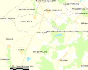
Gigny-Bussy
- commune in Marne, France
- Country:
- Postal Code: 51290
- Coordinates: 48° 36' 23" N, 4° 34' 14" E
- GPS tracks (wikiloc): [Link]
- AboveSeaLevel: 220 м m
- Area: 22.45 sq km
- Population: 226

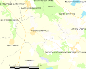
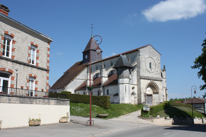
Arzillières-Neuville
- commune in Marne, France
- Country:
- Postal Code: 51290
- Coordinates: 48° 38' 41" N, 4° 35' 19" E
- GPS tracks (wikiloc): [Link]
- AboveSeaLevel: 116 м m
- Area: 12.23 sq km
- Population: 333
- Web site: [Link]