Saint-Cibard (Saint-Cibard)

- commune in Gironde, France
- Country:

- Postal Code: 33570
- Coordinates: 44° 56' 24" N, 0° 1' 24" E


- GPS tracks (wikiloc): [Link]
- Area: 3.54 sq km
- Population: 181
- Web site: http://mairiesaintcibard.wix.com/st-cibard
- Wikipedia en: wiki(en)
- Wikipedia: wiki(fr)
- Wikidata storage: Wikidata: Q1004119
- Wikipedia Commons Category: [Link]
- Freebase ID: [/m/03ns0zw]
- GeoNames ID: Alt: [6432379]
- SIREN number: [213303860]
- BnF ID: [15256435f]
- VIAF ID: Alt: [241215457]
- INSEE municipality code: 33386
Shares border with regions:

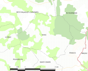
Tayac
- commune in Gironde, France
- Country:
- Postal Code: 33570
- Coordinates: 44° 57' 9" N, 0° 0' 36" E
- GPS tracks (wikiloc): [Link]
- AboveSeaLevel: 90 м m
- Area: 7.22 sq km
- Population: 132

Francs
- commune in Gironde, France
- Country:
- Postal Code: 33570
- Coordinates: 44° 56' 44" N, 0° 0' 22" E
- GPS tracks (wikiloc): [Link]
- AboveSeaLevel: 98 м m
- Area: 6.59 sq km
- Population: 195
- Web site: [Link]


Saint-Philippe-d'Aiguille
- commune in Gironde, France
- Country:
- Postal Code: 33350
- Coordinates: 44° 54' 48" N, 0° 1' 51" E
- GPS tracks (wikiloc): [Link]
- Area: 5.87 sq km
- Population: 377


Les Salles-de-Castillon
- commune in Gironde, France
- Country:
- Postal Code: 33350
- Coordinates: 44° 54' 44" N, 0° 0' 4" E
- GPS tracks (wikiloc): [Link]
- AboveSeaLevel: 82 м m
- Area: 10.81 sq km
- Population: 382


Puisseguin
- commune in Gironde, France
- Country:
- Postal Code: 33570
- Coordinates: 44° 55' 25" N, 0° 4' 23" E
- GPS tracks (wikiloc): [Link]
- Area: 17.25 sq km
- Population: 869
- Web site: [Link]