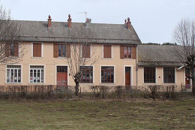
Saint-Eusèbe-en-Champsaur (Saint-Eusèbe-en-Champsaur)
- former commune in Hautes-Alpes, France
 Hiking in Saint-Eusèbe-en-Champsaur
Saint-Eusèbe-en-Champsaur is a picturesque village located in the French Alps, in the Champsaur valley. It offers a variety of hiking opportunities for both novice and experienced hikers. Here are some highlights of hiking in this area:
Scenic Trails
- Diverse Landscapes: Hiking trails around Saint-Eusèbe-en-Champsaur feature stunning mountain scenery, lush valleys, and alpine meadows. The trails often provide breathtaking views of the surrounding peaks, including the Dévoluy massif and the Ecrins National Park.
- Wildlife Observation: The region is rich in biodiversity. While hiking, you may spot various wildlife, including chamois, deer, and a variety of bird species, making it a great spot for nature enthusiasts.
Popular Hiking Routes
- Le Col du Noyer: A moderate hike that leads to the Col du Noyer, offering panoramic views and the chance to experience the local flora and fauna.
- Lac de Pétarel: A lovely hike that takes you to a glacial lake, ideal for a picnic or simply soaking in the natural beauty.
- Grand Veymont: For more experienced hikers, this trail offers a challenging ascent with rewarding views from the summit.
Seasonal Recommendations
- Summer: The best time for hiking in this area is during the summer months (June to September) when trails are generally clear of snow and the weather is mild.
- Fall: Autumn can also be beautiful, with the changing colors of the foliage; however, be prepared for cooler temperatures.
Tips for Hiking in Saint-Eusèbe-en-Champsaur
- Equipment: Wear sturdy hiking boots and bring plenty of water and snacks. A map or GPS device can also be helpful for navigation.
- Weather: Be aware that mountain weather can change rapidly, so it's a good idea to check forecasts and be prepared for sudden changes.
- Respect Nature: Stay on marked paths, take your litter with you, and respect wildlife and plants to preserve the area's natural beauty.
Local Resources
- Visitor Center: Consider stopping by the local tourist office for maps, trail information, and recommendations on guided hikes if you're new to the area.
- Guided Hikes: If you're unfamiliar with the terrain, joining a guided hike can enhance your experience and provide insights into the ecology and history of the region.
Hiking in Saint-Eusèbe-en-Champsaur offers a blend of natural beauty, adventure, and serenity, making it a wonderful destination for outdoor enthusiasts. Enjoy your hike!
- Country:

- Postal Code: 05500
- Coordinates: 44° 43' 33" N, 6° 1' 39" E


- GPS tracks (wikiloc): [Link]
- Area: 7.83 sq km
- Population: 150
- Wikipedia en: wiki(en)
- Wikipedia: wiki(fr)
- Wikidata storage: Wikidata: Q1085868
- Wikipedia Commons Category: [Link]
- Freebase ID: [/m/03mfp2_]
- Freebase ID: [/m/03mfp2_]
- SIREN number: [210501417]
- SIREN number: [210501417]
- INSEE municipality code: 05141
- INSEE municipality code: 05141
Shares border with regions:

Bénévent-et-Charbillac
- former commune in Hautes-Alpes, France
Hiking in Bénévent-et-Charbillac
Bénévent-et-Charbillac is a charming commune in the Drôme department of southeastern France, nestled in the beautiful landscape of the Vercors Massif. This region offers various opportunities for hiking enthusiasts, with trails that cater to different skill levels and preferences....
- Country:
- Postal Code: 05500
- Coordinates: 44° 41' 54" N, 6° 5' 12" E
- GPS tracks (wikiloc): [Link]
- AboveSeaLevel: 1120 м m
- Population: 274

Saint-Bonnet-en-Champsaur
- former commune in Hautes-Alpes, France
Hiking in Saint-Bonnet-en-Champsaur
Saint-Bonnet-en-Champsaur, located in the Hautes-Alpes region of southeastern France, is a picturesque area that offers a variety of hiking opportunities. The region is known for its stunning alpine scenery, including mountains, rivers, and lush forests, making it a fantastic destination for outdoor enthusiasts....
- Country:
- Postal Code: 05500
- Coordinates: 44° 40' 55" N, 6° 4' 35" E
- GPS tracks (wikiloc): [Link]
- AboveSeaLevel: 1040 м m
- Area: 15.01 sq km
- Population: 2047
- Web site: [Link]

La Motte-en-Champsaur
- commune in Hautes-Alpes, France
Hiking in La Motte-en-Champsaur
La Motte-en-Champsaur is a charming village located in the French Alps, known for its stunning natural scenery and a variety of hiking opportunities. The region offers a mix of landscapes, including alpine meadows, dense forests, and panoramic mountain views, making it an excellent destination for both novice and experienced hikers....
- Country:
- Postal Code: 05500
- Coordinates: 44° 43' 57" N, 6° 4' 5" E
- GPS tracks (wikiloc): [Link]
- Area: 52.8 sq km
- Population: 215
- Web site: [Link]

Le Noyer
- commune in Hautes-Alpes, France
Hiking in Le Noyer
Le Noyer, located in the Hautes-Alpes region of southeastern France, is an excellent destination for hiking enthusiasts. This charming alpine village is situated near the Écrins National Park, which offers a diverse range of trails suitable for different skill levels, from beginners to more experienced hikers....
- Country:
- Postal Code: 05500
- Coordinates: 44° 41' 55" N, 6° 0' 45" E
- GPS tracks (wikiloc): [Link]
- Area: 21.5 sq km
- Population: 289

Les Costes
- former commune in Hautes-Alpes, France
Hiking in Les Costes
Les Costes is a beautiful area that offers a range of hiking opportunities, characterized by its stunning landscapes and diverse terrain. While the specifics can vary depending on the exact location you're referring to, here's a general overview of what you might expect when hiking in a region like Les Costes:...
- Country:
- Postal Code: 05500
- Coordinates: 44° 44' 46" N, 6° 2' 2" E
- GPS tracks (wikiloc): [Link]
- Area: 8.78 sq km
- Population: 178
Poligny
- commune in Hautes-Alpes, France
Hiking in Poligny
Poligny, situated in the Hautes-Alpes region of southeastern France, is a fantastic destination for hikers, offering stunning landscapes, diverse trails, and a variety of outdoor activities....
- Country:
- Postal Code: 05500
- Coordinates: 44° 41' 30" N, 6° 2' 50" E
- GPS tracks (wikiloc): [Link]
- Area: 13.81 sq km
- Population: 302

Chauffayer
- former commune in Hautes-Alpes, France
Hiking in Chauffayer
Chauffayer is a charming commune located in the Hautes-Alpes department of southeastern France. It is surrounded by stunning mountainous landscapes, making it an appealing destination for hiking enthusiasts. Here are some highlights about hiking in and around Chauffayer:...
- Country:
- Postal Code: 05800
- Coordinates: 44° 45' 15" N, 6° 0' 31" E
- GPS tracks (wikiloc): [Link]
- Area: 10.9 sq km
- Population: 383