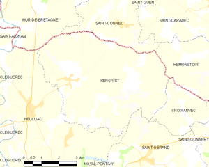
Saint-Gérand (Saint-Gérand)
- commune in Morbihan, France
- Country:

- Postal Code: 56920
- Coordinates: 48° 6' 30" N, 2° 53' 17" E


- GPS tracks (wikiloc): [Link]
- Area: 18.05 sq km
- Population: 1088
- Wikipedia en: wiki(en)
- Wikipedia: wiki(fr)
- Wikidata storage: Wikidata: Q127988
- Wikipedia Commons Category: [Link]
- Freebase ID: [/m/03cbzx5]
- GeoNames ID: Alt: [6437374]
- SIREN number: [215602137]
- BnF ID: [152654629]
- INSEE municipality code: 56213
Shares border with regions:


Saint-Gonnery
- commune in Morbihan, France
- Country:

- Postal Code: 56920
- Coordinates: 48° 7' 26" N, 2° 49' 11" E


- GPS tracks (wikiloc): [Link]
- Area: 16.29 sq km
- Population: 1083


Croixanvec
- commune in Morbihan, France
- Country:

- Postal Code: 56920
- Coordinates: 48° 8' 22" N, 2° 52' 9" E


- GPS tracks (wikiloc): [Link]
- Area: 6.09 sq km
- Population: 165


Neulliac
- commune in Morbihan, France
- Country:

- Postal Code: 56300
- Coordinates: 48° 7' 40" N, 2° 58' 56" E


- GPS tracks (wikiloc): [Link]
- Area: 30.99 sq km
- Population: 1432
- Web site: [Link]


Gueltas
- commune in Morbihan, France
- Country:

- Postal Code: 56920
- Coordinates: 48° 5' 39" N, 2° 47' 45" E


- GPS tracks (wikiloc): [Link]
- Area: 20.45 sq km
- Population: 511


Kergrist
- commune in Morbihan, France
- Country:

- Postal Code: 56300
- Coordinates: 48° 8' 47" N, 2° 57' 22" E


- GPS tracks (wikiloc): [Link]
- Area: 29.66 sq km
- Population: 717


Noyal-Pontivy
- commune in Morbihan, France
- Country:

- Postal Code: 56920
- Coordinates: 48° 4' 0" N, 2° 53' 0" E


- GPS tracks (wikiloc): [Link]
- Area: 53.45 sq km
- Population: 3677
- Web site: [Link]
