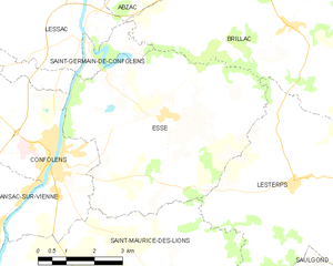
Saint-Germain-de-Confolens (Saint-Germain-de-Confolens)

- former commune in Charente, France
- Country:

- Postal Code: 16500
- Coordinates: 46° 3' 11" N, 0° 41' 4" E


- GPS tracks (wikiloc): [Link]
- Area: 4.67 sq km
- Population: 71
- Wikipedia en: wiki(en)
- Wikipedia: wiki(fr)
- Wikidata storage: Wikidata: Q1438528
- Wikipedia Commons Category: [Link]
- Freebase ID: [/m/03mcdcz]
- GeoNames ID: Alt: [2979839]
- BnF ID: [15248759j]
- INSEE municipality code: 16322
Shares border with regions:


Brillac
- commune in Charente, France
- Country:
- Postal Code: 16500
- Coordinates: 46° 3' 38" N, 0° 46' 39" E
- GPS tracks (wikiloc): [Link]
- Area: 42.41 sq km
- Population: 676


Lessac
- commune in Charente, France
- Country:
- Postal Code: 16500
- Coordinates: 46° 4' 7" N, 0° 40' 32" E
- GPS tracks (wikiloc): [Link]
- Area: 34.14 sq km
- Population: 555


Confolens
- commune in Charente, France
- Country:
- Postal Code: 16500
- Coordinates: 46° 0' 49" N, 0° 40' 20" E
- GPS tracks (wikiloc): [Link]
- AboveSeaLevel: 152 м m
- Area: 18.96 sq km
- Population: 2640
- Web site: [Link]

Esse
- commune in Charente, France
- Country:
- Postal Code: 16500
- Coordinates: 46° 1' 57" N, 0° 43' 17" E
- GPS tracks (wikiloc): [Link]
- Area: 30.37 sq km
- Population: 506