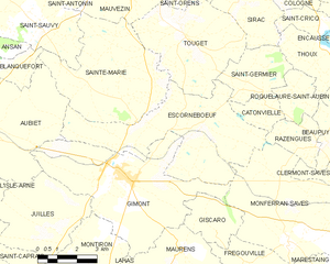
Saint-Germier (Saint-Germier)

- commune in Gers, France
- Country:

- Postal Code: 32200
- Coordinates: 43° 40' 1" N, 0° 57' 3" E


- GPS tracks (wikiloc): [Link]
- AboveSeaLevel: 200 м m
- Area: 7.05 sq km
- Population: 215
- Wikipedia en: wiki(en)
- Wikipedia: wiki(fr)
- Wikidata storage: Wikidata: Q1004010
- Wikipedia Commons Category: [Link]
- Freebase ID: [/m/03nrz5b]
- GeoNames ID: Alt: [6616525]
- SIREN number: [213203797]
- BnF ID: [15255965h]
- INSEE municipality code: 32379
Shares border with regions:
Thoux
- commune in Gers, France
- Country:
- Postal Code: 32430
- Coordinates: 43° 41' 0" N, 0° 59' 34" E
- GPS tracks (wikiloc): [Link]
- Area: 6.12 sq km
- Population: 244
Sirac
- commune in Gers, France
- Country:
- Postal Code: 32430
- Coordinates: 43° 42' 37" N, 0° 57' 2" E
- GPS tracks (wikiloc): [Link]
- Area: 8 sq km
- Population: 165
Roquelaure-Saint-Aubin
- commune in Gers, France
- Country:
- Postal Code: 32430
- Coordinates: 43° 40' 3" N, 0° 58' 54" E
- GPS tracks (wikiloc): [Link]
- Area: 4.21 sq km
- Population: 125

Escornebœuf
- commune in Gers, France
- Country:
- Postal Code: 32200
- Coordinates: 43° 39' 17" N, 0° 54' 42" E
- GPS tracks (wikiloc): [Link]
- Area: 25.45 sq km
- Population: 548
Touget
- commune in Gers, France
- Country:
- Postal Code: 32430
- Coordinates: 43° 41' 25" N, 0° 54' 55" E
- GPS tracks (wikiloc): [Link]
- Area: 17.72 sq km
- Population: 518
- Web site: [Link]
Catonvielle
- commune in Gers, France
- Country:
- Postal Code: 32200
- Coordinates: 43° 39' 35" N, 0° 57' 44" E
- GPS tracks (wikiloc): [Link]
- Area: 3.07 sq km
- Population: 102