Saint-Gibrien (Saint-Gibrien)

- commune in Marne, France
- Country:

- Postal Code: 51510
- Coordinates: 48° 58' 23" N, 4° 18' 0" E


- GPS tracks (wikiloc): [Link]
- Area: 4.04 sq km
- Population: 507
- Wikipedia en: wiki(en)
- Wikipedia: wiki(fr)
- Wikidata storage: Wikidata: Q684555
- Wikipedia Commons Category: [Link]
- Freebase ID: [/m/03qd97g]
- GeoNames ID: Alt: [2979687]
- SIREN number: [215104472]
- BnF ID: [152630783]
- PACTOLS thesaurus ID: [pcrtxMI94c4GSc]
- INSEE municipality code: 51483
Shares border with regions:

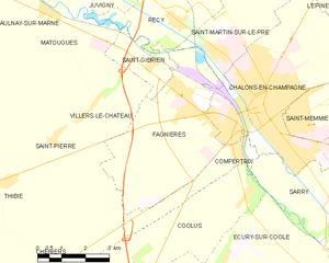
Fagnières
- commune in Marne, France
- Country:
- Postal Code: 51510
- Coordinates: 48° 57' 49" N, 4° 19' 6" E
- GPS tracks (wikiloc): [Link]
- Area: 19.48 sq km
- Population: 4748
- Web site: [Link]

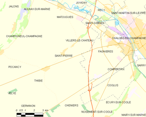
Villers-le-Château
- commune in Marne, France
- Country:
- Postal Code: 51510
- Coordinates: 48° 57' 38" N, 4° 16' 5" E
- GPS tracks (wikiloc): [Link]
- Area: 20.94 sq km
- Population: 245


Recy
- commune in Marne, France
- Country:
- Postal Code: 51520
- Coordinates: 48° 59' 22" N, 4° 18' 45" E
- GPS tracks (wikiloc): [Link]
- Area: 14.38 sq km
- Population: 1042


Matougues
- commune in Marne, France
- Country:
- Postal Code: 51510
- Coordinates: 48° 59' 38" N, 4° 14' 32" E
- GPS tracks (wikiloc): [Link]
- Area: 13.77 sq km
- Population: 622