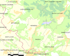
Saint-Hilarion (Saint-Hilarion)

- commune in Yvelines, France
- Country:

- Postal Code: 78125
- Coordinates: 48° 37' 13" N, 1° 44' 0" E


- GPS tracks (wikiloc): [Link]
- Area: 14 sq km
- Population: 894
- Web site: http://www.saint-hilarion.fr
- Wikipedia en: wiki(en)
- Wikipedia: wiki(fr)
- Wikidata storage: Wikidata: Q1462655
- Wikipedia Commons Category: [Link]
- Freebase ID: [/m/03qg3vt]
- Freebase ID: [/m/03qg3vt]
- GeoNames ID: Alt: [6444070]
- GeoNames ID: Alt: [6444070]
- SIREN number: [217805571]
- SIREN number: [217805571]
- BnF ID: [15276090w]
- BnF ID: [15276090w]
- INSEE municipality code: 78557
- INSEE municipality code: 78557
Shares border with regions:


Droue-sur-Drouette
- commune in Eure-et-Loir, France
- Country:
- Postal Code: 28230
- Coordinates: 48° 36' 4" N, 1° 42' 6" E
- GPS tracks (wikiloc): [Link]
- Area: 5.26 sq km
- Population: 1261


Raizeux
- commune in Yvelines, France
- Country:
- Postal Code: 78125
- Coordinates: 48° 37' 27" N, 1° 41' 1" E
- GPS tracks (wikiloc): [Link]
- Area: 10.25 sq km
- Population: 923
- Web site: [Link]


Gazeran
- commune in Yvelines, France
- Country:
- Postal Code: 78125
- Coordinates: 48° 38' 2" N, 1° 46' 25" E
- GPS tracks (wikiloc): [Link]
- Area: 25.8 sq km
- Population: 1287
- Web site: [Link]


Émancé
- commune in Yvelines, France
- Country:
- Postal Code: 78125
- Coordinates: 48° 35' 25" N, 1° 43' 48" E
- GPS tracks (wikiloc): [Link]
- Area: 11.99 sq km
- Population: 879
- Web site: [Link]


Épernon
- commune in Eure-et-Loir, France
- Country:
- Postal Code: 28230
- Coordinates: 48° 36' 39" N, 1° 40' 27" E
- GPS tracks (wikiloc): [Link]
- Area: 6.45 sq km
- Population: 5540
- Web site: [Link]

Hermeray
- commune in Yvelines, France
- Country:
- Postal Code: 78125
- Coordinates: 48° 39' 0" N, 1° 41' 17" E
- GPS tracks (wikiloc): [Link]
- AboveSeaLevel: 134 м m
- Area: 18.07 sq km
- Population: 954