Saint-Ismier (Saint-Ismier)
- commune in Isère, France
Saint-Ismier is a charming village located in the Auvergne-Rhône-Alpes region of southeastern France, near the Isère River and the picturesque city of Grenoble. The surrounding area offers a variety of hiking options, making it an excellent destination for both novice and experienced hikers. Here are some key points to consider if you're planning to hike in and around Saint-Ismier:
Trails and Scenery
-
Diverse Landscapes: The region features diverse landscapes, including lush forests, rolling hills, and views of the Chartreuse and Belledonne mountain ranges. The trails often lead to breathtaking viewpoints over the valley and surrounding mountains.
-
Local Trails: Popular hiking trails in the vicinity include routes that take you through nature reserves and along scenic paths. The chemin des Écureuils, for instance, is a lovely trail for a family outing.
-
Marked Paths: Many trails are well-marked, ensuring that hikers can easily navigate the routes. It's advisable to carry a map or use a hiking app for additional navigation and trail insights.
Difficulty Levels
- Trails range from easy to challenging, accommodating all skill levels. Beginners can enjoy gentle slopes, while more experienced hikers can tackle steeper trails for a greater challenge and panoramic views.
Season Considerations
- Spring/Summer: Ideal for hiking, as the weather is pleasant, and the flora is vibrant. Be prepared with plenty of water, sun protection, and proper footwear.
- Autumn: The fall foliage adds a spectacular backdrop for hikes, but be cautious of slippery leaves on trails.
- Winter: Depending on snow conditions, some trails may be suitable for snowshoeing or winter hiking, but proper gear is essential.
Local Facilities
- Accommodations: Saint-Ismier has various lodging options, from hotels to guesthouses, making it easy for hikers to plan multi-day hikes.
- Dining: After a long hike, you can enjoy local cuisine at nearby restaurants or cafés, offering a taste of regional dishes.
Recommendations
- Always check local weather forecasts before setting out, as conditions can change rapidly in mountainous areas.
- Share your hiking plans with someone, especially if you're going alone.
- Carry essentials: water, snacks, a first aid kit, appropriate clothing, and a fully charged mobile device.
Hiking in Saint-Ismier allows you to experience the natural beauty and tranquility of the French Alps while enjoying a range of outdoor activities. Happy hiking!
- Country:

- Postal Code: 38330
- Coordinates: 45° 14' 55" N, 5° 49' 37" E


- GPS tracks (wikiloc): [Link]
- Area: 14.9 sq km
- Population: 6857
- Web site: http://www.mairie-saint-ismier.fr
- Wikipedia en: wiki(en)
- Wikipedia: wiki(fr)
- Wikidata storage: Wikidata: Q1072187
- Wikipedia Commons Category: [Link]
- Freebase ID: [/m/0dm89d]
- GeoNames ID: Alt: [6433349]
- SIREN number: [213803976]
- BnF ID: [152582074]
- VIAF ID: Alt: [238786823]
- INSEE municipality code: 38397
Shares border with regions:


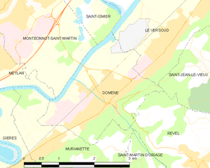
Domène
- commune in Isère, France
Domène, located in the Isère department in the Auvergne-Rhône-Alpes region of southeastern France, offers picturesque hiking opportunities with stunning views of the surrounding mountains and valleys. Nestled near the Chartreuse and Belledonne mountain ranges, the area boasts a variety of trails suitable for different skill levels, from leisurely walks to more challenging hikes....
- Country:

- Postal Code: 38420
- Coordinates: 45° 12' 9" N, 5° 50' 20" E


- GPS tracks (wikiloc): [Link]
- Area: 5.29 sq km
- Population: 6739
- Web site: [Link]


Montbonnot-Saint-Martin
- commune in Isère, France
 Hiking in Montbonnot-Saint-Martin
Montbonnot-Saint-Martin is a charming commune located near Grenoble in the Auvergne-Rhône-Alpes region of France. It's situated at the foothills of the Chartreuse Mountains, making it an ideal starting point for hiking enthusiasts. Here’s what you can expect when hiking in and around Montbonnot-Saint-Martin:...
- Country:

- Postal Code: 38330
- Coordinates: 45° 13' 37" N, 5° 48' 9" E


- GPS tracks (wikiloc): [Link]
- Area: 6.38 sq km
- Population: 5010
- Web site: [Link]


Le Versoud
- commune in Isère, France
Le Versoud is a charming commune located in the Grenoble metropolitan area of France, nestled in the stunning French Alps. This region offers picturesque landscapes, making it ideal for hiking enthusiasts of all levels. Here are some key points to consider when planning a hiking experience in Le Versoud:...
- Country:

- Postal Code: 38420
- Coordinates: 45° 12' 57" N, 5° 51' 44" E


- GPS tracks (wikiloc): [Link]
- Area: 6.35 sq km
- Population: 4768
- Web site: [Link]


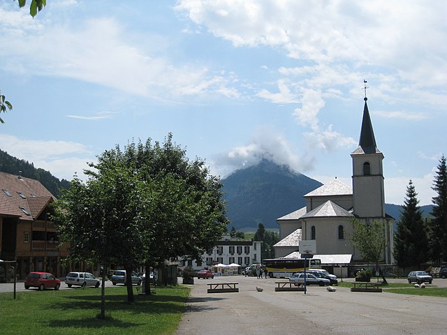
Le Sappey-en-Chartreuse
- commune in Isère, France
 Hiking in Le Sappey-en-Chartreuse
Le Sappey-en-Chartreuse is a charming village located in the Chartreuse mountain range of the French Alps. This region is known for its stunning natural landscapes, rich biodiversity, and a variety of outdoor activities, making it an excellent destination for hiking enthusiasts. Here are some highlights for hiking in Le Sappey-en-Chartreuse:...
- Country:

- Postal Code: 38700
- Coordinates: 45° 15' 45" N, 5° 46' 41" E


- GPS tracks (wikiloc): [Link]
- Area: 15.13 sq km
- Population: 1119


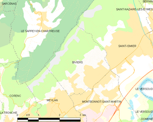
Biviers
- commune in Isère, France
Biviers is a small town located near Grenoble in the Auvergne-Rhône-Alpes region of France, and it serves as a great gateway for exploring the beautiful surrounding landscapes. Hiking in and around Biviers offers various opportunities for outdoor enthusiasts, ranging from easy walks to more challenging trails....
- Country:

- Postal Code: 38330
- Coordinates: 45° 14' 24" N, 5° 48' 12" E


- GPS tracks (wikiloc): [Link]
- Area: 6.17 sq km
- Population: 2324


Saint-Nazaire-les-Eymes
- commune in Isère, France
 Hiking in Saint-Nazaire-les-Eymes
Saint-Nazaire-les-Eymes is a charming commune situated in the Auvergne-Rhône-Alpes region of southeastern France, near the French Alps. It offers a variety of hiking opportunities, making it a great destination for outdoor enthusiasts....
- Country:

- Postal Code: 38330
- Coordinates: 45° 14' 58" N, 5° 51' 12" E


- GPS tracks (wikiloc): [Link]
- AboveSeaLevel: 283 м m
- Area: 8.49 sq km
- Population: 2961
- Web site: [Link]


Saint-Pierre-de-Chartreuse
- commune in Isère, France
 Hiking in Saint-Pierre-de-Chartreuse
Saint-Pierre-de-Chartreuse is a picturesque village located in the Chartreuse Mountains, in the Auvergne-Rhône-Alpes region of France. It's a popular destination for outdoor enthusiasts, particularly hikers, due to its stunning landscapes, diverse trails, and rich natural heritage. Here are some highlights and tips for hiking in this beautiful area:...
- Country:

- Postal Code: 38380
- Coordinates: 45° 20' 33" N, 5° 48' 56" E


- GPS tracks (wikiloc): [Link]
- Area: 80.12 sq km
- Population: 1028
- Web site: [Link]


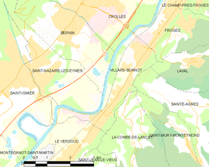
Villard-Bonnot
- commune in Isère, France
Villard-Bonnot, located in the French Alps near Grenoble, offers an excellent opportunity for hiking enthusiasts. With its picturesque landscapes, diverse trails, and stunning mountain views, the area is appealing to both beginners and experienced hikers....
- Country:

- Postal Code: 38190
- Coordinates: 45° 14' 17" N, 5° 53' 18" E


- GPS tracks (wikiloc): [Link]
- Area: 5.84 sq km
- Population: 7096
- Web site: [Link]
