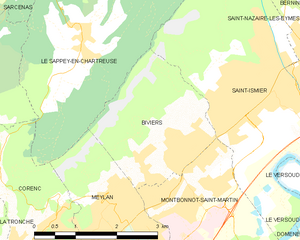
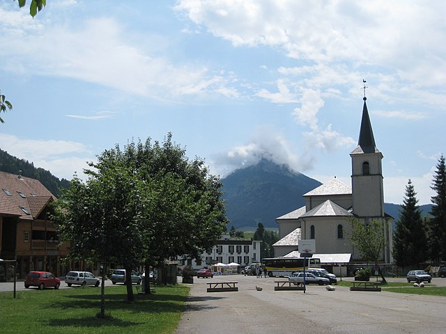
Le Sappey-en-Chartreuse (Le Sappey-en-Chartreuse)
- commune in Isère, France
 Hiking in Le Sappey-en-Chartreuse
Le Sappey-en-Chartreuse is a charming village located in the Chartreuse mountain range of the French Alps. This region is known for its stunning natural landscapes, rich biodiversity, and a variety of outdoor activities, making it an excellent destination for hiking enthusiasts. Here are some highlights for hiking in Le Sappey-en-Chartreuse:
Trail Options:
-
Les Sentiers Pédestres: There are numerous well-marked hiking trails around Le Sappey-en-Chartreuse catering to different skill levels, from easy walks to challenging hikes.
-
Col de Porte: A popular route that offers stunning views of the Chartreuse mountains and the valley below. This trail is moderate in difficulty, making it suitable for families and casual hikers.
-
Montée au Mont Granier: For more experienced hikers, the trail to Mont Granier provides breathtaking panoramic views from the summit. It can be challenging, so proper hiking gear and fitness are required.
-
The GR9 Trail: This long-distance hiking trail passes through the Chartreuse area, linking different villages and offering diverse landscapes and experiences.
Scenic Highlights:
- Flora and Fauna: The area is rich in biodiversity, making it a great spot for wildlife observation and botany enthusiasts.
- Panoramic Views: Many trails offer scenic overlooks where hikers can enjoy breathtaking views of the surrounding mountains and valleys.
- Cascades: Some trails lead to beautiful waterfalls and streams, adding to the picturesque quality of hikes in the area.
Accessibility:
- Most trails are accessible from the village, often starting at local trailheads. Maps and local guides can be obtained from the tourism office in Le Sappey-en-Chartreuse.
Best Time to Visit:
- Spring and Fall: These seasons are particularly popular for hiking due to pleasant temperatures and fewer crowds.
- Summer: Great for outdoor activities, though it's best to start hikes early in the morning to avoid the heat.
Tips for Hikers:
- Packing Essentials: Make sure to bring enough water, snacks, appropriate clothing, a map or GPS, and a first-aid kit.
- Weather Check: Always check the weather forecast before heading out, as mountain weather can change rapidly.
- Respect Nature: Follow the Leave No Trace principles to preserve the natural beauty of the area.
Le Sappey-en-Chartreuse offers a beautiful setting for hikers of all levels, with its scenic trails and stunning mountain vistas, making it an ideal destination for a day hike or a multi-day exploration of the Chartreuse massif.
- Country:

- Postal Code: 38700
- Coordinates: 45° 15' 45" N, 5° 46' 41" E


- GPS tracks (wikiloc): [Link]
- Area: 15.13 sq km
- Population: 1119
- Wikipedia en: wiki(en)
- Wikipedia: wiki(fr)
- Wikidata storage: Wikidata: Q515446
- Wikipedia Commons Category: [Link]
- Freebase ID: [/m/03nvkwg]
- GeoNames ID: Alt: [6455954]
- SIREN number: [213804719]
- BnF ID: [152582779]
- WOEID: [12665114]
- INSEE municipality code: 38471
Shares border with regions:


Saint-Ismier
- commune in Isère, France
Saint-Ismier is a charming village located in the Auvergne-Rhône-Alpes region of southeastern France, near the Isère River and the picturesque city of Grenoble. The surrounding area offers a variety of hiking options, making it an excellent destination for both novice and experienced hikers. Here are some key points to consider if you're planning to hike in and around Saint-Ismier:...
- Country:

- Postal Code: 38330
- Coordinates: 45° 14' 55" N, 5° 49' 37" E


- GPS tracks (wikiloc): [Link]
- Area: 14.9 sq km
- Population: 6857
- Web site: [Link]


Quaix-en-Chartreuse
- commune in Isère, France
Hiking in Quaix-en-Chartreuse, located in the Chartreuse mountain range of France, offers stunning landscapes, diverse trails, and a rich natural heritage. Here are some key highlights for hikers in the area:...
- Country:

- Postal Code: 38950
- Coordinates: 45° 15' 10" N, 5° 43' 7" E


- GPS tracks (wikiloc): [Link]
- AboveSeaLevel: 525 м m
- Area: 18.09 sq km
- Population: 906
- Web site: [Link]


Corenc
- commune in Isère, France
Corenc is a charming village located near the Grenoble area in the French Alps, offering beautiful hiking opportunities with stunning views of the surrounding mountains and nature. Here are some highlights and tips for hiking in Corenc:...
- Country:

- Postal Code: 38700
- Coordinates: 45° 12' 41" N, 5° 45' 2" E


- GPS tracks (wikiloc): [Link]
- Area: 6.5 sq km
- Population: 3980
- Web site: [Link]


Biviers
- commune in Isère, France
Biviers is a small town located near Grenoble in the Auvergne-Rhône-Alpes region of France, and it serves as a great gateway for exploring the beautiful surrounding landscapes. Hiking in and around Biviers offers various opportunities for outdoor enthusiasts, ranging from easy walks to more challenging trails....
- Country:

- Postal Code: 38330
- Coordinates: 45° 14' 24" N, 5° 48' 12" E


- GPS tracks (wikiloc): [Link]
- Area: 6.17 sq km
- Population: 2324


Meylan
- commune in Isère, France
Meylan is a charming suburb located near Grenoble in the Auvergne-Rhône-Alpes region of France. It is surrounded by beautiful natural landscapes, making it a great starting point for hiking enthusiasts. Here are some things to know about hiking in and around Meylan:...
- Country:

- Postal Code: 38240
- Coordinates: 45° 12' 31" N, 5° 46' 46" E


- GPS tracks (wikiloc): [Link]
- Area: 12.32 sq km
- Population: 17289
- Web site: [Link]


Saint-Pierre-de-Chartreuse
- commune in Isère, France
 Hiking in Saint-Pierre-de-Chartreuse
Saint-Pierre-de-Chartreuse is a picturesque village located in the Chartreuse Mountains, in the Auvergne-Rhône-Alpes region of France. It's a popular destination for outdoor enthusiasts, particularly hikers, due to its stunning landscapes, diverse trails, and rich natural heritage. Here are some highlights and tips for hiking in this beautiful area:...
- Country:

- Postal Code: 38380
- Coordinates: 45° 20' 33" N, 5° 48' 56" E


- GPS tracks (wikiloc): [Link]
- Area: 80.12 sq km
- Population: 1028
- Web site: [Link]


Sarcenas
- commune in Isère, France
Sarcenas, located in the French Alps near Grenoble, is a fantastic destination for hiking enthusiasts. The area offers a variety of trails that cater to different experience levels, from gentle walks to challenging hikes, making it an excellent spot for both beginners and seasoned hikers....
- Country:

- Postal Code: 38700
- Coordinates: 45° 16' 26" N, 5° 45' 29" E


- GPS tracks (wikiloc): [Link]
- Area: 7.76 sq km
- Population: 196
- Web site: [Link]
