Saint-Jean-Bonnefonds (Saint-Jean-Bonnefonds)

- commune in Loire, France
- Country:

- Postal Code: 42650
- Coordinates: 45° 27' 4" N, 4° 26' 47" E


- GPS tracks (wikiloc): [Link]
- Area: 11.59 sq km
- Population: 6680
- Web site: http://www.ville-st-jean-bonnefonds.fr/
- Wikipedia en: wiki(en)
- Wikipedia: wiki(fr)
- Wikidata storage: Wikidata: Q1066464
- Wikipedia Commons Category: [Link]
- Freebase ID: [/m/03nwb1r]
- Freebase ID: [/m/03nwb1r]
- GeoNames ID: Alt: [2979371]
- GeoNames ID: Alt: [2979371]
- SIREN number: [214202376]
- SIREN number: [214202376]
- BnF ID: [15259805b]
- BnF ID: [15259805b]
- INSEE municipality code: 42237
- INSEE municipality code: 42237
Shares border with regions:


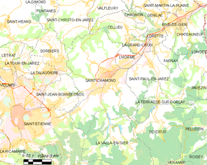
Sorbiers
- commune in Loire, France
- Country:
- Postal Code: 42290
- Coordinates: 45° 29' 16" N, 4° 27' 1" E
- GPS tracks (wikiloc): [Link]
- Area: 12.19 sq km
- Population: 8083
- Web site: [Link]

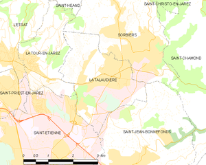
La Talaudière
- commune in Loire, France
- Country:
- Postal Code: 42350
- Coordinates: 45° 28' 53" N, 4° 25' 55" E
- GPS tracks (wikiloc): [Link]
- Area: 7.63 sq km
- Population: 6608
- Web site: [Link]

Saint-Chamond
- commune in Loire, France
- Country:
- Postal Code: 42400
- Coordinates: 45° 28' 35" N, 4° 30' 53" E
- GPS tracks (wikiloc): [Link]
- AboveSeaLevel: 375 м m
- Area: 54.88 sq km
- Population: 34870
- Web site: [Link]


Saint-Étienne
- commune in Loire, France
- Country:
- Postal Code: 42230; 42000; 42100
- Coordinates: 45° 26' 2" N, 4° 23' 23" E
- GPS tracks (wikiloc): [Link]
- AboveSeaLevel: 516 м m
- Area: 79.97 sq km
- Population: 171057
- Web site: [Link]