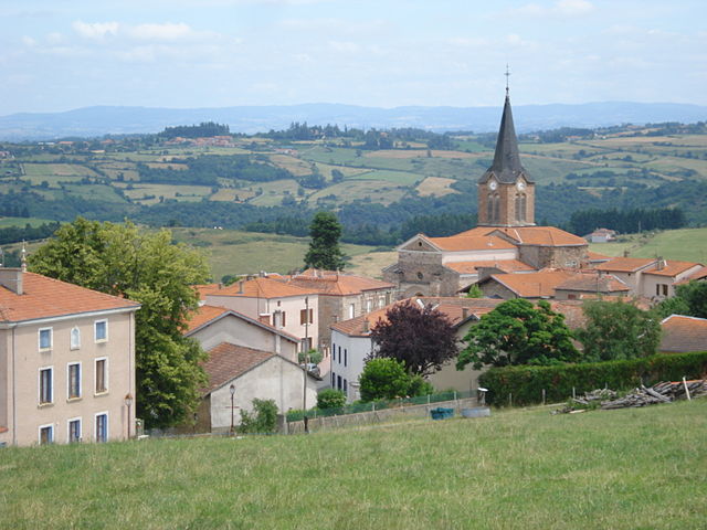
Saint-Jean-Saint-Maurice-sur-Loire (Saint-Jean-Saint-Maurice-sur-Loire)

- commune in Loire, France
- Country:

- Postal Code: 42155
- Coordinates: 45° 57' 57" N, 4° 0' 7" E


- GPS tracks (wikiloc): [Link]
- AboveSeaLevel: 430 м m
- Area: 23.57 sq km
- Population: 1138
- Web site: http://www.saint-jean-saint-maurice.fr/
- Wikipedia en: wiki(en)
- Wikipedia: wiki(fr)
- Wikidata storage: Wikidata: Q1094593
- Wikipedia Commons Category: [Link]
- Freebase ID: [/m/03nw8dc]
- Freebase ID: [/m/03nw8dc]
- GeoNames ID: Alt: [6616776]
- GeoNames ID: Alt: [6616776]
- SIREN number: [214202392]
- SIREN number: [214202392]
- BnF ID: [152598071]
- BnF ID: [152598071]
- PACTOLS thesaurus ID: [pcrtSvEttderVQ]
- PACTOLS thesaurus ID: [pcrtSvEttderVQ]
- INSEE municipality code: 42239
- INSEE municipality code: 42239
Shares border with regions:

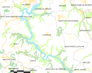
Cordelle
- commune in Loire, France
- Country:
- Postal Code: 42123
- Coordinates: 45° 56' 38" N, 4° 3' 41" E
- GPS tracks (wikiloc): [Link]
- Area: 26.64 sq km
- Population: 902
- Web site: [Link]

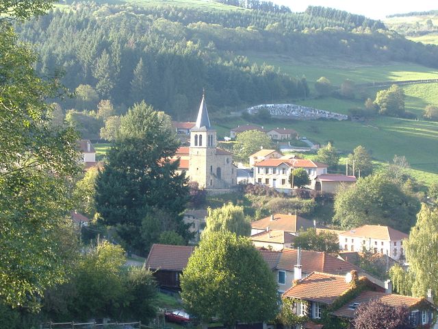
Bully
- commune in Loire, France
- Country:
- Postal Code: 42260
- Coordinates: 45° 55' 39" N, 4° 0' 18" E
- GPS tracks (wikiloc): [Link]
- Area: 19.03 sq km
- Population: 415


Villerest
- commune in Loire, France
- Country:
- Postal Code: 42300
- Coordinates: 45° 59' 36" N, 4° 2' 12" E
- GPS tracks (wikiloc): [Link]
- AboveSeaLevel: 360 м m
- Area: 14.82 sq km
- Population: 4776
Lentigny
- commune in Loire, France
- Country:
- Postal Code: 42155
- Coordinates: 45° 59' 42" N, 3° 58' 51" E
- GPS tracks (wikiloc): [Link]
- Area: 11.3 sq km
- Population: 1695
- Web site: [Link]


Commelle-Vernay
- commune in Loire, France
- Country:
- Postal Code: 42120
- Coordinates: 45° 59' 39" N, 4° 3' 58" E
- GPS tracks (wikiloc): [Link]
- Area: 12.41 sq km
- Population: 2883
- Web site: [Link]

Cherier
- commune in Loire, France
- Country:
- Postal Code: 42430
- Coordinates: 45° 57' 53" N, 3° 54' 34" E
- GPS tracks (wikiloc): [Link]
- Area: 28.11 sq km
- Population: 532

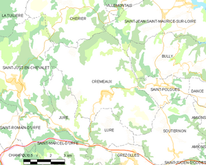
Cremeaux
- commune in Loire, France
- Country:
- Postal Code: 42260
- Coordinates: 45° 54' 28" N, 3° 55' 42" E
- GPS tracks (wikiloc): [Link]
- Area: 33.32 sq km
- Population: 911


Villemontais
- commune in Loire, France
- Country:
- Postal Code: 42155
- Coordinates: 45° 58' 45" N, 3° 57' 2" E
- GPS tracks (wikiloc): [Link]
- Area: 12.73 sq km
- Population: 1018