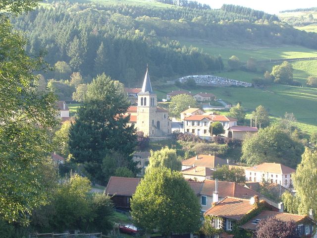
Villemontais (Villemontais)

- commune in Loire, France
- Country:

- Postal Code: 42155
- Coordinates: 45° 58' 45" N, 3° 57' 2" E


- GPS tracks (wikiloc): [Link]
- Area: 12.73 sq km
- Population: 1018
- Wikipedia en: wiki(en)
- Wikipedia: wiki(fr)
- Wikidata storage: Wikidata: Q978890
- Wikipedia Commons Category: [Link]
- Freebase ID: [/m/03nw9k3]
- Freebase ID: [/m/03nw9k3]
- GeoNames ID: Alt: [6434345]
- GeoNames ID: Alt: [6434345]
- SIREN number: [214203317]
- SIREN number: [214203317]
- BnF ID: [15259897t]
- BnF ID: [15259897t]
- INSEE municipality code: 42331
- INSEE municipality code: 42331
Shares border with regions:
Arcon
- commune in Loire, France
- Country:
- Postal Code: 42370
- Coordinates: 46° 0' 37" N, 3° 53' 17" E
- GPS tracks (wikiloc): [Link]
- Area: 19.19 sq km
- Population: 109


Saint-Jean-Saint-Maurice-sur-Loire
- commune in Loire, France
- Country:
- Postal Code: 42155
- Coordinates: 45° 57' 57" N, 4° 0' 7" E
- GPS tracks (wikiloc): [Link]
- AboveSeaLevel: 430 м m
- Area: 23.57 sq km
- Population: 1138
- Web site: [Link]


Saint-Alban-les-Eaux
- commune in Loire, France
- Country:
- Postal Code: 42370
- Coordinates: 46° 0' 32" N, 3° 56' 8" E
- GPS tracks (wikiloc): [Link]
- Area: 7.75 sq km
- Population: 969
- Web site: [Link]
Lentigny
- commune in Loire, France
- Country:
- Postal Code: 42155
- Coordinates: 45° 59' 42" N, 3° 58' 51" E
- GPS tracks (wikiloc): [Link]
- Area: 11.3 sq km
- Population: 1695
- Web site: [Link]

Cherier
- commune in Loire, France
- Country:
- Postal Code: 42430
- Coordinates: 45° 57' 53" N, 3° 54' 34" E
- GPS tracks (wikiloc): [Link]
- Area: 28.11 sq km
- Population: 532