Saint-Léons (Saint-Léons)

- commune in Aveyron, France
- Country:

- Postal Code: 12780
- Coordinates: 44° 12' 56" N, 2° 59' 9" E


- GPS tracks (wikiloc): [Link]
- Area: 32.89 sq km
- Population: 398
- Wikipedia en: wiki(en)
- Wikipedia: wiki(fr)
- Wikidata storage: Wikidata: Q1361946
- Wikipedia Commons Category: [Link]
- Freebase ID: [/m/03m95lj]
- GeoNames ID: Alt: [2978777]
- SIREN number: [211202387]
- BnF ID: [15247214z]
- VIAF ID: Alt: [153945392]
- Library of Congress authority ID: Alt: [no2002090143]
- MusicBrainz area ID: [9fe2ff2e-caa4-4e00-a9f4-aef1270a2c67]
- INSEE municipality code: 12238
Shares border with regions:

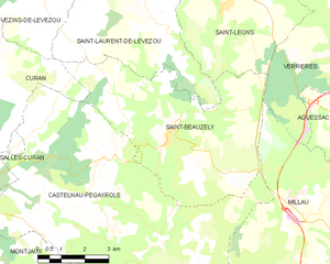
Saint-Beauzély
- commune in Aveyron, France
- Country:
- Postal Code: 12620
- Coordinates: 44° 9' 55" N, 2° 57' 29" E
- GPS tracks (wikiloc): [Link]
- Area: 30.69 sq km
- Population: 573
- Web site: [Link]


Vézins-de-Lévézou
- commune in Aveyron, France
- Country:
- Postal Code: 12780
- Coordinates: 44° 16' 45" N, 2° 57' 10" E
- GPS tracks (wikiloc): [Link]
- Area: 78.96 sq km
- Population: 654
- Web site: [Link]
Saint-Laurent-de-Lévézou
- commune in Aveyron, France
- Country:
- Postal Code: 12620
- Coordinates: 44° 12' 28" N, 2° 57' 31" E
- GPS tracks (wikiloc): [Link]
- Area: 23.33 sq km
- Population: 158


Verrières
- commune in Aveyron, France
- Country:
- Postal Code: 12520
- Coordinates: 44° 12' 5" N, 3° 3' 29" E
- GPS tracks (wikiloc): [Link]
- AboveSeaLevel: 480 м m
- Area: 53.01 sq km
- Population: 450
- Web site: [Link]