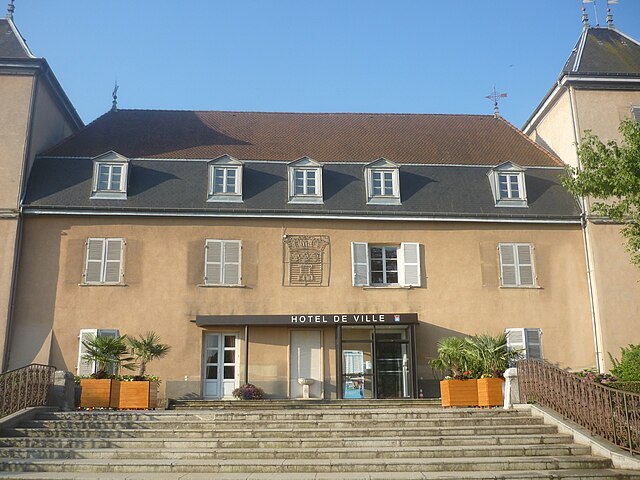
Saint-Laurent-de-Mure (Saint-Laurent-de-Mure)
- commune in Rhône, France
 Hiking in Saint-Laurent-de-Mure
Saint-Laurent-de-Mure is a charming commune located in the Auvergne-Rhône-Alpes region of France, near Lyon. While it may not be as famous as some of the larger national parks, it offers some scenic opportunities for hiking and enjoying the natural landscape.
Here are a few things to consider when planning a hiking trip in and around Saint-Laurent-de-Mure:
Scenic Areas
-
Nearby Parks: Although Saint-Laurent-de-Mure itself is relatively small, it is close to natural areas where you can enjoy longer hikes. The Parc de la Tête d'Or in Lyon is a popular destination for walking and picnicking and features extensive trails.
-
Rhône River Trail: The trails along the Rhône River provide opportunities for hiking and biking, allowing you to enjoy beautiful river views and local flora and fauna.
Local Trails
-
Marked Paths: If you're looking for a local experience, seek out marked paths and small trails in the surrounding countryside. These can often lead you through serene landscapes, vineyards, and farms.
-
Walking and Hiking Routes: There are hiking routes that can take you from Saint-Laurent-de-Mure into the adjacent countryside. Keep an eye out for small rural roads that are suitable for walking.
Practical Tips
- Weather Considerations: Always check the weather before your hike, especially in the spring and autumn when conditions can change rapidly.
- Hydration and Snacks: Carry plenty of water and snacks to keep your energy up, especially if you're planning on longer hikes.
- Navigation: Use a reliable map or a hiking app to help you navigate the trails, as signage may not always be clear.
- Respect Nature: Stay on marked paths and respect private property to protect the natural environment.
How to Get There
Saint-Laurent-de-Mure is easily accessible by public transport from Lyon. Trains and buses can take you to and from the larger city, making it a convenient day trip for those looking to escape the city for a hike.
Whether you're looking for a leisurely stroll or a more adventurous hike, you can enjoy the beauty of the natural surroundings while immersing yourself in the serene atmosphere of this lesser-known destination.
- Country:

- Postal Code: 69720
- Coordinates: 45° 41' 8" N, 5° 2' 41" E


- GPS tracks (wikiloc): [Link]
- Area: 18.63 sq km
- Population: 5391
- Web site: http://www.ville-saint-laurent-de-mure.fr
- Wikipedia en: wiki(en)
- Wikipedia: wiki(fr)
- Wikidata storage: Wikidata: Q1617124
- Wikipedia Commons Category: [Link]
- Freebase ID: [/m/03qgfsc]
- Freebase ID: [/m/03qgfsc]
- GeoNames ID: Alt: [6441833]
- GeoNames ID: Alt: [6441833]
- SIREN number: [216902882]
- SIREN number: [216902882]
- BnF ID: [15272374h]
- BnF ID: [15272374h]
- INSEE municipality code: 69288
- INSEE municipality code: 69288
Shares border with regions:


Satolas-et-Bonce
- commune in Isère, France
Satolas-et-Bonce is a charming commune located in the Auvergne-Rhône-Alpes region of France, not far from the city of Lyon. While it may not be as widely recognized as a major hiking destination, there are various opportunities in and around the area for outdoor enthusiasts. Here are some tips and insights for hiking in and around Satolas-et-Bonce:...
- Country:

- Postal Code: 38290
- Coordinates: 45° 41' 36" N, 5° 7' 50" E


- GPS tracks (wikiloc): [Link]
- Area: 16.8 sq km
- Population: 2360
- Web site: [Link]


Grenay
- commune in Isère, France
Grenay, located in the Isère department of the Auvergne-Rhône-Alpes region in France, offers beautiful landscapes and a variety of hiking options. While Grenay itself is a smaller town, it is well-positioned for access to the surrounding natural beauty of the region....
- Country:

- Postal Code: 38540
- Coordinates: 45° 39' 52" N, 5° 4' 46" E


- GPS tracks (wikiloc): [Link]
- Area: 7.2 sq km
- Population: 1586
- Web site: [Link]


Saint-Bonnet-de-Mure
- commune in Rhône, France
 Hiking in Saint-Bonnet-de-Mure
Saint-Bonnet-de-Mure is a charming commune located near Lyon, in the Auvergne-Rhône-Alpes region of France. While it may not be as famous as some larger hiking destinations, it offers some pleasant trails and outdoor opportunities for hikers. Here are a few points of interest regarding hiking in and around Saint-Bonnet-de-Mure:...
- Country:

- Postal Code: 69720
- Coordinates: 45° 41' 26" N, 5° 1' 45" E


- GPS tracks (wikiloc): [Link]
- Area: 16.34 sq km
- Population: 6851
- Web site: [Link]


Colombier-Saugnieu
- commune in Rhône, France
Colombier-Saugnieu, located in the Auvergne-Rhône-Alps region of France, offers a variety of hiking opportunities that showcase the natural beauty of the surrounding landscape. Here are some key points about hiking in this area:...
- Country:

- Postal Code: 69124
- Coordinates: 45° 42' 41" N, 5° 6' 44" E


- GPS tracks (wikiloc): [Link]
- Area: 27.62 sq km
- Population: 2554


Saint-Pierre-de-Chandieu
- commune in Rhône, France
 Hiking in Saint-Pierre-de-Chandieu
Saint-Pierre-de-Chandieu is a small commune located in the Rhône department of the Auvergne-Rhône-Alpes region in France, not far from the city of Lyon. While it may not be as widely recognized as a hiking destination compared to larger national parks or mountainous areas, it offers some charming trails and outdoor activities....
- Country:

- Postal Code: 69780
- Coordinates: 45° 38' 47" N, 5° 0' 53" E


- GPS tracks (wikiloc): [Link]
- Area: 29.28 sq km
- Population: 4546
- Web site: [Link]
