Saint-Laurent-du-Pont (Saint-Laurent-du-Pont)
- commune in Isère, France
 Hiking in Saint-Laurent-du-Pont
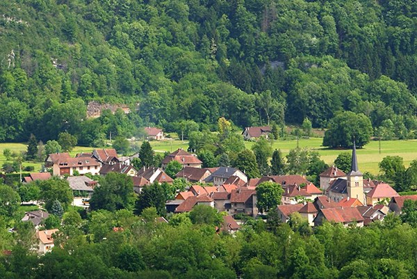
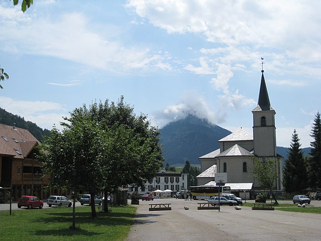
Saint-Laurent-du-Pont is a charming commune located in the Isère department of the Auvergne-Rhône-Alpes region in France. It is surrounded by stunning natural landscapes, including the Chartreuse Mountains, making it an excellent destination for hiking enthusiasts.
Hiking Opportunities
-
Chartreuse Regional Natural Park: The area is part of the larger Chartreuse National Park, which offers a vast network of hiking trails. The park features diverse landscapes, from rocky cliffs to deep forests, and showcases unique flora and fauna.
-
Popular Trails:
- Col de la Charmette: A moderately difficult hike that leads through picturesque alpine meadows and offers panoramic views of the surrounding mountains.
- Le Sentier des Cimes: This is a scenic trail that runs along the ridge, offering breathtaking views of the valley and the peaks of the Chartreuse massif.
- Lac de la Bourne: A beautiful hike that can lead you to the tranquil lakes nestled in the mountains, perfect for a picnic break against a stunning backdrop.
-
Difficulty Levels: Whether you are a beginner or an experienced hiker, there are trails suited to all skill levels. Make sure to check trail descriptions and difficulty ratings before setting off.
-
Guided Hikes: If you're unfamiliar with the area or would like to enhance your experience, consider joining a guided hike. Local guides can provide insights into the local geology, flora, and fauna, enhancing your appreciation of the natural beauty.
Practical Tips
-
Best Time to Hike: Spring and early autumn offer the best conditions for hiking, with mild temperatures and beautiful scenery. Summer can be hot, while winter may bring snow, making certain trails less accessible.
-
Preparation: Always wear appropriate footwear, carry enough water, snacks, and a map or GPS device. It's also advisable to inform someone about your hiking plans.
-
Safety: Watch for weather changes, especially in mountainous regions, as conditions can change rapidly. Make sure to follow marked trails and leave no trace.
Local Amenities
In Saint-Laurent-du-Pont, you'll find local shops and restaurants where you can enjoy regional cuisine after your hike. The town's atmosphere, combined with its proximity to natural attractions, makes it a lovely spot to relax and unwind.
Enjoy your hiking adventure in Saint-Laurent-du-Pont!
- Country:

- Postal Code: 38380
- Coordinates: 45° 23' 15" N, 5° 44' 5" E


- GPS tracks (wikiloc): [Link]
- Area: 35.25 sq km
- Population: 4543
- Web site: http://www.mairie-st-laurent-du-pont.fr
- Wikipedia en: wiki(en)
- Wikipedia: wiki(fr)
- Wikidata storage: Wikidata: Q301496
- Wikipedia Commons Category: [Link]
- Freebase ID: [/m/03g_5wr]
- GeoNames ID: Alt: [2978893]
- SIREN number: [213804123]
- BnF ID: [15258221p]
- VIAF ID: Alt: [235199756]
- PACTOLS thesaurus ID: [pcrtwRhyRGwTsL]
- INSEE municipality code: 38412
Shares border with regions:


Saint-Christophe-sur-Guiers
- commune in Isère, France
 Hiking in Saint-Christophe-sur-Guiers
Saint-Christophe-sur-Guiers is a charming village located in the Isère department of the Auvergne-Rhône-Alpes region in southeastern France. The area is surrounded by stunning natural landscapes, making it a great destination for hiking enthusiasts....
- Country:

- Postal Code: 38380
- Coordinates: 45° 26' 19" N, 5° 46' 26" E


- GPS tracks (wikiloc): [Link]
- Area: 23.54 sq km
- Population: 858
- Web site: [Link]


Entre-deux-Guiers
- commune in Isère, France
Entre-deux-Guiers, located in the Isère department of the Auvergne-Rhône-Alpes region in France, is a fantastic hiking destination. The area is known for its beautiful landscapes, characterized by beautiful mountains, lush valleys, and varied terrain. Here are some highlights for hiking in this region:...
- Country:

- Postal Code: 38380
- Coordinates: 45° 25' 56" N, 5° 45' 0" E


- GPS tracks (wikiloc): [Link]
- Area: 10.55 sq km
- Population: 1699
- Web site: [Link]


Miribel-les-Échelles
- commune in Isère, France
 Hiking in Miribel-les-Échelles
Miribel-les-Échelles is a charming village located in the Isère department of the Auvergne-Rhône-Alpes region in southeastern France. It is nestled in the foothills of the Chartreuse Mountains, providing a stunning backdrop for various outdoor activities, including hiking....
- Country:

- Postal Code: 38380
- Coordinates: 45° 25' 45" N, 5° 42' 30" E


- GPS tracks (wikiloc): [Link]
- Area: 29.34 sq km
- Population: 1720


Saint-Pierre-de-Chartreuse
- commune in Isère, France
 Hiking in Saint-Pierre-de-Chartreuse
Saint-Pierre-de-Chartreuse is a picturesque village located in the Chartreuse Mountains, in the Auvergne-Rhône-Alpes region of France. It's a popular destination for outdoor enthusiasts, particularly hikers, due to its stunning landscapes, diverse trails, and rich natural heritage. Here are some highlights and tips for hiking in this beautiful area:...
- Country:

- Postal Code: 38380
- Coordinates: 45° 20' 33" N, 5° 48' 56" E


- GPS tracks (wikiloc): [Link]
- Area: 80.12 sq km
- Population: 1028
- Web site: [Link]


Saint-Joseph-de-Rivière
- commune in Isère, France
 Hiking in Saint-Joseph-de-Rivière
Saint-Joseph-de-Rivière is a charming village located in the Isère department in the Auvergne-Rhône-Alpes region of France. This area is surrounded by beautiful natural landscapes, making it an appealing destination for hiking enthusiasts....
- Country:

- Postal Code: 38134
- Coordinates: 45° 22' 33" N, 5° 41' 49" E


- GPS tracks (wikiloc): [Link]
- Area: 17.39 sq km
- Population: 1218
- Web site: [Link]
