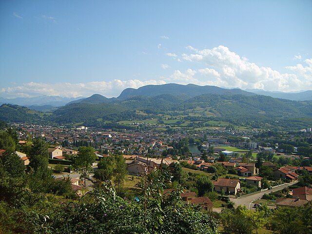
Saint-Lizier (Saint-Lizier)
- commune in Ariège, France
- Country:

- Postal Code: 09190
- Coordinates: 43° 0' 6" N, 1° 8' 13" E


- GPS tracks (wikiloc): [Link]
- Area: 9.01 sq km
- Population: 1417
- Web site: http://mairie.saint-lizier.over-blog.fr
- Wikipedia en: wiki(en)
- Wikipedia: wiki(fr)
- Wikidata storage: Wikidata: Q322771
- Wikipedia Commons Category: [Link]
- Freebase ID: [/m/08t023]
- GeoNames ID: Alt: [2978760]
- SIREN number: [210902680]
- BnF ID: [11949078s]
- VIAF ID: Alt: [243862698]
- GND ID: Alt: [4581778-9]
- PACTOLS thesaurus ID: [pcrtRYSJ5IDdw8]
- Digital Atlas of the Roman Empire ID: [394]
- INSEE municipality code: 09268
Shares border with regions:

Montgauch
- commune in Ariège, France
- Country:

- Postal Code: 09160
- Coordinates: 43° 0' 1" N, 1° 4' 31" E


- GPS tracks (wikiloc): [Link]
- Area: 9.15 sq km
- Population: 122


Montégut-en-Couserans
- commune in Ariège, France
- Country:

- Postal Code: 09200
- Coordinates: 42° 58' 52" N, 1° 5' 40" E


- GPS tracks (wikiloc): [Link]
- Area: 6.18 sq km
- Population: 68

Caumont
- commune in Ariège, France
- Country:

- Postal Code: 09160
- Coordinates: 43° 1' 50" N, 1° 5' 8" E


- GPS tracks (wikiloc): [Link]
- Area: 9.22 sq km
- Population: 318


Gajan
- commune in Ariège, France
- Country:

- Postal Code: 09190
- Coordinates: 43° 1' 57" N, 1° 7' 36" E


- GPS tracks (wikiloc): [Link]
- Area: 8.17 sq km
- Population: 314

Saint-Girons
- commune in Ariège, France
- Country:

- Postal Code: 09200
- Coordinates: 42° 59' 5" N, 1° 8' 45" E


- GPS tracks (wikiloc): [Link]
- AboveSeaLevel: 390 м m
- Area: 19.13 sq km
- Population: 6324
- Web site: [Link]

Montjoie-en-Couserans
- commune in Ariège, France
- Country:

- Postal Code: 09200
- Coordinates: 43° 0' 6" N, 1° 9' 34" E


- GPS tracks (wikiloc): [Link]
- Area: 29.63 sq km
- Population: 1082

Moulis
- commune in Ariège, France
- Country:

- Postal Code: 09200
- Coordinates: 42° 57' 40" N, 1° 5' 27" E


- GPS tracks (wikiloc): [Link]
- Area: 36.55 sq km
- Population: 774

Lorp-Sentaraille
- commune in Ariège, France
- Country:

- Postal Code: 09190
- Coordinates: 43° 0' 32" N, 1° 7' 10" E


- GPS tracks (wikiloc): [Link]
- Area: 6.15 sq km
- Population: 1418