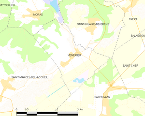
Saint-Marcel-Bel-Accueil (Saint-Marcel-Bel-Accueil)

- commune in Isère, France
 Hiking in Saint-Marcel-Bel-Accueil
Saint-Marcel-Bel-Accueil is a charming commune located in the Auvergne-Rhône-Alpes region of France. While it may not be as well-known as some major hiking destinations, it provides opportunities for outdoor enthusiasts to explore beautiful natural landscapes.
Hiking Opportunities:
-
Surrounding Natural Areas: The region around Saint-Marcel-Bel-Accueil boasts a variety of terrain, including gentle hills, forests, and fields, making it suitable for hikes of varying difficulty.
-
Trails: There are several local trails and paths that you can explore. Look for marked paths that may connect to larger networks in the Rhône-Alpes region. It's always a good idea to grab a local map or consult with local hiking clubs for trail recommendations and conditions.
-
Nearby Parks and Nature Reserves: The nearby Parc Naturel Régional du Pilat and other natural reserves offer more extensive hiking options and are home to diverse flora and fauna.
-
Scenic Views: Many trails in the region provide scenic overlooks and views of the surrounding countryside and the Rhône valley, making for rewarding hikes.
Preparation Tips:
-
Weather: Be sure to check the weather forecast before heading out, as conditions can change rapidly in the mountains.
-
Equipment: Wear appropriate hiking boots, and bring plenty of water, snacks, and a map or GPS device to help with navigation.
-
Safety: Always let someone know your hiking plans and estimated return time, especially if you're exploring less frequented trails.
Local Amenities:
- After a day of hiking, you can enjoy the local cuisine in nearby towns and restaurants, which often feature regional specialties.
Conclusion:
Overall, hiking in and around Saint-Marcel-Bel-Accueil offers a peaceful outdoor experience with lovely landscapes. Whether you're a casual hiker or looking for a bit of adventure, the area around the commune could provide a satisfying outing. Just be sure to research specific trails before you go for the best experience!
- Country:

- Postal Code: 38080
- Coordinates: 45° 38' 51" N, 5° 14' 9" E


- GPS tracks (wikiloc): [Link]
- Area: 18.23 sq km
- Population: 1357
- Web site: http://saintmarcelbelaccueil.fr
- Wikipedia en: wiki(en)
- Wikipedia: wiki(fr)
- Wikidata storage: Wikidata: Q527583
- Wikipedia Commons Category: [Link]
- Freebase ID: [/m/03nvh0q]
- GeoNames ID: Alt: [6433363]
- SIREN number: [213804156]
- BnF ID: [15258224q]
- INSEE municipality code: 38415
Shares border with regions:


Veyssilieu
- commune in Isère, France
Hiking in Veyssilieu
Veyssilieu is a charming commune located in the Isère department of the Auvergne-Rhône-Alpes region in France. Nestled within the stunning landscape of the French Alps, it offers various hiking opportunities for outdoor enthusiasts....
- Country:
- Postal Code: 38460
- Coordinates: 45° 40' 48" N, 5° 13' 13" E
- GPS tracks (wikiloc): [Link]
- Area: 6.49 sq km
- Population: 322
- Web site: [Link]

Vénérieu
- commune in Isère, France
Hiking in Vénérieu
Vénérieu is a small commune located in the Isère department of the Auvergne-Rhône-Alpes region in southeastern France. While it may not be as famous as other hiking destinations, it can offer some charming walking and hiking opportunities, especially for those looking to explore the lesser-known paths of the French countryside....
- Country:
- Postal Code: 38460
- Coordinates: 45° 39' 33" N, 5° 16' 39" E
- GPS tracks (wikiloc): [Link]
- Area: 6 sq km
- Population: 753
- Web site: [Link]


Moras
- commune in Isère, France
Hiking in Moras
Moras, a scenic area, offers a variety of hiking opportunities for outdoor enthusiasts. Whether you’re a beginner or an experienced hiker, you’ll find trails that suit your skill level and preferences. Here are some general things to consider about hiking in Moras:...
- Country:
- Postal Code: 38460
- Coordinates: 45° 41' 14" N, 5° 15' 30" E
- GPS tracks (wikiloc): [Link]
- AboveSeaLevel: 345 м m
- Area: 8.32 sq km
- Population: 503
- Web site: [Link]


L'Isle-d'Abeau
- commune in Isère, France
Hiking in L'Isle-d'Abeau
L'Isle-d'Abeau, located in the Auvergne-Rhône-Alpes region of France, is surrounded by a variety of landscapes that offer several hiking opportunities. While the town itself is primarily urban and industrial, its location makes it a convenient starting point for exploring nearby natural areas....
- Country:
- Postal Code: 38080
- Coordinates: 45° 37' 10" N, 5° 13' 59" E
- GPS tracks (wikiloc): [Link]
- Area: 9.11 sq km
- Population: 16282


Saint-Savin
- commune in Isère, France
Hiking in Saint-Savin
Saint-Savin, located in the Isère department of the Auvergne-Rhône-Alpes region of France, is a charming village known for its natural beauty and access to various hiking trails. The area features stunning landscapes, rolling hills, and proximity to the Chartreuse and Vercors mountain ranges, making it a great destination for outdoor enthusiasts....
- Country:
- Postal Code: 38300
- Coordinates: 45° 37' 43" N, 5° 18' 22" E
- GPS tracks (wikiloc): [Link]
- Area: 24.55 sq km
- Population: 3967
- Web site: [Link]
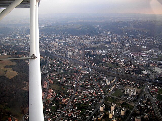

Bourgoin-Jallieu
- commune in Isère, France
Hiking in Bourgoin-Jallieu
Bourgoin-Jallieu, located in the Auvergne-Rhône-Alpes region of eastern France, offers a variety of hiking opportunities for outdoor enthusiasts. The town is nestled between the Isère River and the Chartreuse Mountains, providing both flat terrain and more challenging trails....
- Country:
- Postal Code: 38300
- Coordinates: 45° 35' 27" N, 5° 16' 45" E
- GPS tracks (wikiloc): [Link]
- AboveSeaLevel: 254 м m
- Area: 24.37 sq km
- Population: 27502
- Web site: [Link]


Frontonas
- commune in Isère, France
Hiking in Frontonas
Frontonas, located in the Auvergne-Rhône-Alpes region of France, is a charming town that offers a unique hiking experience. The surrounding natural landscape features rolling hills, forests, and picturesque views, making it an ideal destination for outdoor enthusiasts looking to explore trails off the beaten path....
- Country:
- Postal Code: 38290
- Coordinates: 45° 38' 56" N, 5° 11' 3" E
- GPS tracks (wikiloc): [Link]
- Area: 12.65 sq km
- Population: 2030
- Web site: [Link]