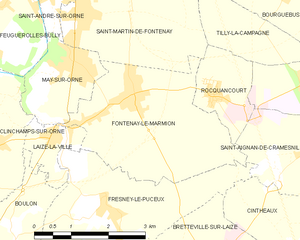
Saint-Martin-de-Fontenay (Saint-Martin-de-Fontenay)

- commune in Calvados, France
- Country:

- Postal Code: 14320
- Coordinates: 49° 7' 9" N, 0° 22' 16" E


- GPS tracks (wikiloc): [Link]
- Area: 10.72 sq km
- Population: 2594
- Web site: http://www.saint-martin-de-fontenay.fr
- Wikipedia en: wiki(en)
- Wikipedia: wiki(fr)
- Wikidata storage: Wikidata: Q679283
- Wikipedia Commons Category: [Link]
- Freebase ID: [/m/03xzc2]
- GeoNames ID: Alt: [6427467]
- SIREN number: [211406236]
- BnF ID: [152480317]
- VIAF ID: Alt: [150222738]
- Library of Congress authority ID: Alt: [n89633698]
- PACTOLS thesaurus ID: [pcrt15rclUqYya]
- Twitter username: Alt: [MairieSMDF]
- INSEE municipality code: 14623
Shares border with regions:


May-sur-Orne
- commune in Calvados, France
- Country:
- Postal Code: 14320
- Coordinates: 49° 6' 1" N, 0° 22' 26" E
- GPS tracks (wikiloc): [Link]
- Area: 3.49 sq km
- Population: 1903
- Web site: [Link]


Fleury-sur-Orne
- commune in Calvados, France
- Country:
- Postal Code: 14123
- Coordinates: 49° 8' 46" N, 0° 22' 35" E
- GPS tracks (wikiloc): [Link]
- Area: 6.75 sq km
- Population: 4744
- Web site: [Link]


Saint-André-sur-Orne
- commune in Calvados, France
- Country:
- Postal Code: 14320
- Coordinates: 49° 7' 6" N, 0° 22' 59" E
- GPS tracks (wikiloc): [Link]
- Area: 3.68 sq km
- Population: 1802
- Web site: [Link]


Tilly-la-Campagne
- commune in Calvados, France
- Country:
- Postal Code: 14540
- Coordinates: 49° 6' 40" N, 0° 18' 21" E
- GPS tracks (wikiloc): [Link]
- Area: 3.55 sq km
- Population: 164

Fontenay-le-Marmion
- commune in Calvados, France
- Country:
- Postal Code: 14320
- Coordinates: 49° 5' 36" N, 0° 21' 11" E
- GPS tracks (wikiloc): [Link]
- Area: 10.16 sq km
- Population: 1887


Hubert-Folie
- commune in Calvados, France
- Country:
- Postal Code: 14540
- Coordinates: 49° 7' 44" N, 0° 18' 53" E
- GPS tracks (wikiloc): [Link]
- Area: 1.93 sq km
- Population: 361

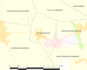
Rocquancourt
- commune in Calvados, France
- Country:
- Postal Code: 14540
- Coordinates: 49° 5' 40" N, 0° 19' 20" E
- GPS tracks (wikiloc): [Link]
- Area: 2.75 sq km
- Population: 869


Ifs
- commune in Calvados, France
- Country:
- Postal Code: 14123
- Coordinates: 49° 8' 18" N, 0° 21' 11" E
- GPS tracks (wikiloc): [Link]
- Area: 9.06 sq km
- Population: 11562
- Web site: [Link]