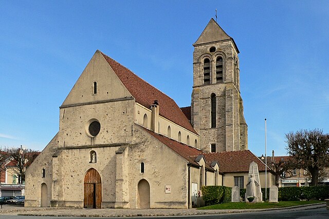
Saint-Maur-des-Fossés (Saint-Maur-des-Fossés)
- commune in Val-de-Marne, France
- Country:

- Postal Code: 94100; 94210
- Coordinates: 48° 48' 9" N, 2° 29' 8" E


- GPS tracks (wikiloc): [Link]
- Area: 11.25 sq km
- Population: 75168
- Web site: http://www.saint-maur.com
- Wikipedia en: wiki(en)
- Wikipedia: wiki(fr)
- Wikidata storage: Wikidata: Q193313
- Wikipedia Commons Category: [Link]
- Wikipedia Commons Maps Category: [Link]
- Freebase ID: [/m/02dt3l]
- Freebase ID: [/m/02dt3l]
- Freebase ID: [/m/02dt3l]
- Freebase ID: [/m/02dt3l]
- GeoNames ID: Alt: [6452032]
- GeoNames ID: Alt: [6452032]
- GeoNames ID: Alt: [6452032]
- GeoNames ID: Alt: [6452032]
- SIREN number: [219400686]
- SIREN number: [219400686]
- SIREN number: [219400686]
- SIREN number: [219400686]
- BnF ID: [15280355z]
- BnF ID: [15280355z]
- BnF ID: [15280355z]
- BnF ID: [15280355z]
- VIAF ID: Alt: [152492011]
- VIAF ID: Alt: [152492011]
- VIAF ID: Alt: [152492011]
- VIAF ID: Alt: [152492011]
- archINFORM location ID: [8253]
- archINFORM location ID: [8253]
- archINFORM location ID: [8253]
- archINFORM location ID: [8253]
- Library of Congress authority ID: Alt: [n84057866]
- Library of Congress authority ID: Alt: [n84057866]
- Library of Congress authority ID: Alt: [n84057866]
- Library of Congress authority ID: Alt: [n84057866]
- PACTOLS thesaurus ID: [pcrtt8yuXFLPy7]
- PACTOLS thesaurus ID: [pcrtt8yuXFLPy7]
- PACTOLS thesaurus ID: [pcrtt8yuXFLPy7]
- PACTOLS thesaurus ID: [pcrtt8yuXFLPy7]
- MusicBrainz area ID: [64b986a7-eac0-44c6-b93c-e97a736e3b40]
- MusicBrainz area ID: [64b986a7-eac0-44c6-b93c-e97a736e3b40]
- MusicBrainz area ID: [64b986a7-eac0-44c6-b93c-e97a736e3b40]
- MusicBrainz area ID: [64b986a7-eac0-44c6-b93c-e97a736e3b40]
- Quora topic ID: [Saint-Maur-des-Fossés]
- Quora topic ID: [Saint-Maur-des-Fossés]
- Quora topic ID: [Saint-Maur-des-Fossés]
- Quora topic ID: [Saint-Maur-des-Fossés]
- SUDOC authorities ID: [029940435]
- SUDOC authorities ID: [029940435]
- SUDOC authorities ID: [029940435]
- SUDOC authorities ID: [029940435]
- Encyclopædia Britannica Online ID: [place/Saint-Maur-des-Fosses]
- Encyclopædia Britannica Online ID: [place/Saint-Maur-des-Fosses]
- Encyclopædia Britannica Online ID: [place/Saint-Maur-des-Fosses]
- Encyclopædia Britannica Online ID: [place/Saint-Maur-des-Fosses]
- ISNI: Alt: [0000 0001 2293 8444]
- ISNI: Alt: [0000 0001 2293 8444]
- ISNI: Alt: [0000 0001 2293 8444]
- ISNI: Alt: [0000 0001 2293 8444]
- data.gouv.fr org ID: [saint-maur-des-fosses]
- data.gouv.fr org ID: [saint-maur-des-fosses]
- data.gouv.fr org ID: [saint-maur-des-fosses]
- data.gouv.fr org ID: [saint-maur-des-fosses]
- INSEE municipality code: 94068
- INSEE municipality code: 94068
- INSEE municipality code: 94068
- INSEE municipality code: 94068
Shares border with regions:


Chennevières-sur-Marne
- commune in Val-de-Marne, France
- Country:

- Postal Code: 94430
- Coordinates: 48° 47' 54" N, 2° 32' 2" E


- GPS tracks (wikiloc): [Link]
- AboveSeaLevel: 105 м m
- Area: 5.27 sq km
- Population: 18226
- Web site: [Link]


Champigny-sur-Marne
- commune in Val-de-Marne, France
- Country:

- Postal Code: 94500
- Coordinates: 48° 49' 2" N, 2° 30' 56" E


- GPS tracks (wikiloc): [Link]
- Area: 11.3 sq km
- Population: 76508
- Web site: [Link]


Maisons-Alfort
- commune in Val-de-Marne, France
- Country:

- Postal Code: 94700
- Coordinates: 48° 48' 21" N, 2° 26' 16" E


- GPS tracks (wikiloc): [Link]
- Area: 5.35 sq km
- Population: 54915
- Web site: [Link]


Sucy-en-Brie
- commune in Val-de-Marne, France
- Country:

- Postal Code: 94370
- Coordinates: 48° 46' 11" N, 2° 31' 22" E


- GPS tracks (wikiloc): [Link]
- AboveSeaLevel: 99 м m
- Area: 10.43 sq km
- Population: 26264
- Web site: [Link]


Créteil
- commune in Val-de-Marne, France
- Country:

- Postal Code: 94000
- Coordinates: 48° 46' 40" N, 2° 27' 11" E


- GPS tracks (wikiloc): [Link]
- AboveSeaLevel: 75 м m
- Area: 11.46 sq km
- Population: 90739
- Web site: [Link]


Joinville-le-Pont
- commune in Val-de-Marne, France
- Country:

- Postal Code: 94340
- Coordinates: 48° 49' 17" N, 2° 28' 22" E


- GPS tracks (wikiloc): [Link]
- Area: 2.3 sq km
- Population: 18859
- Web site: [Link]


Bonneuil-sur-Marne
- commune in Val-de-Marne, France
- Country:

- Postal Code: 94380
- Coordinates: 48° 46' 27" N, 2° 29' 15" E


- GPS tracks (wikiloc): [Link]
- Area: 5.51 sq km
- Population: 16903
- Web site: [Link]
