
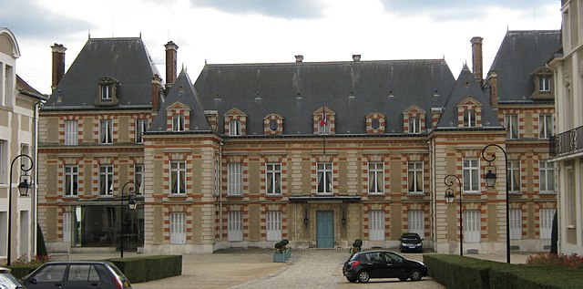
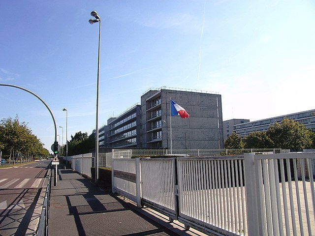
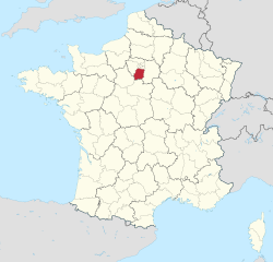
Val-de-Marne (Val-de-Marne)

- French department
- Country:

- Capital: Créteil
- Coordinates: 48° 45' 0" N, 2° 25' 0" E


- GPS tracks (wikiloc): [Link]
- Area: 245 sq km
- Population: 1372389
- Web site: http://www.val-de-marne.pref.gouv.fr/
- Wikipedia en: wiki(en)
- Wikipedia: wiki(fr)
- Wikidata storage: Wikidata: Q12788
- Wikipedia Commons Gallery: [Link]
- Wikipedia Commons Category: [Link]
- Wikipedia Commons Maps Category: [Link]
- Freebase ID: [/m/0mhq6]
- GeoNames ID: Alt: [2971090]
- SIREN number: [229400288]
- BnF ID: [11865836b]
- VIAF ID: Alt: [155485894]
- OSM relation ID: [7458]
- GND ID: Alt: [4119348-9]
- archINFORM location ID: [2045]
- Library of Congress authority ID: Alt: [n83200305]
- PACTOLS thesaurus ID: [pcrtf5LrDKAkoj]
- MusicBrainz area ID: [d34be230-71fc-421d-94e8-f10d2caa412b]
- SUDOC authorities ID: [026404893]
- Encyclopædia Britannica Online ID: [place/Val-de-Marne]
- Gran Enciclopèdia Catalana ID: [0068864]
- Twitter username: Alt: [val_de_marne]
- NUTS code: [FR107]
- INSEE department code: [94]
- ISO 3166-2 code: FR-94
Includes regions:

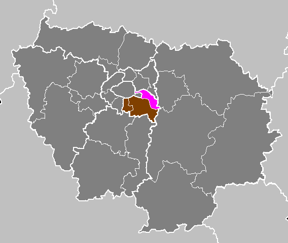
arrondissement of Nogent-sur-Marne
- arrondissement of France
- Country:
- Capital: Nogent-sur-Marne
- Coordinates: 48° 50' 11" N, 2° 28' 44" E
- GPS tracks (wikiloc): [Link]
- Area: 63 sq km
- Population: 396606


arrondissement of Créteil
- arrondissement of France
- Country:
- Capital: Créteil
- Coordinates: 48° 47' 30" N, 2° 26' 47" E
- GPS tracks (wikiloc): [Link]
- Population: 712934


arrondissement of L'Haÿ-les-Roses
- arrondissement of France
- Country:
- Capital: L'Haÿ-les-Roses
- Coordinates: 48° 46' 43" N, 2° 20' 18" E
- GPS tracks (wikiloc): [Link]
- Area: 35 sq km
Shares border with regions:


Hauts-de-Seine
- French department
- Country:
- Capital: Nanterre
- Coordinates: 48° 50' 0" N, 2° 12' 0" E
- GPS tracks (wikiloc): [Link]
- Area: 176 sq km
- Population: 1601569
- Web site: [Link]

Seine-et-Marne
- French department
- Country:
- Capital: Melun
- Coordinates: 48° 36' 0" N, 3° 0' 0" E
- GPS tracks (wikiloc): [Link]
- Area: 5915 sq km
- Population: 1390121
- Web site: [Link]


Seine-Saint-Denis
- département of France in the Greater Paris area
- Country:
- Capital: Bobigny
- Coordinates: 48° 54' 0" N, 2° 29' 0" E
- GPS tracks (wikiloc): [Link]
- Area: 236 sq km
- Population: 1592663
- Web site: [Link]
Essonne
- French department
- Country:
- Capital: Évry
- Coordinates: 48° 30' 0" N, 2° 17' 0" E
- GPS tracks (wikiloc): [Link]
- Area: 1804 sq km
- Population: 1276233
- Web site: [Link]

Paris
- capital and largest city of France
- Country:
- Postal Code: 75020; 75019; 75018; 75017; 75016; 75015; 75014; 75013; 75012; 75011; 75010; 75009; 75008; 75007; 75006; 75005; 75004; 75003; 75002; 75001; 75116
- Local Dialing Code: 1
- Licence Plate Code: 75
- Coordinates: 48° 51' 24" N, 2° 21' 7" E
- GPS tracks (wikiloc): [Link]
- AboveSeaLevel: 28 м m
- Area: 105.4 sq km
- Population: 2206488
- Web site: [Link]