Saint-Michel-de-Montjoie (Saint-Michel-de-Montjoie)

- commune in Manche, France
- Country:

- Postal Code: 50670
- Coordinates: 48° 45' 48" N, 1° 1' 39" E


- GPS tracks (wikiloc): [Link]
- Area: 14.46 sq km
- Population: 320
- Wikipedia en: wiki(en)
- Wikipedia: wiki(fr)
- Wikidata storage: Wikidata: Q280161
- Wikipedia Commons Category: [Link]
- Freebase ID: [/m/03x_z7x]
- Freebase ID: [/m/03x_z7x]
- GeoNames ID: Alt: [6435628]
- GeoNames ID: Alt: [6435628]
- SIREN number: [215005257]
- SIREN number: [215005257]
- BnF ID: [15262498k]
- BnF ID: [15262498k]
- INSEE municipality code: 50525
- INSEE municipality code: 50525
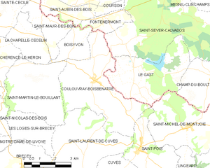
Shares border with regions:


Le Gast
- former commune in Calvados, France
- Country:
- Postal Code: 14380
- Coordinates: 48° 47' 45" N, 1° 4' 34" E
- GPS tracks (wikiloc): [Link]
- Area: 12.74 sq km
- Population: 196


Saint-Pois
- commune in Manche, France
- Country:
- Postal Code: 50670
- Coordinates: 48° 44' 58" N, 1° 4' 1" E
- GPS tracks (wikiloc): [Link]
- Area: 7.78 sq km
- Population: 508


Lingeard
- commune in Manche, France
- Country:
- Postal Code: 50670
- Coordinates: 48° 44' 20" N, 1° 1' 35" E
- GPS tracks (wikiloc): [Link]
- Area: 3.65 sq km
- Population: 80


Gathemo
- commune in Manche, France
- Country:
- Postal Code: 50150
- Coordinates: 48° 45' 55" N, 0° 58' 33" E
- GPS tracks (wikiloc): [Link]
- Area: 10.41 sq km
- Population: 242


Champ-du-Boult
- former commune in Calvados, France
- Country:
- Postal Code: 14380
- Coordinates: 48° 47' 35" N, 1° 0' 29" E
- GPS tracks (wikiloc): [Link]
- Area: 13.85 sq km
- Population: 372
- Web site: [Link]

Coulouvray-Boisbenâtre
- commune in Manche, France
- Country:
- Postal Code: 50670
- Coordinates: 48° 47' 13" N, 1° 6' 33" E
- GPS tracks (wikiloc): [Link]
- Area: 17.25 sq km
- Population: 553


Perriers-en-Beauficel
- commune in Manche, France
- Country:
- Postal Code: 50150
- Coordinates: 48° 44' 13" N, 0° 59' 48" E
- GPS tracks (wikiloc): [Link]
- Area: 9.3 sq km
- Population: 216