Saint-Michel-en-Beaumont (Saint-Michel-en-Beaumont)
- commune in Isère, France
 Hiking in Saint-Michel-en-Beaumont
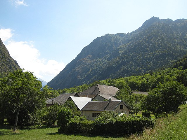
Saint-Michel-en-Beaumont is a picturesque village located in the Auvergne-Rhône-Alpes region of southeastern France. This area is known for its stunning natural landscapes, rolling hills, and diverse outdoor activities, making it a great destination for hiking enthusiasts.
Here are some aspects to consider when hiking in and around Saint-Michel-en-Beaumont:
Trail Options
-
Local Trails: The region features various well-marked hiking trails that cater to different skill levels. You can find easy walks suitable for families or more challenging routes for seasoned hikers.
-
Monts du Vivarais: Nearby, you can explore the Monts du Vivarais, a mountain range with numerous hiking options. Many trails offer breathtaking views and lead through forests, vineyards, and charming villages.
-
GR Trails: The long-distance GR (Grande Randonnée) trails are also accessible from the area. These trails are typically longer and can provide a multi-day hiking experience if you're looking for more adventure.
Scenic Views and Nature
- The region boasts diverse landscapes, including forests, rivers, and terraced hillsides.
- Wildlife is abundant, and you may encounter various species of birds, deer, and other fauna.
- The changing seasons offer a variety of visual experiences, from vibrant spring flowers to colorful autumn foliage.
Local Attractions
- Combining your hike with visits to local attractions such as historical buildings, churches, and cultural sites can enhance your experience. Saint-Michel-en-Beaumont itself has charming spots worth exploring.
- The surrounding areas often have local markets and eateries where you can sample regional cuisine, adding a culinary aspect to your journey.
Tips for Hiking
- Preparation: Always check the weather forecast and trail conditions before you set out. Make sure to wear appropriate footwear and bring enough water and snacks.
- Navigation: Carry a map or download hiking apps that work offline to help with navigation on the trails.
- Respect Nature: Stay on marked paths, carry out what you bring in, and follow any local guidelines to preserve the natural beauty of the area.
Conclusion
Hiking in Saint-Michel-en-Beaumont offers a mix of natural beauty, local culture, and a chance to explore the serene landscapes of the Auvergne-Rhône-Alpes region. Whether you're looking for a leisurely stroll or a more challenging hike, you'll find plenty of options to enjoy the great outdoors.
- Country:

- Postal Code: 38350
- Coordinates: 44° 52' 6" N, 5° 53' 59" E


- GPS tracks (wikiloc): [Link]
- Area: 8.04 sq km
- Population: 31
- Web site: http://www.saint-michel-en-beaumont.fr/
- Wikipedia en: wiki(en)
- Wikipedia: wiki(fr)
- Wikidata storage: Wikidata: Q1155568
- Wikipedia Commons Category: [Link]
- Freebase ID: [/m/03nvh33]
- GeoNames ID: Alt: [6433374]
- SIREN number: [213804289]
- BnF ID: [152582372]
- INSEE municipality code: 38428
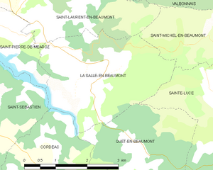
Shares border with regions:


Les Côtes-de-Corps
- commune in Isère, France
Les Côtes-de-Corps, located in the Auvergne-Rhône-Alpes region of France, offers beautiful hiking opportunities amidst stunning natural landscapes. The area is known for its rugged terrain, rich biodiversity, and picturesque views of the surrounding mountains....
- Country:

- Postal Code: 38970
- Coordinates: 44° 49' 56" N, 5° 55' 23" E


- GPS tracks (wikiloc): [Link]
- AboveSeaLevel: 930 м m
- Area: 9.83 sq km
- Population: 67


Entraigues
- commune in Isère, France
Entraigues, located in the Isère department of the Auvergne-Rhône-Alpes region in southeastern France, is a charming village surrounded by beautiful natural landscapes, making it a great destination for hiking enthusiasts. Here are some key aspects to consider when planning your hike in this area:...
- Country:

- Postal Code: 38740
- Coordinates: 44° 54' 6" N, 5° 56' 53" E


- GPS tracks (wikiloc): [Link]
- AboveSeaLevel: 800 м m
- Area: 21.66 sq km
- Population: 235


Sainte-Luce
- commune in Isère, France
Sainte-Luce, located in the Isère department in the Auvergne-Rhône-Alpes region of southeastern France, offers a variety of hiking opportunities, characterized by beautiful landscapes, lush forests, and views of the surrounding mountains....
- Country:

- Postal Code: 38970
- Coordinates: 44° 51' 2" N, 5° 54' 42" E


- GPS tracks (wikiloc): [Link]
- Area: 7.95 sq km
- Population: 43

Saint-Laurent-en-Beaumont
- commune in Isère, France
 Hiking in Saint-Laurent-en-Beaumont
Saint-Laurent-en-Beaumont is a charming commune located in the Isère department in the Auvergne-Rhône-Alpes region of southeastern France. It offers excellent opportunities for hiking and outdoor activities, set amidst stunning natural scenery, including mountains and forests....
- Country:

- Postal Code: 38350
- Coordinates: 44° 52' 45" N, 5° 51' 1" E


- GPS tracks (wikiloc): [Link]
- Area: 13.15 sq km
- Population: 462
- Web site: [Link]


Valbonnais
- commune in Isère, France
Valbonnais is a beautiful area located in the French Alps, specifically in the Isère department. It’s known for its stunning natural landscapes, diversity of hiking trails, and rich cultural heritage. Here’s what you need to know about hiking in Valbonnais:...
- Country:

- Postal Code: 38740
- Coordinates: 44° 54' 0" N, 5° 54' 15" E


- GPS tracks (wikiloc): [Link]
- Area: 23.95 sq km
- Population: 499
- Web site: [Link]


La Salle-en-Beaumont
- commune in Isère, France
 Hiking in La Salle-en-Beaumont
La Salle-en-Beaumont is a picturesque commune located in the Isère department of the Auvergne-Rhône-Alpes region in southeastern France. It is surrounded by the stunning natural landscapes of the French Alps, making it an excellent destination for hiking enthusiasts....
- Country:

- Postal Code: 38350
- Coordinates: 44° 51' 43" N, 5° 51' 50" E


- GPS tracks (wikiloc): [Link]
- Area: 9.26 sq km
- Population: 323
- Web site: [Link]


La Salette-Fallavaux
- commune in Isère, France
 Hiking in La Salette-Fallavaux
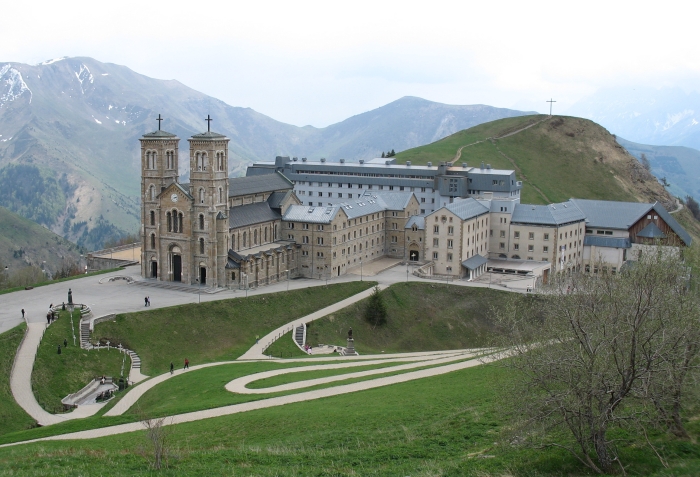
La Salette-Fallavaux is a beautiful area nestled in the French Alps, famous for its stunning natural landscapes, history, and religious significance. Here are some key points about hiking in this region:...
- Country:

- Postal Code: 38970
- Coordinates: 44° 50' 26" N, 5° 58' 30" E


- GPS tracks (wikiloc): [Link]
- Area: 22.29 sq km
- Population: 68
