Saint-Ovin (Saint-Ovin)

- commune in Manche, France
- Country:

- Postal Code: 50300
- Coordinates: 48° 40' 53" N, 1° 15' 41" E


- GPS tracks (wikiloc): [Link]
- Area: 12.93 sq km
- Population: 768
- Wikipedia en: wiki(en)
- Wikipedia: wiki(fr)
- Wikidata storage: Wikidata: Q735651
- Wikipedia Commons Category: [Link]
- Freebase ID: [/m/03x_zsz]
- Freebase ID: [/m/03x_zsz]
- Freebase ID: [/m/03x_zsz]
- GeoNames ID: Alt: [6616920]
- GeoNames ID: Alt: [6616920]
- GeoNames ID: Alt: [6616920]
- SIREN number: [215005315]
- SIREN number: [215005315]
- SIREN number: [215005315]
- BnF ID: [152625020]
- BnF ID: [152625020]
- BnF ID: [152625020]
- INSEE municipality code: 50531
- INSEE municipality code: 50531
- INSEE municipality code: 50531
Shares border with regions:

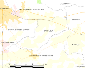
Saint-Loup
- commune in Manche, France
- Country:
- Postal Code: 50300
- Coordinates: 48° 40' 4" N, 1° 17' 42" E
- GPS tracks (wikiloc): [Link]
- Area: 6.45 sq km
- Population: 716


Le Petit-Celland
- commune in Manche, France
- Country:
- Postal Code: 50370
- Coordinates: 48° 41' 46" N, 1° 12' 37" E
- GPS tracks (wikiloc): [Link]
- Area: 6.57 sq km
- Population: 210
- Web site: [Link]


Marcilly
- commune in Manche, France
- Country:
- Postal Code: 50220
- Coordinates: 48° 38' 53" N, 1° 15' 7" E
- GPS tracks (wikiloc): [Link]
- AboveSeaLevel: 21 м m
- Area: 8.86 sq km
- Population: 341


La Godefroy
- commune in Manche, France
- Country:
- Postal Code: 50300
- Coordinates: 48° 41' 23" N, 1° 17' 21" E
- GPS tracks (wikiloc): [Link]
- Area: 3.65 sq km
- Population: 266


Le Grand-Celland
- commune in Manche, France
- Country:
- Postal Code: 50370
- Coordinates: 48° 40' 51" N, 1° 11' 9" E
- GPS tracks (wikiloc): [Link]
- Area: 12.45 sq km
- Population: 575


Saint-Quentin-sur-le-Homme
- commune in Manche, France
- Country:
- Postal Code: 50220
- Coordinates: 48° 38' 51" N, 1° 19' 0" E
- GPS tracks (wikiloc): [Link]
- Area: 16.84 sq km
- Population: 1219
- Web site: [Link]


Saint-Senier-sous-Avranches
- commune in Manche, France
- Country:
- Postal Code: 50300
- Coordinates: 48° 41' 4" N, 1° 20' 30" E
- GPS tracks (wikiloc): [Link]
- Area: 8.62 sq km
- Population: 1377

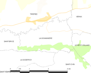
La Gohannière
- commune in Manche, France
- Country:
- Postal Code: 50300
- Coordinates: 48° 42' 23" N, 1° 15' 17" E
- GPS tracks (wikiloc): [Link]
- Area: 3.78 sq km
- Population: 118


Le Mesnil-Ozenne
- commune in Manche, France
- Country:
- Postal Code: 50220
- Coordinates: 48° 40' 1" N, 1° 13' 51" E
- GPS tracks (wikiloc): [Link]
- Area: 4.59 sq km
- Population: 259