La Gohannière (La Gohannière)

- commune in Manche, France
- Country:

- Postal Code: 50300
- Coordinates: 48° 42' 23" N, 1° 15' 17" E


- GPS tracks (wikiloc): [Link]
- Area: 3.78 sq km
- Population: 118
- Wikipedia en: wiki(en)
- Wikipedia: wiki(fr)
- Wikidata storage: Wikidata: Q634801
- Wikipedia Commons Category: [Link]
- Freebase ID: [/m/03w9ltx]
- Freebase ID: [/m/03w9ltx]
- GeoNames ID: Alt: [6456113]
- GeoNames ID: Alt: [6456113]
- SIREN number: [215002064]
- SIREN number: [215002064]
- BnF ID: [15262183q]
- BnF ID: [15262183q]
- INSEE municipality code: 50206
- INSEE municipality code: 50206
Shares border with regions:


Tirepied
- commune in Manche, France
- Country:
- Postal Code: 50870
- Coordinates: 48° 42' 36" N, 1° 15' 50" E
- GPS tracks (wikiloc): [Link]
- Area: 18.77 sq km
- Population: 802


Le Petit-Celland
- commune in Manche, France
- Country:
- Postal Code: 50370
- Coordinates: 48° 41' 46" N, 1° 12' 37" E
- GPS tracks (wikiloc): [Link]
- Area: 6.57 sq km
- Population: 210
- Web site: [Link]


Saint-Brice
- commune in Manche, France
- Country:
- Postal Code: 50300
- Coordinates: 48° 41' 54" N, 1° 18' 28" E
- GPS tracks (wikiloc): [Link]
- AboveSeaLevel: 80 м m
- Area: 2.55 sq km
- Population: 138


La Godefroy
- commune in Manche, France
- Country:
- Postal Code: 50300
- Coordinates: 48° 41' 23" N, 1° 17' 21" E
- GPS tracks (wikiloc): [Link]
- Area: 3.65 sq km
- Population: 266

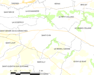
Saint-Ovin
- commune in Manche, France
- Country:
- Postal Code: 50300
- Coordinates: 48° 40' 53" N, 1° 15' 41" E
- GPS tracks (wikiloc): [Link]
- Area: 12.93 sq km
- Population: 768

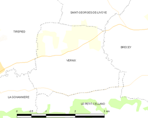
Vernix
- commune in Manche, France
- Country:
- Postal Code: 50370
- Coordinates: 48° 42' 56" N, 1° 13' 29" E
- GPS tracks (wikiloc): [Link]
- Area: 5.84 sq km
- Population: 163