Saint-Paul-et-Valmalle (Saint-Paul-et-Valmalle)

- commune in Hérault, France
- Country:

- Postal Code: 34570
- Coordinates: 43° 37' 35" N, 3° 40' 29" E


- GPS tracks (wikiloc): [Link]
- Area: 12.72 sq km
- Population: 1091
- Web site: http://www.stpauletvalmalle.fr
- Wikipedia en: wiki(en)
- Wikipedia: wiki(fr)
- Wikidata storage: Wikidata: Q1148450
- Wikipedia Commons Category: [Link]
- Freebase ID: [/m/03nv855]
- Freebase ID: [/m/03nv855]
- Freebase ID: [/m/03nv855]
- GeoNames ID: Alt: [6432649]
- GeoNames ID: Alt: [6432649]
- GeoNames ID: Alt: [6432649]
- SIREN number: [213402829]
- SIREN number: [213402829]
- SIREN number: [213402829]
- BnF ID: [152568822]
- BnF ID: [152568822]
- BnF ID: [152568822]
- PACTOLS thesaurus ID: [pcrtAZy8EnAi4W]
- PACTOLS thesaurus ID: [pcrtAZy8EnAi4W]
- PACTOLS thesaurus ID: [pcrtAZy8EnAi4W]
- INSEE municipality code: 34282
- INSEE municipality code: 34282
- INSEE municipality code: 34282
Shares border with regions:


La Boissière
- commune in Hérault, France
- Country:
- Postal Code: 34150
- Coordinates: 43° 39' 50" N, 3° 38' 42" E
- GPS tracks (wikiloc): [Link]
- AboveSeaLevel: 138 м m
- Area: 24.45 sq km
- Population: 1019

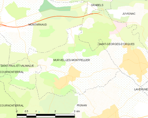
Murviel-lès-Montpellier
- commune in Hérault, France
- Country:
- Postal Code: 34570
- Coordinates: 43° 36' 16" N, 3° 44' 12" E
- GPS tracks (wikiloc): [Link]
- Area: 10.11 sq km
- Population: 1900
- Web site: [Link]


Cournonterral
- commune in Hérault, France
- Country:
- Postal Code: 34660
- Coordinates: 43° 33' 28" N, 3° 43' 8" E
- GPS tracks (wikiloc): [Link]
- AboveSeaLevel: 50 м m
- Area: 28.62 sq km
- Population: 5790
- Web site: [Link]


Montarnaud
- commune in Hérault, France
- Country:
- Postal Code: 34570
- Coordinates: 43° 38' 56" N, 3° 41' 56" E
- GPS tracks (wikiloc): [Link]
- Area: 27.53 sq km
- Population: 3157
- Web site: [Link]

Aumelas
- commune in Hérault, France
- Country:
- Postal Code: 34230
- Coordinates: 43° 36' 10" N, 3° 35' 55" E
- GPS tracks (wikiloc): [Link]
- AboveSeaLevel: 295 м m
- Area: 58.26 sq km
- Population: 519
- Web site: [Link]


Pignan
- commune in Hérault, France
- Country:
- Postal Code: 34570
- Coordinates: 43° 35' 3" N, 3° 45' 43" E
- GPS tracks (wikiloc): [Link]
- Area: 20.32 sq km
- Population: 6669
- Web site: [Link]