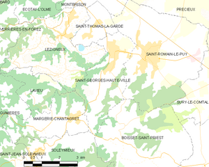
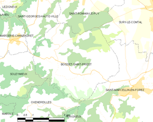
Saint-Romain-le-Puy (Saint-Romain-le-Puy)
- commune in Loire, France
- Country:

- Postal Code: 42610
- Coordinates: 45° 33' 20" N, 4° 7' 23" E


- GPS tracks (wikiloc): [Link]
- Area: 21.14 sq km
- Population: 3882
- Web site: http://www.mairie-saintromainlepuy.fr
- Wikipedia en: wiki(en)
- Wikipedia: wiki(fr)
- Wikidata storage: Wikidata: Q1106403
- Wikipedia Commons Category: [Link]
- Freebase ID: [/m/0776py]
- Freebase ID: [/m/0776py]
- GeoNames ID: Alt: [6434316]
- GeoNames ID: Alt: [6434316]
- SIREN number: [214202855]
- SIREN number: [214202855]
- BnF ID: [15259851h]
- BnF ID: [15259851h]
- VIAF ID: Alt: [141020165]
- VIAF ID: Alt: [141020165]
- Library of Congress authority ID: Alt: [no95055879]
- Library of Congress authority ID: Alt: [no95055879]
- PACTOLS thesaurus ID: [pcrtIS1umlI6f3]
- PACTOLS thesaurus ID: [pcrtIS1umlI6f3]
- Pleiades ID: [167905]
- Pleiades ID: [167905]
- INSEE municipality code: 42285
- INSEE municipality code: 42285
Shares border with regions:


Saint-Thomas-la-Garde
- commune in Loire, France
- Country:

- Postal Code: 42600
- Coordinates: 45° 34' 0" N, 4° 4' 50" E


- GPS tracks (wikiloc): [Link]
- Area: 3.41 sq km
- Population: 592


Saint-Georges-Haute-Ville
- commune in Loire, France
- Country:

- Postal Code: 42610
- Coordinates: 45° 33' 15" N, 4° 5' 55" E


- GPS tracks (wikiloc): [Link]
- Area: 9.63 sq km
- Population: 1403
- Web site: [Link]


Précieux
- commune in Loire, France
- Country:

- Postal Code: 42600
- Coordinates: 45° 35' 11" N, 4° 9' 4" E


- GPS tracks (wikiloc): [Link]
- AboveSeaLevel: 375 м m
- Area: 16.29 sq km
- Population: 1023


Sury-le-Comtal
- commune in Loire, France
- Country:

- Postal Code: 42450
- Coordinates: 45° 32' 15" N, 4° 10' 59" E


- GPS tracks (wikiloc): [Link]
- Area: 24.18 sq km
- Population: 6283


Montbrison
- commune in Loire, France
- Country:

- Postal Code: 42600
- Coordinates: 45° 36' 27" N, 4° 3' 55" E


- GPS tracks (wikiloc): [Link]
- AboveSeaLevel: 399 м m
- Area: 16.33 sq km
- Population: 15526
- Web site: [Link]


Boisset-Saint-Priest
- commune in Loire, France
- Country:

- Postal Code: 42560
- Coordinates: 45° 30' 47" N, 4° 6' 16" E


- GPS tracks (wikiloc): [Link]
- Area: 18.28 sq km
- Population: 1209
- Web site: [Link]
